< US 9 | Home | US 11E >
US 11 | US 11 Bus
US 211 | US 311 | US 411 | US 511
|
|
|
| ROUTE LOG |
US 11, US 460, US 460 ALT Begin: 0 - 0 US 11: 1.06 - 1.06 VA 419 SB: 1.43 - 2.49 US 460 WB, US 460 ALT END, VA 419 NB: 0.53 - 3.02 Roanoke-Salem Line: 0.44 - 3.46 VA 117: 0.65 - 4.11 VA 116 NB: 1.75 - 5.86 I-581 (exit 5), US 220, VA 220 ALT Begin: 2.31 - 8.17 US 11, US 221, US 460 EB, VA 116 SB, VA 220 ALT NB: 0.24 - 8.41
|
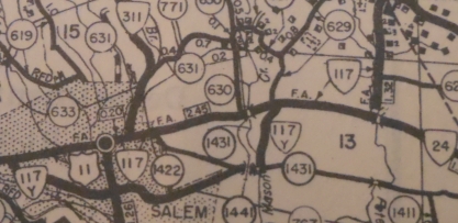
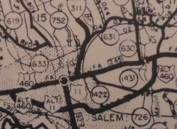
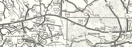
Creation: Appeared Jan 1 1947 (per Dec 1946 AASHO approval letter) as a bypass of central Salem, running on 4th St between US 11 Main St and US 11 College Ave. This had been part of VA 117Y. This is one of 9 US 11 ALTs in Virginia.
|
Adjustments: In April 1955 (CTB), US 11 ALT was extended east along existing US 460 ALT and US 460 to its current endpoint in Roanoke. At some point (possibly the 1988 widening), US 11 ALT gets a split routing approaching VA 419 from Salem. NB veers onto Lynchburg Tpk to make the left onto VA 419. SB uses Texas St as always (it is now no longer possible to turn left from Texas St onto 419 North) Improvements: Paved upon inception US 11 ALT was multilaned from on its US 460 duplex from Salem to VA 117 in 1957. In 1963, US 11 ALT was widened from VA 117 to VA 116 and also from 11th Ave to US 11-220 in Roanoke. In 1968, US 11 ALT was multilaned on its VA 419 duplex. In 1988, the original piece of US 11 ALT was multilaned from Colorado St westward; a small bit of Texas St west from VA 419. Posted: Fully posted; Multiplexes: US 460 ALT (2.49 mi) US 460 ALT, VA 419 (0.53 mi) US 460 (2.84 mi) US 460, VA 116 (2.31 mi) US 460, VA 116, VA 220 ALT (0.24 mi) Legislative names: None Other names: 4th St/Texas St/Electric Rd/Main St (Salem); Melrose Ave/Orange Ave (Roanoke) Scenic Byway: no segments Comment: US 11 ALT is far faster than US 11 from end to end, but VA 117 would've made a better selection for the continuation of US 11 ALT so that Roanoke can be bypassed as well.
| Previous US 11 ALT's:
|
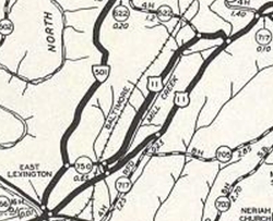
US 11 ALT #1: Appeared Sept 1934 (CTB) mostly as a renumbering of US 11. Ran on today's SR 645 north of Lexington. The south end was where I-64 and US 11 overpass are now. South of SR 750 was not part of US 11 at any point.
In May 1945 (CTB), US 11 ALT was downgraded to SR 645. This US 11 ALT didn't make any sense. There is no town that was being bypassed or anything.
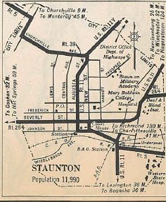
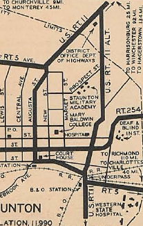
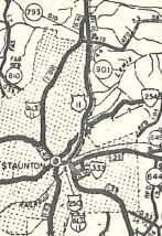
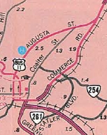
US 11 ALT #2: Appeared Oct 1935 (CTB) as a renumbering of US 11 in Staunton. It ran on Coalter St. About 1950, US 11 ALT was downgraded to SR 900. Today some of Coalter St is part of VA 254.
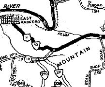
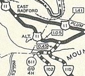
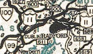
US 11 ALT #3: Appeared Aug 1936 (CTB), as a renumbering of mainline US 11 through Radford. US 11 ALT followed current VA 177 south, then used Auburn Ave which loops back over VA 177. US 11 ALT followed Auburn to Rock Rd east to today's US 11. In Jan 1937 (CTB), US 11 ALT was eliminated. Auburn Rd north of Rock Rd became an extended VA 102.
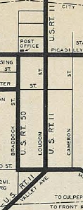
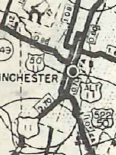
US 11 ALT #4: Appeared Apr 1944 (CTB), running on Valley and Loudoun Sts in central Winchester. This had been mainline US 11. In Aug 1950 (CTB), US 11 ALT was eliminated. A tiny piece of Valley Ave returned to being US 11 NB but the rest has been non-primary ever since. This US 11 ALT was stil shown on the 1958 Frederick County Map and on recent MSN maps.
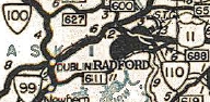
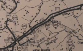
US 11 ALT #5: Appeared in 1945 or 1946 as a renumbering of US 11 from Dublin east to the new US 11 near Fairlawn. Shown but unlabeled on official maps. In May 1954 (CTB), US 11 was downgraded to SR 757.
US 11 ALT #6: Appeared about 1950 as a renumbering of mainline US 11 through central Staunton. US 11 ALT became US 11 Business in June 1971 (AASHO).
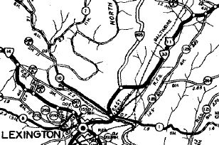
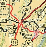
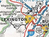
US 11 ALT #7: Mentioned in May 1954 CTB as the designation for the bypass of Harrisonburg. By the time this was built it was part of I-81 between the two US 11 exits north and south of Harrisonburg. US 11 ALT #8: Appeared Jan 1956 (AASHO) as a new bypass east of Lexington. US 11 ALT became part of mainline US 11 in 1976. Official maps showed this as US 11A while the 1958 Rockbridge County map called it US 11 Bypass. Interestingly, the 1956 AASHO document contained a sketch from VDOH showing the south intersection with US 11 was also supposed to be a grade-separated flyover (note VA 251 didn't get rerouted to this intersection until the early 1970s).
|
||||||||||||||||||||||||
Previous: US 9 |
Next: US 11E
US 11 | US 11 Bus
US 211 | US 311 | US 411 | US 511
Top | Virginia Hwy Index
Home
Page last modified 29 January 2022