< US 23 | Home | US 25E >
US 29 | US 29 Bus
| US 29 ALT All decommissioned | |||||||||||
| Previous US 29 ALT's: |
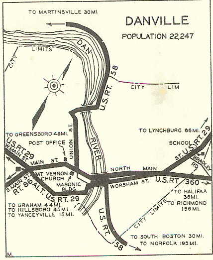
US 29 ALT #1: Appeared in Oct 1935 (CTB) as new primary routing. Originally began at US 29 (now VA 293) W. Main St, using Howland Circle, Hawthorne Dr (now Avondale Dr), Watson St, Stokes St, Jefferson Ave, E. Green St, Newton St, Bridge St to the south end of Worsham Street Bridge where it met up again with US 29 which came from the other direction on Bridge St.
1936 and 1937 Officials incorrectly show the south end to be at the then-US 29/VA 86 jct. Officials from 1938 onward show it correctly. This US 29 ALT was eliminated by June 1941 (CTB) which references US 29 ALT on the original Danville Bypass.
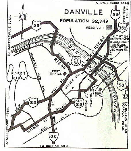
US 29 ALT #2: Created by Jan 1941 (CTB) in the Danville area. This was a bypass on the west side of Danville. It ran from the original US 29-VA 125 jct (now VA 293 at Bishop Ave) south of town to US 29 (curr VA 293) north of VA 41. All of this was a replacement of what had briefly been part of VA 125. In May 1943 (CTB), US 29 ALT was removed from Bishop Rd and instead used Memorial Dr southwest to a new ending at US 29 (now VA 293). In Dec 1970 (CTB), US 29 ALT was renumbered as mainline US 29. Today it is US 29 Business except US 29 ALT used Piedmont Dr to cross the Dan River and used US 58 and Old Riverside Dr to Piney Forest Rd north.
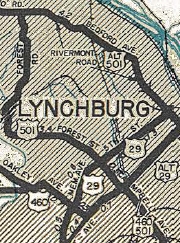
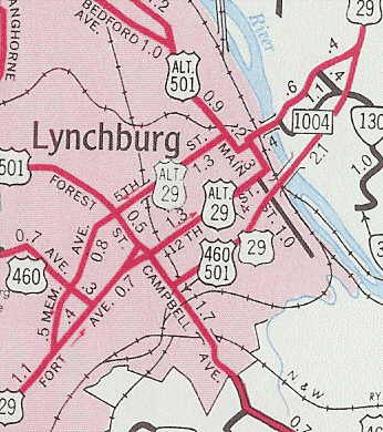
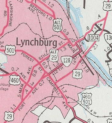
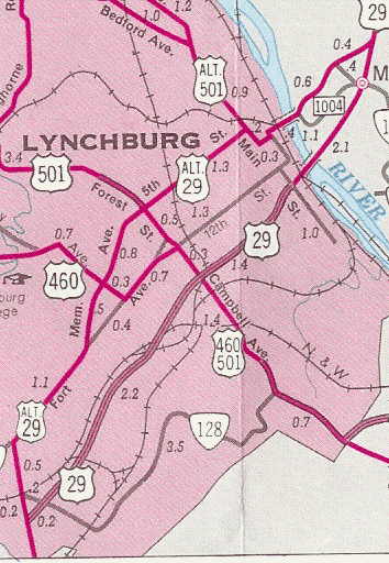
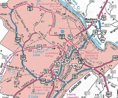
US 29 ALT #3: Appeared in 1945 or 1946. The 1946 Official suggests it could have followed US 460 or US 501 over to Fort Ave from US 29 in Lynchburg. US 29 ALT then followed 12th to Main west back to US 29 at its bridge over th James River. Definitely by 1947, US 29 ALT was using Fort Ave itself to connect with US 29 on its south end. Oddly, 12th to Main was placed into the primary system in July 1939 (CTB) as part of VA 128 which was never shown on maps until 1956. Maps in 1952 begin showing US 29 ALT as one-way NB and US 29 one-way SB. In Aug 1955 (CTB), US 29 ALT was extended to Madison Heights to the current VA 163 north end, as US 29 moved to the Lynchburg Expwy over the James River, and continued the one-way alignments (NB used the previous 29 ALT, SB used today's US 29 Bus). In 1956, it appears US 29 ALT was running only on Memorial and 5th in Lynchburg.
In Sept 1959 (CTB), US 29 ALT was extended south to the current VA 163 south end, as US 29 was placed on more Lynchburg Expwy. In Nov 1974 (AASHO), US 29 ALT was renumbered as US 29 Business. Today it is VA 163.
US 29 ALT #4: Appears in the July 1960 and April 1961 CTB Minutes as the proposed number for the Chatham Bypass, which was completed about 1965. US 29 ALT #5: Appears on page 7-60 of the VTRANS 2035 surface plan as a newly constructed route from US 29 south of Yellow Branch northwest to US 460 in the Lynchburg area. |
||||||||||
Previous: US 25E |
Next: US 33
US 29 | US 29 Bus
Top | Virginia Hwy Index
Home
Page last modified 4 February 2022