< VA 101 to 120 | Home | VA 141 to 160 >
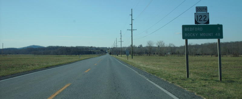
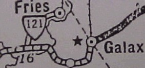
Photo: VA 122 southbound near Sedalia (photo by Mapmikey 1/20/07)
| VA 121
to 140 < VA 101 to 120 | Home | VA 141 to 160 > |
Photo: VA 122 southbound near Sedalia (photo by Mapmikey 1/20/07) |
| ||||||
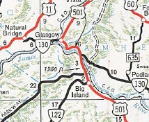
| ROUTE LOG I-77, I-81 (exit 80), US 11, US 52: 0 - 0 SR 1004, SR 1006: 1.83 - 1.83 |
Creation: Appeared in July 1933 as a renumbering of part of VA 15. Originaly it ran from US 11-121 (now F-044) to Max Meadows. This is the 4th VA 121.
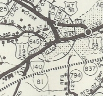
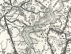
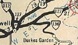
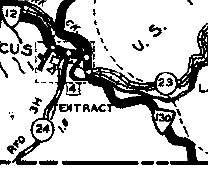
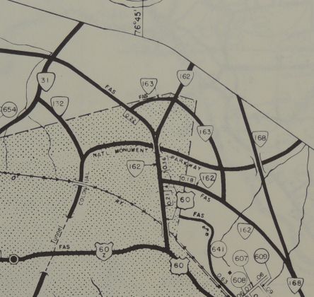
Adjustments: In Feb 1969 (CTB), VA 121's south end was moved west to its current endpoint. Initially the south end of VA 121 was at the west side of the Barber shop on F-044, just about where the I-81 SB ramp to VA 121 begins, and had a series of sharp curves heading around the north edge of the McDonalds parking lot, then after a bit of current 121 curled east and north around another sharp curve that is still accessible as accesses to a few homes. Improvements: Paved upon inception; no multilane segments Posted: Fully posted; The last cutout was removed in the late 90s and was located at its north endpoint. A US 121 shield has been on a BGS on I-81 SB for a few years. Multiplexes: None Legislative names: None Other names: Max Meadows Rd Scenic Byway: Entire route, since 8-19-76 Comment: VA 121 is left over from the existence of US 121 in Virginia. It is doubtful this was under consideration from any promotion to US Route status. When US 121 is finally signed in Virginia again, will VA 121 be renumbered as an extended VA 94? The 1939 VDOT report on primary system development had recommended that VA 121 be decommissioned in its entirety.
|
|||||
| Previous VA 121's:
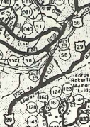
1925 ROUTE LOG VA 12: 0 - 0 NC STATE LINE: 11 - 11 1928 ROUTE LOG VA 12: 0 - 0 CR 3: 1.33 - 1.33 1932 ROUTE LOG CR 112: 0 - 0 US 23 NB, VA 120 NB: 5 - 5 US 23 SB, VA 120 SB: 1 - 6 VA 122: 10 - 16 VA 123: 9 - 25 VA 111 SB: 16 - 41 VA 111 NB: 1 - 42 VA 126 EB: 16 - 58 VA 126 WB: 5 - 63 WV STATE LINE: 16 - 79 |
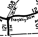
VA 121 #1: Appeared in 1923 as a renumbering of VA 12Y, running from VA 12 (now US 58 Bus) Franklin south to the North Carolina line.
About 1926, VA 121 was renumbered as an extended VA 108. Today this is part of US 258 and US 258 Bus, except within Franklin it cut over on High St to end at 4th St. VA 121 #2: Appeared in Mar 1927 (CTB) as an upgrade to CR 3, running from VA 12 (now VA 94-274 jct) north 1.33 miles to current SR 805 Providence. In Aug 1928, VA 121 was renumbered as VA 116. Today it is part of VA 94, although the lower end of this has been rebuilt in places leaving behind abandoned segments. SR 816 Turkey Knob Rd is the northernmost part of this VA 121.
VA 121 #3: Appeared Aug 1928 as a renumbering of VA 1141 from Pound to Georges Fork and VA 114
from Georges Fork to Haysi. VA 121 continued east as an upgrade to CR 2
east to the Buchanan County line. A second piece of VA 121 was created
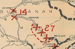
as an upgrade to CRs 1 and 3 from VA 126 (now US 460) Grundy east
through Stacy to West Virginia.
|
|||||
| ||||||
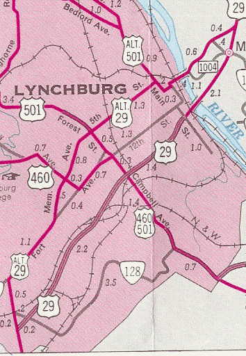
| ROUTE LOG VA 40: 0 - 0 VA 116: 7.14 - 7.14 Bedford-Franklin Line: 10.26 - 17.40 VA 24: 8.69 - 26.09 Bedford City-Bedford Line: 7.25 - 33.34 US 221 SB, US 460 WB, VA 122 Bus: 0.54 - 33.88 Bedford-Bedford City Line: 0 - 33.88 Bedford City-Bedford Line: 0.50 - 34.38 US 460 EB, US 460 Bus BEGIN: 0.94 - 35.32 US 460 Bus WB: 0.10 - 35.42 US 221 NB, US 221 Bus, VA 122 Bus: 1.71 - 37.13 Bedford-Bedford City Line: 0.65 - 37.78 US 501: 16.80 - 54.58 |
Improvements: Paved only from Bedford south to SR 801 upon inception In 1937, VA 122 was paved north a few miles; also a couple miles were paved south of US 501. In 1938, all of VA 122 between Bedford and Big Island were paved; pavement was extended south to Moneta In 1941, VA 122 was paved from VA 40 to VA 116. In 1943, the remainder of VA 122 was paved. VA 122 was multilaned on the north side of Bedford sometime before the early 90s. VA 122 was multilaned when added to the US 460 duplex of the Bedford Bypass in 1995. Otherwise, VA 122 is still 2-lane everywhere. Posted: Fully posted Multiplexes: US 221, US 460 (1.44 mi) US 221, US 460 Bus (0.10 mi) US 221 (1.71 mi) Legislative names: Booker T Washington Memorial Highway, entire route except Bedford Bypass (since 7-28-53) Other names: Moneta Rd (Bedford Co s of Bedford); Burks Hill Rd/Independence Blvd/Longwood Ave (Bedford City); Big Island Hwy (Bedford Co n of Bedford) Scenic Byway: None Comment: VA 122 serves the Booker T Washington Nat'l Monument as well as the rapidly congesting Smith Mountain Lake. VA 122 is an easy road to drive even though it is in foothills for a lot of its journey. | |||||
| Previous VA 122's:
1926 ROUTE LOG VA 12: 0 - 0 NC STATE LINE: 10 - 10 1928 ROUTE LOG VA 12: 0 - 0 US 1, VA 31: 13 - 13 1932 ROUTE LOG VA 107: 0 - 0 VA 123 EB: 6.78 - 6.78 VA 123 WB: 1.40 - 8.18 Wise-Scott Line: 6.00 - 14.18 VA 11 EB: 5.80 - 19.98 VA 11 WB: 0.45 - 20.43 Dickenson-Wise Line: 9.35 - 29.78 VA 121: 7.85 - 37.63 |
VA 122 #1: Appeared in 1923 as a renumbering of VA 12X,
running from VA 12 (curr US 58) near South Hill south to N.C. Today it
is SR 903 out of South Hill down to SR 615, then west until it nears US
1 where VA 122 cut SW to cross the Roanoke River on a private toll
bridge. VA 122 then followed SR 711 to Palmer Springs, then SR 712 over
to VA 4 where it then dipped into North Carolina. It is unclear whether the route was changed at Palmer Springs to use SR 713 southeast to the current US 1 crossing before or after the route was renumbered as part of VA 31 in 1925. VA 122 #2: Appeared in 1925 as a renumbering of part of VA 31 running from VA 12 (now SR 750) Edgerton north to the rerouted VA 31 at the Nottoway River. In 1926, VA 122 south was truncated slightly to the new routing of VA 12 (now US 58). In Aug 1928, VA 122 was renumbered as VA 402. Today it is SR 712.
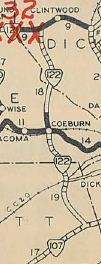
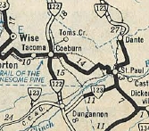
VA 122Y?: The 1936 Wise County shows what was likely VA 72Y at the current VA 72-158 split in western Coeburn. The 1932 Wise County map does not show the area clearly enough to tell if VA 122Y preceeded it until July 1933. The triangle setup is gone today, but it looks like mainline VA 72 follows what would've been the Y designation. |
|||||
| |||||||||
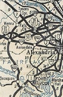
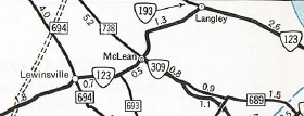
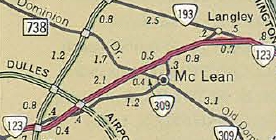
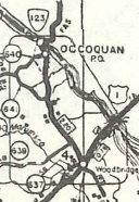
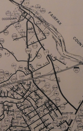
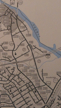
| ROUTE LOG US 1: 0 - 0 I-95 (exit 160): 0.61 - 0.61 Fairfax-Prince William Line: 1.17 - 1.78 VA 383: 12.24 - 14.02 Fairfax City-Fairfax Line: 0.20 - 14.22 VA 236: 0.73 - 14.95 US 29, US 50: 0.87 - 15.82 Fairfax-Fairfax City Line: 0.35 - 16.17 I-66 (exit 60): 0 - 16.17 VA 243: 3.16 - 19.33 VA 7: 2.85 - 22.18 I-495 (exit 46): 0.87 - 23.05 VA 267: 0.84 - 23.89 VA 309: 1.20 - 25.09 VA 193: 1.93 - 27.02 GW PKWY: 0.90 - 27.92 Arlington-Fairfax Line: 0.95 - 28.87 VA 120: 0.37 - 29.24 DC LINE: 0.03 - 29.27 |
Creation: Appeared in Oct 1940 (CTB) as a renumbering of part of VA 9, running generally the way it does today. This is the 4th VA 123.
Adjustments: In Aug 1956 (CTB), VA 123 was removed from today's Old Chain Bridge Rd just east of VA 309 in McLean and put on Chain Bridge Rd. This was a route swap with SR 1820. Part of the old route is today the path of modern 123 Dolley Madison Blvd. In Nov 1963 (CTB), VA 123 was placed on new construction in the McLean and Langley areas onto today's Dolley Madison Blvd. The old routes were not removed formally from the primary system until 1968 (OSR 123?) but eventually left behind SRs 3547 and 3563, plus an extended VA 193.
In April 1967 (CTB), VA 123 was removed from Occoquan Rd and placed on newly constructed Gordon Blvd (providing an interchange with I-95), then it used today's SR 1203 into Occoquan. Occoquan Rd became VA 253 (now SR 906). Around 1975, VA 123 was removed from the town of Occoquan altogether, leaving behind Prince William SR 1203 and Fairfax SR 722.
Around 1994, VA 123 was rebuilt below today's SR 7100 for a couple miles, leaving behind OSR 123 Old Ox Rd. Around 2006, VA 123 was rebuilt above the old Lorton prison area, leaving behind another substantial segment of Old Ox Rd. Improvements: Paved at time of inception VA 123 was first multilaned on its Dolley Madison Blvd alignment in 1963. VA 123 was multilaned further west to Vienna in 1966. VA 123 was multilaned on its new Gordon Blvd alignment in 1967 to SCl Occoquan. VA 123 was multilaned from Vienna to US 29-50 in 1974. VA 123 was multilaned from VA 383 south to SR 620 in 1979. In 1983 or 1984, VA 123 was widened from SR 620 to Fairfax Station. About 1994, VA 123 was widened from VA 383 to VA 236; also from Fairfax Station south to SR 645. Around 2005, VA 123 was widened from SR 645 to about SR 636. Around 2006, VA 123 was widened from SR 636 to SR 722. In 2007, VA 123 was widened from SR 722 across the Occoquan River to SR 1203. The only 2-lane segments of VA 123 remaining are between VA 236 and US 29-50; GW Pkwy to DC Line VA 123 is 6-8 lanes from SR 684 International Dr to VA 267. Posted: Fully posted; circle 123 signs back to at least 1995 in Fairfax City; circle 123 sign on SR 610 back to at least 2002; white border shields at the VA 243 intersection; US 123 shield existed briefly at US 1 in early 2000s; last known cutout removed from SR 645 EB; in 2004 Dan F observed presumably posted signs by George Mason University that had trailblazers for I-66 and I-495 as well as a VA 123N shield and a VA 123S shield (which denoted north and south). All the shields looked normal and used Federal Highway fonts, though they were white-on-maroon (maroon or green) to match the GMU sign. Multiplexes: None Legislative names: Dolley Madison Boulevard, from I-495 and VA 193 (since 6-21-62) Other names: Gordon Blvd (Prince William Co); Ox Rd (Fairfax Co s of Fairfax); Chain Bridge Rd (fairfax City to Vienna); Maple Ave (Vienna); Chain Bridge Rd (Vienna to I-495; VA 193 to DC) Scenic Byway: No segments Comment: VA 123 is a heavily traveled route in Northern Virginia with almost no rural areas left. Oddly, VA 123 turns left at VA 120 to access the Chain Bridge. I'm guessing this is so because VA 123 is Chain Bridge Rd through northern Fairfax County. |
||||||||
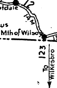
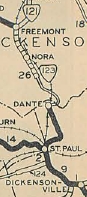
| Previous VA 123's:
1928 ROUTE LOG VA 12: 0 - 0 NC STATE LINE: 1.60 - 1.60 1932 ROUTE LOG CR 2: 0 - 0 VA 122 NB: 16 - 16 VA 122 SB: 1 - 17 VA 11 EB: 11 - 28 VA 11 WB: 3 - 31 VA 121: 27 - 58 1940 ROUTE LOG VA 114: 0 - 0 VA 320: 0.70 - 0.70 |
VA 123 #2: Appeared in Aug 1928 as a renumbering of VA 113, running from VA 11 (now US 58 ALT) St. Paul north to Dante, then extended north 3.2 miles to the Dickenson line. A second piece was created as an upgrade to CR 3, running from VA 121 (now SR 865) Fremont south 7.11 miles. In Aug 1929 (CTB), the northern piece of VA 123 was extended south 3 miles. In June 1930 (CTB), the northern piece of VA 123 was extended south 4.65 miles. In 1932, VA 123 was extended southeast with VA 11, then west replacing VA 124 to 5.6 miles past Dungannon. In June 1932, VA 123 was extended southwest 10.11 miles towards Natural Tunnel, ending at the present SR 649 bridge over Cove Creek west of Duncan Mill. In July 1933, VA 123 was renumbered as VA 70. Today this is Scott SR 649 east to VA 65 to Dungannon. VA 123 left VA 65-72 at the curve just north of SR 1010, then crossed the RR (no crossing now) onto Emmet St which curls around to Washington St which used to cross the Clinch River, then VA 123 used SR 659 east to VA 65. VA 123 used SR 683 in northeastern Scott County, but used VA 65 east to SR 828 to US 58 ALT, then north to St. Paul (used SR 811 loop), 4th Av (NOT VA 270), then VA 63 north to SR 663 except for SR 769 near Dante; SR 652 loop through Stratton.
|
||||||||
| |||||||
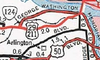
| ROUTE LOG US 29: 0 - 0 Lorcom Ln: 0.17 - 0.17 |
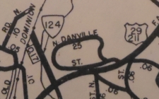
Creation: Appeared in May 1948 (CTB) as new routing, running as it does now. This is the 5th VA 124.
Adjustments: None Improvements: Paved and multilaned upon inception Posting: Fully posted at US 29; there are no VA 124 WB postings. Multiplexes: None Legislative names: None Other names: Spout Run Pkwy Scenic Byway: No segments Comment: VA 124 didn't explicitly appear on official maps until 1954. VA 124 connects US 29 to the Nat'l Park Service portion of Spout Run Pkwy which runs only to George Washington Pkwy SB. For a time NB George Washington Pkwy traffic had to end up on VA 124 until the road was built further north to the beltway.
| ||||||
| Previous VA 124's:
1926 ROUTE LOG VA 12: 0 - 0 VA 323: 15.9 - 15.9 1931 ROUTE LOG CR 1: 0 - 0 VA 122 NB: 6 - 6 VA 122 SB: 1 - 7 VA 11: 11 - 18 1937 ROUTE LOG VA 8: 0 - 0 WV STATE LINE: 1.62 - 1.62 1942 ROUTE LOG VA 30: 0 - 0 END VA 124: 1.20 - 1.20 |
VA 124 #1: Appeared in March 1924 (CTB) as an upgrade to
Mecklenburg CR 1, running from VA 12 (now VA 47-49-92 jct) Chase City
northeast 5 miles.
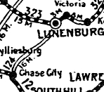
In Jan 1925 (CTB), VA 124 was extended north 10.9 miles to VA 323 (now VA 40) Lunenburg C.H., as an upgrade to Lunenburg CR 10. In May 1926 (CTB), VA 124 was renumbered as VA 201. Today it is VA 49 except in Rehoboth it used SR 677/727 and approaching Lunenburg it used SRs 674/675. VA 124 #2: Appeared Aug 1928 as an upgrade to CR 4, running from VA 11 (US 58 ALT-SR 683 jct) Banners Corner west 3 miles. See scan under VA 123 #2 entry. In Dec 1930 (CTB), VA 124 was extended west to end 5.61 miles past Dungannon. In 1932, VA 124 was renumbered as an extended VA 123. Today, it is VA 65-72 east to Dungannon, then VA 124 left VA 65-72 at the curve just north of SR 1010, then crossed the RR (no crossing now) onto Emmet St which curls around to Washington St which used to cross the Clinch River, then VA 124 used SR 659 east to VA 65. VA 124 used SR 683 in northeastern Scott County, but used VA 65 east to SR 828 to US 58 ALT. VA 124 #3: Appeared in July 1933 as a renumbering of VA 216 running from VA 8 (now SR 1001) Rich Creek north to the West Virginia line.
In 1937, VA 124 was renumbered as part of US 219. VA 124 #4: Appeared in 1937 as a renumbering of VA 219 running from VA 30 to the defunct Port Richmond Airport near West Point. In May 1943 (CTB), VA 124 was downgraded to SR 701.
|
||||||
| ||||||||||
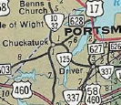
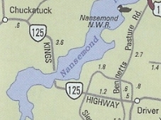
| ROUTE LOG VA 10, VA 32: 0 - 0 END VA 125: 2.69 - 2.69 GAP IN ROUTE BEGIN VA 125: 0 - 2.69 VA 337: 3.04 - 5.73 |
Creation: Appeared in Sept 1963 as an upgrade to SR 630
from VA 10-32 to SR 620 and an upgrade to SR 630 from SR 627 Driver to
VA 337. The 4.45 miles between SR 620 and SR 627 were the "Kings
Highway" which was a private road dating back to 1928 that included a
toll bridge over the Nanesmond River. This is the 4th VA 125.
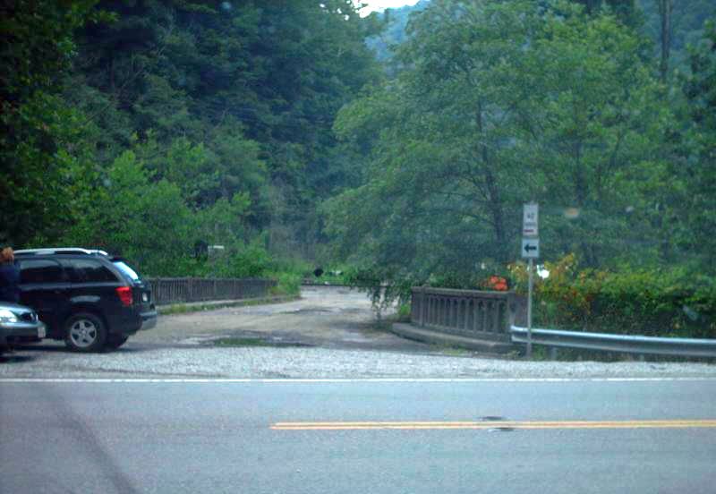
Adjustments: In Dec 1963 (CTB), the toll was removed from the Nanesmond River Bridge. In 2005, the Nanesmond River Bridge was closed out of safety concerns. VDOT did not have the money to repair it, so in 2007 the bridge was totally torn down. As of this writing there is no plan for putting another bridge in place, which was estimated to run around $50 million.
Improvements: Fully paved upon inception; no multilane segments Posted: Fully posted; A detour route was posted using SR 627, US 17 and SR 628 for a while but was not there when I visited here in March 2010. Multiplexes: None Legislative names: None Other names: Kings Highway Scenic Byway: None Comment: VA 125 makes no sense as a disconnected state highway. This should either be decommissioned or at least permanently rerouted to run along SR 628 to US 17. | |||||||||
| Previous VA 125's:
1928 ROUTE LOG VA 12: 0 - 0 US 11, VA 10: 6.1 - 6.1 CR 13: 1.1 - 7.2 1931 ROUTE LOG US 19, VA 11: 0 - 0 CR 7: 20 - 20 GAP IN ROUTE CR 5: 0 - 20 VA 121 WB: 4 - 24 VA 121 EB: 1 - 25 CR 6: 2 - 27 1953 ROUTE LOG US 29: 0 - 0 US 29 ALT SB: 0.75 - 0.75 US 29 ALT NB: 0.5 - 1.25 US 58: 0.5 - 1.75 |
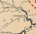
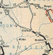
VA 125 #2: Appeared Aug 1928 as a renumbering of VA 118 running from US 19/VA 11 (now Old Rosedale Hwy) Rosedale north to Council. It was hen extended northwest as new routing 3.18 miles. In Dec 1930 (CTB), a separate piece of VA 125 was born as an upgrade to CR 2, running from VA 121 (now VA 63) Haysi south 3.52 miles; also VA 125 was extended along VA 121 east a bit, then north as new routing 1.94 miles towards Breaks Interstate Park. In June 1931 (CTB), the Haysi piece was extended south 1.18 miles towards Council. In 1932, VA 125 was renumbered as an extended VA 111. Today, it is part of VA 80 except: The route from Honaker south to the Holston River ran to the west of today's VA 80 using a bit of SR 672 and Clover Rd but is mostly not a road today.
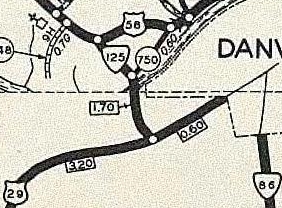
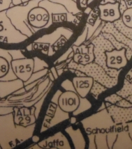
VA 125 #3: Appeared in July 1933 as a renumbering of VA 300 running from US 29/VA 14 (now VA 293) Schoolfield over to US 58/VA 12 (now VA 51) in the Westover area In Nov 1940 (CTB), VA 125 was rerouted to replace SR 739 north to US 29 north of Danville. The northernmost mile of this was taken into the primary system in July 1940 (CTB) but what number it was assigned is a mystery. The segment over to US 58 Westover became VA 125Y? By July 1941, VA 125 was renumbered as US 29 ALT from the Dan River north to US 29 (now US 29 Bus and Piedmont Dr). VA 125 was reduced to running from US 29 ALT at the dan River Bridge northwest to US 58 Westover (replaced 125Y?). South of the river was also made part of US 29 ALT (which has since been rerouted - VA 125 used Bishop Rd originally.) In May 1946 (CTB), SR 1145 was placed into the Primary Highway System, running between US 29 (now VA 293) and US 29 ALT (now US 29 Bus) in the Schoolfield area. This was almost certainly an extension of VA 125 south. VA 125 disappeared from official maps in 1954 and I can find no CTB reference to decommission it. Today it is Park Ave and Dan View Dr below VA 51; Piedmont Dr over the Dan River; US 29 Bus east to Park Ave (may have used Park Cir?) south to VA 293 Main St.
VA 125Y ?: For a few months in 1940-41, VA 125 was rerouted north of the Dan River along roughly Piedmont Drive and US 29 Bus. This left Park Ave/Dan View Dr which was not decommissioned. Best guess this was briefly VA 125Y before being returned to mainline VA 125 when US 29 ALT was designated. |
|||||||||
| |||||||||||
| ROUTE LOG VA 179: 0 - 0 US 13 Bus, VA 316: 1.38 - 1.38 |
| ||||||||||
| Previous VA 126's:
1932 ROUTE LOG CR 2: 0 - 0 VA 121 EB: 6 - 6 VA 121 WB: 1 - 7 VA 138: 28 - 35 US 19, VA 11: 5 - 40 1942 ROUTE LOG US 501: 0 - 0 VA 40: 6.35 - 6.35 GAP IN ROUTE Campbell-Pittsylvania Line: 0 - 6.35 US 501: 8.10 - 14.45 1975 ROUTE LOG US 221: 0 - 0 VA 291: 1.8 - 1.8 US 460: 1.4 - 3.2 |
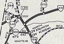
VA 126 #2: Appeared in July 1933 as a 2-piece route - 1. US 501 Volens west to VA 40 Cody (renumbering of VA 303). 2. US 501 Gladys southwest towards Long Island (renumbering of VA 323). In Aug 1933 (CTB), piece 2 was extended south over SR 670 to the Pittsylvania County line below Long Island. In Feb 1937 (CTB), VA 40 was rebuilt in the Cody area, and VA 126 was shifted east onto new alignment to meet VA 40 a little east of Cody, leaving behind SR 668.
In May 1943 (CTB), Piece 1 was downgraded to SR 603. Also, Piece 2 was truncated on its south end to SR 699 near Gladys, leaving behind SR 761. In April 1944 (CTB), the remaining bit of VA 126 was downgraded to SR 761. Note that the 1933 Route log says VA 126 followed VA 40 briefly and then north to Long Island. Best guess is that SR 668 was in line to become VA 126 at some point but that did not happen.
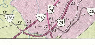
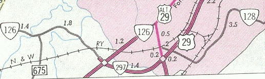
VA 126 #3: Created in Nov 1948 (CTB) as a renumbering of part of VA 128. Ran from US 460 (now US 221) east along Graves Mill Rd to end at VA 297 (now US 460 Bus). In Aug 1964 (CTB), VA 126 east was extended over new freeway construction over to US 29. In Oct 1964 (CTB), VA 126 was removed from the new freeway which became part of VA 297 (today it is US 501). VA 126 unstead was extended to replace VA 297 on Fort Ave from Graves Mill Rd to US 29 (now VA 163). This reversal of 126 on the freeway was because 297 was considered an arterial route coming from Bedford and should therefore be continued over the new freeway. In July 1976 (CTB), VA 126 east was truncated to its original ending. Fort Ave north to Wards Rd became part of US 460 Bus. In Sept 1977 (CTB), VA 126 was decommissioned within the City of Lynchburg, leaving behind Graves Mill Rd. In Sept 1979 (CTB), the 0.26 miles of VA 126 remaining in Bedford County off US 221 were downgraded to SR 1425. The last Official map to explicitly show VA 126 was 1976.
VA 126Y ?: May have been created Feb 1937 when VA 126 was rerouted at Cody. It would've been the eastern leg of the wye at VA 40. If this existed it was decommissioned in May 1943 when VA 126 was downgraded to SR 603. Today this is the mainline SR 603 approach to VA 40. See scan under VA 126 #2 above. |
||||||||||
| |||||
| ROUTE LOG US 522: 0 - 0 WV STATE LINE: 3.35 - 3.35 |
| ||||
| Previous VA 127's:
1932 ROUTE LOG VA 112: 0 - 0 US 19 NB, VA 11 EB: 2 - 2 US 19 SB, VA 11 WB: 1 - 3 VA 136: 5 - 8 US 19, VA 11: 8 - 16 1947 ROUTE LOG VA 24: 0 - 0 Bedford-Campbell Line: 3.10 - 3.10 VA 297: 2.70 - 5.80 US 460: 5.67 - 11.47 |
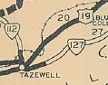
VA 127 #1: Appeared in Aug 1928 as an upgrade to CR 16, running
from US 19/VA 11 (now just Ben Bolt Ave) Tazewell east 12.58 miles
towards Rocky Gap, ending 1.18 miles short of the Bland County line.
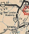
In 1932, VA 127 west was extended with US 19/VA 11 across the Clinch River, then replaced VA 137 over to VA 112 (now VA 16) North Tazewell. In July 1933, VA 127 was renumbered as VA 61. VA 127 #2: Appeared in July 1933 as a renumbering of part of VA 43, running from VA 24 (current SR 725-811-812 jct) Evington north to US 460 (now US 221) Forest. In May 1948 (CTB), VA 127 was downgraded to SR 811. The northernmost 1/3 of a mile is now SR 854 (SR 811 has been rerouted on its north end at US 221).
|
||||
| ||||||
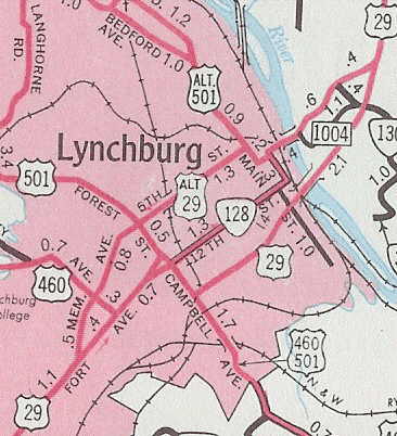
| ROUTE LOG VA 163: 0 - 0 US 29 Bus, US 501 NB: 0.29 - 0.29 US 501 SB: 0.40 - 0.69 US 460 Bus, US 501 Bus: 2.78 - 3.47 |
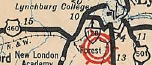
Creation: Appeared July 1933 as a renumbering of VA 319, running from US 460 (now US 221) to US 460-501 in the southern Lynchburg area. This is the 2nd VA 128.
Adjustments: In July 1939 (CTB), VA 128 east was extended into central Lynchburg with US 460-501 (using Campbell Ave all the way), then northeast as new primary routing via 12th St and Main St. VA 128 now ended at then-US 29 at Main St at 7th. Oddly, official maps up through 1944 do not show this as primary and maps 1946-55 show it as US 29 ALT. Only Official maps 1956-59 show this as VA 128. In Nov 1948 (CTB), VA 128 west was truncated to its present location. US 460 to VA 297 Fort Ave became VA 126 (now just Graves Mill Rd); The Fort Ave segment of VA 128 became an extended VA 297 and the Wards Ave segment remained part of US 29 (now VA 163).
In Sept 1959 (CTB), VA 128 east was truncated to its current ending.
Improvements: Paved upon inception; The US 460-501 duplex is shown as multilaned beginning in 1952. The 12th Ave-Main St portion is shown as multilane starting in 1956. Multilaned on Candler Mtn Rd since 1975 (bridge date). Posted: Fully posted Multiplexes: US 501 (0.40 mi) Legislative names: None Other names: Candler Mtn Rd, Mayflower Dr Scenic Byway: No segments Comment: Today's VA 128 on Mayflower Ave. is not much different from long ago - narrow and rather twisty. The indented horseshoe curve to get over the RR tracks is an adventure. | |||||
| Previous VA 128's:
1950 ROUTE LOG WV LINE: 0 - 0 VA 132: 0.1 - 0.1 US 19 NB, VA 11 EB: 2.40 - 2.50 US 19 SB, VA 11 WB: 0.20 - 2.70 WV LINE: 4.20 - 6.90 GAP IN ROUTE WV LINE: 0 - 6.90 CR 19: 1.05 - 7.95 |
|
|||||
| |||||
| ROUTE LOG US 501: 0 - 0 VA 34: 0.47 - 0.47 US 501: 2.71 - 3.18 |
Creation: Appeared in July 1933 as a renumbering of part of US 501 and VA 18, running as it does now. This is the 2nd VA 129.
Adjustments: None Improvements: paved upon inception; VA 129 was widened from SR 614 west to US 501 in 1983 or 1984. Posted: Fully posted Multiplexes: None Legislative names: None Other names: n Main St (South Boston); Old Halifax Rd (Halifax Co) Scenic Byway: No segments Comment: VA 129 is an OK alternative to US 501, but it does run through residential areas of South Boston. The 1939 VDOT report on primary system development had recommended that VA 129 be decommissioned in its entirety. |
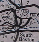
1941-42 Official |
|||
| Previous VA 129's:
1932 ROUTE LOG VA 12: 0 - 0 NC STATE LINE: 1.60 - 1.60 |
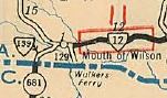
VA 129 #1: Appeared in Aug 1928 as a renumbering of VA 123. It ran from VA 12 (now US 58) Mouth of Wilson across a ferry over the New River, then south into North Carolina.
In July 1933, VA 129 was renumbered as VA 93. Today it is parts of SRs 716 and 838 (ferry over New River is gone), plus most of VA 93. |
1932 Grayson County |
|||
| |||||||||
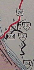
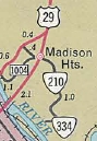
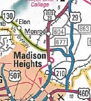
| ROUTE LOG US 11: 0 - 0 US 501 NB: 6.30 - 6.30 Amherst-Rockbridge Line: 2.43 - 8.73 US 501 SB: 4.69 - 13.42 Blue Ridge Pkwy: 1.25 - 14.67 US 29 Bus: 17.49 - 32.16 US 29: 2.05 - 34.21 SR 669: 0.48 - 34.69 |
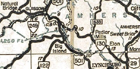
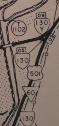
Creation: Appeared in July 1933. It initially ran SR 635-647 Pedlar Mills southeast to US 29 Madison Heights (replacing VA 317, then after a duplex with US 29 south, east replacing VA 311 to the State Epileptic Colony. This is the 2nd VA 130.
Adjustments: In Aug 1941 (CTB), VA 130 was extended west to US 501 Snowden generally following SRs 647, 645, and 610. In Jan 1945 (CTB), VA 130 was removed from the SR 618 loop at Agricola. About 1948, VA 130 was rerouted in Madison Heights to follow US 29 further south to today's VA 210, then east as new construction back to the old route. The previous route east off US 29 became VA 130-Y (now SR 1034) In March 1948 (CTB), VA 130 was removed from SRs 635/647 from Naola through Pedlar Mills. In Aug 1949 (CTB), VA 130 was removed from SR 727 near the Blue Ridge Pkwy. In May 1952 (CTB), VA 130 was extended west over the mountain with US 501 to Glasgow, then replaced VA 249 over to its end at US 11 Natural Bridge.
In Sept 1961 (CTB), VA 130 east was truncated to US 29 (now 29 Bus) Madison Heights, leaving behind its US 29 duplex and VA 210 (now also partly VA 334) over to the Epileptic Colony In 2005, VA 130 was extended east to its current ending at SR 669 just past the US 29 freeway.
Improvements: VA 130 was paved upon inception west of US 29 VA 130 was paved east of US 29 in 1934. The SR 610 part of the extension to US 501 was not paved until 1949. VA 130 was multilaned from US 29 Bus to US 29 in 2005. Posted: Fully posted; Last known cutout removed in Natural Bridge Station in early 2000s. VA 130 is currently posted east of the US 29 Bypass at SR 669. Multiplexes: US 501 (6.37 mi) Legislative names: Lee-Jackson Highway, from US 11 to US 501 (10-25-23 designation predates VA 130); Worthington Faulkner Memorial Highway, from US 11 to US 501 (since 6-27-68); Baldwin G. Locher Bridge over Maury River (10-24-84). Other names: Rockbridge Rd (Glasgow); Glasgow Hwy (US 501 duplex in Rockbridge Co); Elon Rd (US 501 to US 20) Scenic Byway: US 11 to US 29 Bus (since 8-19-76) Comment: VA 130 provides an excellent route for Lynchburg traffic heading for the Blue Ridge Parkway, as US 501 has some actual winding stretches. Access to the Natural Bridge attraction itself is gained from VA 130. The 1939 VDOT report on primary system development had recommended that VA 130 be decommissioned in its entirety west of Elon. | ||||||||
| Previous VA 130's:
1932 ROUTE LOG VA 12: 0 - 0 TN STATE LINE: 3.30 - 3.30 |
VA 130Y #1: Created around 1948 as a renumbering of VA 130 running along today's SR 1034 Main St between VA 130 (now VA 210) and US 29/VA 130 (now VA 163) in Madison Heights. For some reason it was on the wrong leg of the triangle. About 1955, the US 29 (now US 29 Bus) expressway was put in place very nearby and VA 130Y was downgraded to SR 1034. VA 130Y appeared explicitly on 1948 and 1949 Officials and was implied on 1950-54 Officials. See scan under VA 130 entry. VA 130Y #2: Created sometime after 1958 (not on the '58 Rockbridge County map) as the north leg of a triangle where VA 130 meets US 501. This VA 130Y was physically destroyed in early 2009 as part of construction to build a new Maury River bridge for VA 130. This VA 130Y was not posted back to at least 1996.
|
||||||||
| |||||
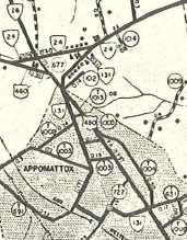
| ROUTE LOG US 460, VA 24: 0 - 0 US 460 Bus WB: 0.52 - 0.52 US 460 Bus EB: 0.07 - 0.59 US 460 Bus: 1.06 - 1.65 |
Creation: Appeared in July 1933 as a renumbering of VA 309 and a small part of VA 306. It ran in its general shape as today except its end was at VA 24 which was using today's SR 748. This is the 3rd VA 131.
Adjustments: About 1993, VA 131 was extended out to the Appomattox Bypass, replacing some of VA 24.
Improvements: Paved upon inception; no multilane segments No multilane segments Posted: Fully posted; However, in each direction at SR 727 there is a shield missing telling you which direction to go on 727. Also, on SR 727 SB there are no VA 131 postings at all. Multiplexes: US 460 Bus (0.07 mi) Legislative names: None Other names: Old Courthouse Rd, Pamplin Rd, Court St, Main St, Church St, Oakleigh Ave Scenic Byway: No segments Comment: VA 131 is one-way on Main St EB from SR 1059 to SR 727. Heading the other way you have to use SR 1060 Harrell St to SR 1059 back to Main. None of this is posted in any way. The traffic log shows no VA 131-P, so technically VA 131 cannot be driven WB in its entirety. The 1939 VDOT report on primary system development had recommended that VA 131 be decommissioned in its entirety. | ||||
| Previous VA 131's:
1932 ROUTE LOG US 19 SB, VA 110: 0 - 0 VA 11 WB: 7 - 7 US 19 NB, VA 11 EB: 1 - 8 CR 1: 8 - 16 |
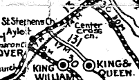
VA 131 #1: Appeared in March 1923 as new primary routing, running from VA 13 (now SR 677) St Stephens Church to King and Queen C.H.
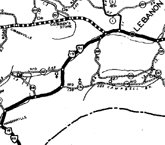
In March 1927 (CTB), VA 131 was extended south 4 miles. In August 1928, VA 131 was renumbered as VA 29. Today it is VA 14 except at King and Queen C.H. it used SR 681 Allens Cir. VA 131 #2: Appeared Aug 1928 as a renumbering of VA 112 from VA 110 (now old US 58 ALT, slightly SE of modern US 58 ALT) Hansonville to VA 11 (now SR 1030 which is Old VA 71) Lebanon. VA 131 was 100% duplexed with US 19. In July 1932, mileage was given to CR 1 between Lebanon and Cleveland. I believe this segment (not shown on officials or the 1932 Russell County Map) was an extension of VA 131. In July 1933, VA 131 was dropped in favor of US 19 from Hansonville to Lebanon and was renumbered as VA 82 from Lebanon to Cleveland. Today it is US 19 up to SR 674, then abandoned alignment on the north side to Sunset Dr; US 19; SR 841 (except used SR 758 loop) to US 19 Bus; tiny bit of 19 Bus; Gilbert St/Old Fincastle Rd; VA 82 to Cleveland except its ridge crossing has since been straightened out in a couple places. VA 131 did not appear on any official maps, but is in the 1932 VDOT County Atlas.
|
||||
| |||||||
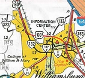
| ROUTE LOG VA 199, Colonial Pkwy: 0 - 0 VA 5 WB: 1.85 - 1.85 VA 5 EB: 0.38 - 2.23 VA 132Y: 0.44 - 2.67 York-Williamsburg Line: 0.16 - 2.83 US 60: 0.10 - 2.93 VA 143: 1.16 - 4.09 |
Creation: Appeared in May 1957 (CTB) as a renumbering of VA 31, running from US 60Z/VA 31 (now Duke of Gloucester St at Boundary St) Williamsburg to VA 31-168 (now VA 143). This is the 4th VA 132.
Adjustments: In June 1973 (CTB), VA 132 was rerouted on Henry St to follow Lafayette St west to US 60 (new primary routing). Henry St south of Lafayette and Duke of Gloucester St became part of VA 5-VA 31. In June 1978 (CTB), VA 132 was removed from Lafayette St (became part of VA 162 which is now not primary here). Instead, VA 132 was rerouted south on Henry St to VA 199 (some of this was a multiplex with VA 5-31) and Colonial Pkwy.
Improvements: Paved upon inception; Although still not shown on officials, VA 132 was multilaned upon inception from VA 132Y to US 60. The only other multilaning is the last teeny bit running into VA 199. Posted: Fully Posted; plethora of cutouts removed in mid-90s. Multiplexes: VA 5 (0.38 mi) Legislative names: None Other names: Henry St Scenic Byway: No segments Comment: VA 132 runs through the original part of Colonial Williamsburg, including a stop sign for pedestrian crossings on car-less Duke of Gloucester St. in the tourist area. VA 132 serves as access to the tourist area from I-64 EB (via VA 143). VA 132 is erroneously shown as VA 32 on the 1975 official. | ||||||
| Previous VA 132's:
1928 ROUTE LOG VA 13: 0 - 0 VA 20: 15 - 15 1931 ROUTE LOG VA 128: 0 - 0 END VA 132: 0.30 - 0.30 1941 ROUTE LOG US 460: 0 - 0 SR 630-681: 0.60 - 0.60 1956 ROUTE LOG VA 31: 0 - 0 Colonial Pkwy: 0.29 - 0.29 |
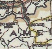
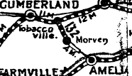
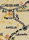
VA 132 #1: Appeared in June 1923 (CTB) as an upgrade to Powhatan CR 7 and Amelia CR 1, running from VA 13 Tobaccoville to Morven.
In Jan 1925 (CTB), VA 132 replaced 4 more miles of CR 1 towards Amelia C.H. In May 1926 (CTB), VA 132 was extended to VA 20 (now SR 656) Amelia C.H. In Aug 1928, VA 132 was renumbered as VA 406. Today it is SR 681.
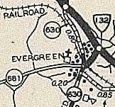
VA 132 #2: Appeared June 1930 (CTB) as new primary routing running from VA 128 (VA 102 College Dr) 0.30 miles to the Bluefield Airport. It is unclear what happened to VA 132 but I'm pretty sure it was one of these two things: 1. VA 132 was renumbered as part of VA 128 in 1932. 2. VA 132 was renumbered as part of VA 85 in July 1933. Today, the airport is gone and the route is the Stadium Dr segment of VA 102. Stadium Drive was shown as secondary on the 1932 Tazewell County map. The only proof of the existence of VA 132 anywhere in the universe is that it appears in the 1931 Route Log. VA 132 #3: Appeared in July 1933 as a renumbering of VA 326, running as a short route from US 460 to SR 630/681 Evergreen. In May 1943 (CTB), VA 132 was downgraded to SR 681. VA 132 #4: First appears in the July 1955 CTB as proposed construction in York County. The Aug 1955 CTB describes VA 132's route to run from the Colonial Pkwy north to VA 168 (current VA 143). In Jan 1956 (CTB), VA 132 north was truncated to end at VA 31 (now VA 132 Henry St). In May 1957 (CTB), VA 132 was renumbered as VA 132Y. VA 132 #4's brief existence is captured on the reverse of the 1957 Official.
|
||||||
| |||||
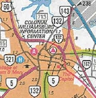
| ROUTE LOG VA 132: 0 - 0 Colonial Pkwy: 0.29 - 0.29 |
Creation: Appeared in May 1956 (CTB) as a renumbering of VA 132 running the way it does now. See scan under VA 132 entry.
This is the only VA 132Y.
Adjustments: None Improvements: Paved and multilaned upon desgination; Posted: Fully posted at VA 132 only Multiplexes: None Legislative names: None Other names: None Scenic Byway: None Comment: VA 132Y provides access to the Colonial Williamsburg Visitor Center, as well as the Colonial Pkwy. | ||||
| |||||
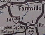
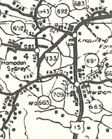
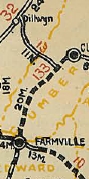
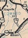
| ROUTE LOG US 15: 0 - 0 SR 604-692: 1.19 - 1.19 |
Creation: Created July 1933 as a renumbering of VA 305, running from US 460 Prospect southeast to US 15 Kingsville. This has been the 3rd VA 133.
Adjustments: In Sept 1942 (CTB), VA 133 west was truncated to Hampden-Sydney (downgraded to SR 626-658), then replaced VA 134 south to the campus. In Oct 1945 (CTB), VA 133 was moved to its current route to the east of the Hampden-Sydney campus, leaving behind SR 692.
Improvements: Paved upon inception only east of old VA 134. The remaining portion of VA 133 was paved in 1940. No multilane segments Posting: Fully posted Multiplexes: None Legislative names: None Other names: None Scenic Byway: No segments Comments: VA 133 connects US 15 to Hampden-Sydney College, although the route skirts around it. | ||||
| Previous VA 133's:
1928 ROUTE LOG US 60, VA 10: 0 - 0 VA 13: 14 - 14 1932 ROUTE LOG VA 128: 0 - 0 END VA 132: 0.30 - 0.30 |
VA 133 #1: Appeared in mid-1926 as a renumbering of part of VA 13 running from VA 10 (now US 460 Bus) Farmville north to VA 13 (now probably SR 670) near Cumberland C.H.
In Aug 1928, VA 133 was renumbered as VA 310. Today it is part of VA 45 except north of Farmville VA 133 used SR 1007 Osborn Rd. VA 133 #2: Appeared Dec 1930 (CTB) as an upgrade to CR 4, running from VA 11 (now US 23 Bus) north 2.82 miles. In June 1932 (CTB), VA 133 was extended north over CR 11 to Dunbar, about 2 miles short of Pardee. In July 1933, VA 133 was renumbered as VA 69. Today it is SR 603.
|
||||
| ||||||
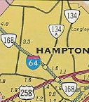
| ROUTE LOG US 60, VA 143: 0 - 0 VA 351: 0.37 - 0.37 I-64 (exit 265): 0.89 - 1.26 US 258 NB: 1.03 - 2.29 VA 152: 0.24 - 2.53 I-64 EB (exit 263), US 258 SB: 0.83 - 3.36 I-64 WB (exit 262): 0.55 - 3.91 VA 172: 2.40 - 6.31 York-Hampton Line: 1.11 - 7.42 VA 171: 3.31 - 10.73 US 17: 0.98 - 11.71 |
Creation: Designated between 9/42 and 1944 as a renumbering of VA 170, running generally the way it does now.
This is the 3rd VA 134. Adjustments: In 1951 or 1953, VA 134 was extended north slightly to its current endpoint with US 17 which was moved off SR 706 Theater Rd. In Apr 1964 (CTB), VA 134 was placed on Magruder Blvd (replacing VA 134-A), duplexed with I-64/VA 168, then duplexed with US 258 Mercury Blvd back over to Armistead Ave. The old route became unnumbered Wythe Creek Rd; VA 172 south to Sheppard Blvd; unnumbered route south to Mercury Blvd VDOT officials from 1967-71 show VA 134 assigned to today's I-664 from I-64 down to VA 351. The April 1966 CTB called this road "Interstate Spur to Route 64." The April and June 1967 CTB do reference it as VA 134 referring to construction dollar allocation. The March 1969 CTB says the Connector was designated an interstate by the 1968 Federal Aid highway Act. So perhaps it was envisioned to put 134 on the Connector when opened but was accepted into the interstate system first. In Jan 1979 (CTB), VA 134 was extended south from Queen St to Settlers Landing Rd, replacing a bit of VA 143. Improvements: Paved upon inception; VA 134 is first shown as multilane on the 1951 Official, from US 60 (Queen St) out to US 258 Mercury Blvd. VA 134 was multilaned in 1964 when it was added to US 258, I-64 and Magruder Blvd VA 134 was multilaned from Wythe Creek Rd to US 17 in 1973. Posting: Fully posted Multiplexes: US 258 (1.07 mi) I-64 (0.55 mi) Legislative names: None Other names: Armistead Ave/Mercury Blvd/Magruder Blvd (Hampton); Hampton Hwy (York Co) Scenic Byway: no segments Comment: Although VA 134 between I-64 and US 17 has taken on a number of stoplights since I lived down that way in 1991, it remains a good viable alternative to reach I-64 EB from US 17 SB. VA 134 on Magruder Blvd still retains some of its original 1964 concrete. One of the first SPUIs in Virginia is located at the VA 134 and Hampton Roads Pkwy interchange.
| |||||
| Previous VA 134's:
1932 ROUTE LOG VA 110: 0 - 0 CR 3: 6.36 - 6.36 1941 ROUTE LOG VA 133: 0 - 0 SR 692: 0.66 - 0.66 |
VA 134 #1: Appeared in Dec 1930 (CTB) as an upgrade to CR 1, running from VA 110 (now US 58 ALT) Bolton southwest 4.12 miles. In June 1932 (CTB), VA 134 was extended southwest over CR 3 for a distance of 2.24 miles to the Willow Spring area. In July 1933, VA 134 was renumbered as VA 74. Today it is SR 613. VA 134 #2: Appeared July 1933 as a renumbering of VA 324, running as a stub from VA 133 (now SR 658) south to Hampden-Sydney College. See scan under VA 133 entry. 1941 CTB references a bypass to the east of Hampden-Sydney as VA 134. However, in Sept 1942 (CTB), VA 134 was renumbered as part of VA 133. VA 134-A: Appears in CTB minutes from 1961-63 as Magruder Blvd under construction. It also appears on the 1963 official and the 1963 Esso map on Hampton Rds. However, I think the road was actually opened as plain ol' VA 134 in 1964.
|
|||||
| ||||||
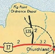
| ROUTE LOG US 17: 0 - 0 VA 164: 0.20 - 0.20 I-664 (exit 7): 1.41 - 1.61 VA 367: 0.59 - 2.20 |
| |||||
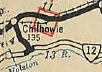
| Previous VA 135's:
1932 ROUTE LOG VA 12: 0 - 0 US 11, VA 10: 4 - 4 1944 ROUTE LOG US 360: 0 - 0 US 460: 10.6 - 10.6 |
VA 135 #1: Appeared in Dec 1930 (CTB) as new primary routing,
running from US 11/VA 10 Chilhowie (now SR T1004 Main St) southeast 1.9
miles.
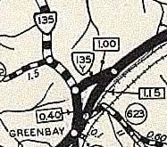
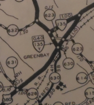
In Jun 1931 (CTB), VA 135 was extended to VA 12 (now SR 660) St Clair Bottom. In July 1933, VA 135 was renumbered as VA 79. Today it is the last bit of VA 107, SR 1034, SR 762, and SR 600. VA 135 #2: Appeared July 1933 as a renumbering of VA 316 running from US 360 Green Bay north to US 460 near Farmville. Between 1936-43, VA 135 and VA 135Y swapped legs in Green Bay. The 1943 VDOT County Atlas shows them switched. In May 1943 (CTB), VA 135 was rerouted in Green Bay to hit US 360 further west, replacing VA 135Y. The old route became SR 694. In May 1945 (CTB), VA 135 was decommissioned to SR 696.
VA 135Y #1: Appeared between 1933-36 connecting VA 135 (now SR 696) southeast to US 360 near Green Bay. Between 1937-40, VA 135Y swapped places with VA 135 in Green Bay. Today it is SR 694. VA 135Y #2: Appeared explicitly in the 1940-43 VDOT County atlases connecting VA 135 (now SR 694) southwest to US 360 in Green Bay. In May 1943 (CTB), VA 135Y was renumbered as part of VA 135. Today it is SR 696. The triangle setup was shown but not labeled on officials from 1937-41.
|
|||||
| |||||
| ROUTE LOG US 1: 0 - 0 SR 652: 1.17 - 1.17 |
| ||||
| Previous VA 136's:
1932 ROUTE LOG VA 128: 0 - 0 CR 15: 8 - 8 1944 ROUTE LOG VA 49: 0 - 0 Nottoway-Lunenburg Line: 4.02 - 4.02 US 460 EB: 9.45 - 13.47 US 460 WB: 1.67 - 15.14 US 360: 2.20 - 17.34 |
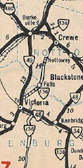
VA 136 #1: Appeared in Dec 1930 (CTB) as new primary routing, running from VA 128 (now VA 61) Gratton southeast 7 miles to Burkes Garden.
In June 1932 (CTB), VA 136 was extended east another mile. In July 1933, VA 135 was renumbered as VA 87. Today it is SR 623. VA 136 #2: Appeared July 1933 as a renumbering of VA 404 from Jennings Ordinary south through Crewe to Victoria, then after a duplex with VA 48 (now VA 40), replaced VA 403 south to the Red Level area at SR 655. About 1935, VA 136 was removed from Lunenburg SRs 693/652 and Nottoway SR 664. In Sept 1942 (CTB), VA 136 south was truncated to VA 49 (now SR 723) north of Victoria, leaving behind a bit of VA 49, its VA 40 duplex and SR 635 south to Red Level. In May 1948 (CTB), VA 136 was renumbered as part of VA 49. It is still VA 49 today except in Crewe VA 136 used Custis St and Russell St to zig-zag over to today's US 460. Then VA 136 left for Jennings Ordinary via Archer St, Maryland Ave and SR 630 back to today's VA 49.
|
||||
| |||||
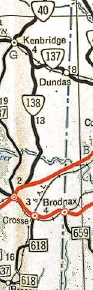
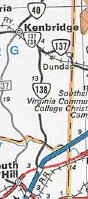
| ROUTE LOG VA 40, BEGIN VA 138: 0.00 - 0.00 VA 138 SB: 3.80 - 3.80 Brunswick-Lunenburg Line: 4.67 - 8.47 VA 46: 3.56 - 12.03 |
Creation: Appeared in July 1933 as a renumbering of VA 437 from US 1 Alberta to VA 34 (now VA 46), a duplex with VA 34 to Danieltown, then replaced VA 423
north to the Nottoway County Line. A separate piece also replaced VA
423 from VA 48 (now VA 40) Blackstone south several miles. This is the 2nd VA 137.
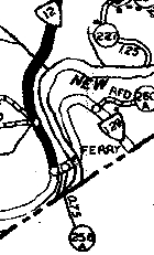
Adjustments: In Oct 1934 (CTB), the 3.63 gap in VA 137 was closed as an upgrade to SR 644. In Oct 1940 (CTB), VA 137 had some changes: 1. VA 137 north was rerouted at Danieltown to replace VA 34 over to VA 40 Kenbridge. The route to Blackstone became VA 46. 2. Two discontinuous pieces of VA 137 were created by replacing VA 32 from VA 88 (now SR 619) Purdy east 4.55 miles and also replacing another part of VA 32 from just west of the Sussex-Greensville line at Jarratt east across US 301 to end 0.9 miles short of SR 645 Henry. In April 1944 (CTB), the Purdy segment was downgraded to 608 and from US 301 to Henry was downgraded to SR 631. The piece of VA 137 from US 301 west to SR 610 Greensville County line became VA 139. In May 1953 (CTB), VA 137 east was truncated to VA 46 Danieltown, leaving behind its VA 46 duplex and SR 652 east to US 1 Alberta (some of this is now VA 136). In April 1979 (CTB), VA 137 was rerouted at Danieltown to meet VA 46 via new construction south of the railroad. The old alignment north of the railroad is now part of SR 729; south of the railroad is abandoned (but visible) routing.
 VA 137 truncated to Danieltown 1954 Official
| ||||
| Previous VA 137's:
1931 ROUTE LOG VA 112: 0 - 0 VA 128: 2 - 2 |
|
||||
| |||||
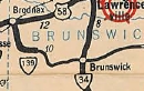
| ROUTE LOG US 1: 0 - 0 Lunenburg-Brunswick Line: 3.27 - 3.27 VA 137 EB: 9.83 - 13.10 VA 40, VA 137 END: 3.80 - 16.90 |
Creation: Appeared in July 1933 (CTB) as a renumbering of VA 433 from VA 137 south to the Brunswick Line. A separate piece also was created as a renumbering of VA 416 running from US 58 (now SR 1520 High St) La Crosse south to about SR 617 Marengo. This is the 2nd VA 138.
Adjustments: In Aug 1933 (CTB), VA 138 was extended south from the Nottoway-Brunswick Line to US 1, then duplexed with US 1 and US 58 over to La Crosse to create a continuous route. In May 1946 (CTB), VA 138 south was truncated to its current end, leaving behind its US 1 and US 58 duplexes, plus SR 618. I cannot find a CTB reference when VA 138 was extended north with VA 137 to Kenbridge. It is NOT shown in the '58 VDOT County Atlas. The first official to show it is the 1977 issue.
Improvements: paved upon inception except the last 3 miles to Marengo South to Marengo was paved in 1934. The segment from US 1 to the Lunenburg line was paved in 1936. VA 138 has no multilane segments. Posting: Fully posted; Multiplexes: VA 137 (3.80 mi) Legislative names: None Other names: 5th Av (Kenbridge); South Hill Rd (Lunenburg Co); Union Mill Rd (Brunswick Co) Scenic Byway: No segments Comment: VA 138 provides direct access to Kenbridge from I-85 which is very close to VA 138's south end. | ||||
| Previous VA 138's:
1932 ROUTE LOG VA 111: 0 - 0 CR 12: 6.5 - 6.5 GAP IN ROUTE VA 126: 0 - 6.5 CR 6: 5.0 - 11.5 |
|
||||
| |||||
| ROUTE LOG US 301: 0 - 0 Greensville-Sussex Line: 0.72 - 0.72 SR 610: 0.76 - 1.48 |
| ||||
| Previous VA 139's:
1932 ROUTE LOG VA 12: 0 - 0 NC STATE LINE: 3.80 - 3.80 1941 ROUTE LOG US 58: 0 - 0 SR 658: 3.95 - 3.95 |
VA 139 #1: Appeared in June 1931 (CTB) as new primary routing,
running from VA 12 (now US 58) Mouth of Wilson southwest to the NC
Line. This had been part of VA 12 in the early 1920s.
In July 1933, VA 139 was renumbered as VA 92. Today it is VA 16 and SR 858. VA 139 #2: Appeared in July 1933 as a renumbering of VA 442 running from US 58 Broadnax southeast 3.95 miles. In Sept 1942 (CTB), VA 139 was downgraded to SR 658.
| ||||
| |||||
| ROUTE LOG I-81 (exit 14), US 58: 0 - 0 VA 372: 0.30 - 0.30 US 11, US 19: 0.07 - 0.37 |
Creation: Appeared Aug 1960 (CTB) as an upgrade to SR 647, running as it does today. This is the 3rd VA 140.
Adjustments: None Improvements: Paved upon designation; shown as multilane starting with the 1967 official. Posting: fully posted; Multiplexes: None Legislative names: None Other names: Jonesboro Rd Scenic Byway: No segments Comment: VA 140 didn't appear on officials until 1964. VA 140 could easily be part of US 19 if it were treated as a through route like US 58 and put on I-81 north from Bristol |
 VA 140 in place before I-81. 1961 Washington County |
|||
| Previous VA 140's:
1932 ROUTE LOG US 411, VA 10: 0 - 0 CR 7: 5.15 - 5.15 1940 ROUTE LOG US 58: 0 - 0 US 1: 13 - 13 |
VA 140 #1: Appeared June 1932 as new primary routing. Did not
appear explicitly on maps or in the CTB minutes but with the pattern of
numbering routes in District 1 I believe this was an upgrade to CR 7
and ran from US 411/VA 10 (now US 58-421) northeast to just east of
Benhams.
In Oct 1940 (CTB), VA 140 was renumbered as VA 75. Today it is SR 700. VA 140 #2: Appeared in July 1933 as a renumbering of VA 402 from US 1 at the Nottoway River south to US 58 Edgerton, then continued west on US 58 briefly before replacing VA 438 south to the Brunswick Airport. In Sept 1942 (CTB), VA 140 south was truncated to Edgerton, leaving behind the US 58 duplex and SR 670. In April 1949 (CTB), the rest of VA 140 was downgraded to SR 712. |
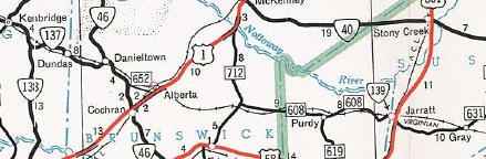
 VA 140 #2 1933 Official |
|||
Previous: VA 101 - 120 |
Next: VA 141 - 160
Top | Virginia Hwy Index
Home
Page last modified 28 February 2015


