< SC 15 | Home | SC 17 >
|
|
|
| ROUTE LOG |
US 176: 0 - 0 US 21, US 321: 0.8 - 0.8 SC 277: 0.5 - 1.3 SC 555: 0.6 - 1.9 US 1: 1.2 - 3.1 SC 12: 1.7 - 4.8 US 76, US 378: 2.2 - 7.0 SC 48: 2.4 - 9.4
|
Creation: Appeared in 1939 as new primary routing running from SC 48 east to US 76 in southern Columbia. This is the 2nd SC 16.
| Adjustments: In 1940, SC 16 was extended north from US 76 as new primary routing to end at SC 12. In 1948, SC 16 was downgraded to S-40-21 from SC 48 to US 76 and S-40-26 from US 76 to SC 12.
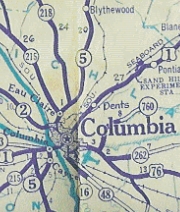
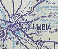
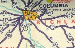
In 1964, SC 16 was re-established, from US 76-378/SC 760 north to SC 12, then replaced a renumbered S-40-21 all the way around to US 176. In 1982, SC 16 was extended west to SC 48, replacing S-40-21. This also left behind a US 76-SC 16 CONN, and SC 16 no longer touched SC 760.
Improvements: SC 16 was fully paved upon designation. The 1940 extension was not paved, but it was paved before 1946. All other SC 16 segments have been paved since. SC 16 was 4-laned between US 21-321 and US 1 when re-established in 1964. Between 1966-67, SC 16 was 4-laned from US 1 to SC 12. In 1968 or 1969, SC 16 was 4-laned from SC 12 to US 76-378. The 1982 extension to SC 48 was 4-laned at that time. SC 16 remains 2-lane from US 176 to US 21. Comment: SC 16 serves as a Beltline around 3 sides of Columbia. | Previous SC 16's:
1930 ROUTE LOG US 21, SC 7, SC 9: 0 - 0 SC 5, SC 163: 24 - 24 SC 161: 3 - 27 SC 55: 3 - 30 NC STATE LINE: 4 - 34 |
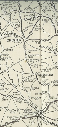
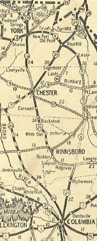
SC 16 #1: An original state route. It ran from SC 2 (current US 176) Columbia north to Ridgeway, then west to Winnsboro, north to Chester, York, and Clover before heading into North Carolina, continuing as NC 16. Some maps 1922-24 show SC 16 using SC 555 through Killian and some show using US 21 avoiding Killian.
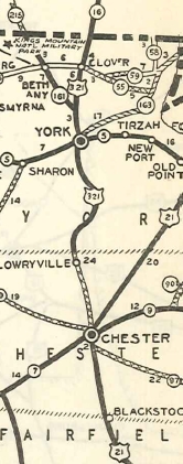
In 1928, SC 16 south was truncated to Chester, leaving behind US 21. Today this is still US 21 to Ridgeway; Dogwood Ave; SC 34; S-20-256 and S-20-178 in the I-77 area; SC 34; Columbia Rd and US 321 Bus through Winnsboro; it is unclear if SC 16 ever used S-20-314 and S-20-222 to get from Winnsboro to White Oak; US 321; S-20-44 and S-20-26 through White Oak; US 321; S-20-130 and S-12-130 through Blackstock; US 321; S-12-709 Old Columbia Rd; US 321; US 321 bus into Chester. In 1931, the rest of SC 16 was renumbered as US 321. Today this is S-12-1 York St and Old York Rd leaving Chester; SC 909; US 321; US 321 Bus through York; S-46-44 and S-46-172 thrgouh Filbert; US 321; S-46-4 Old Main St on the north side of Clover; US 321
|
||||||||||||||


Previous: SC 15 |
Next: SC 17
Top | South Carolina Hwy Index
Home
Page last modified 28 May 2016