< US 19 | Home | US 21 | US 21E | US 22 >
US 121
| US 21 ALT decommssioned | ||||||||||||||
| US 21 ALT: |
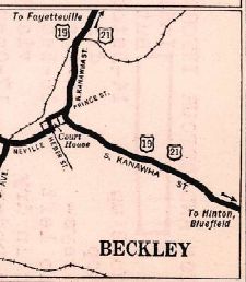
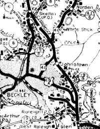
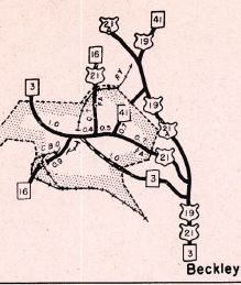
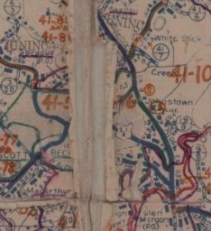
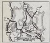
US 21 ALT #1: Appeared about 1934 as the route through Beckley, replacing US 19-21 through town. The bypass is referred to as "Alternate Route" through at least 1936. Then by 1940, it appears mainline US 19-21 was moved onto it. Despite a 1947 Official map showing US 21 and 21 ALT swapping, I don't believe US 21 ALT changed any routing until its ultimate decommissioning in 1975. South of downtown Beckley became WV 210, while north of downtown remained part of WV 16. Note that US 19 ALT was with US 21 ALT until US 19 was moved to today's WV 41 northeast out of Beckley in 1947.
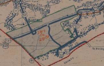
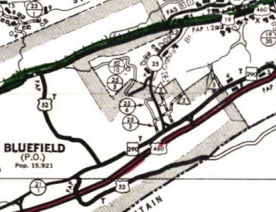
US 21 ALT #2: Appeared about 1937 as a bypass of Bluefield, replacing CR 25. It is very ambiguous about when this exactly went away. The 1968-69 official seemed to show it as relegated back to CR 25. This might have been connected to West Virginia's original request to get rid of US 21 throughout the state. The bypass became unnecessary with the completion of US 460 on Corridor Q in 1977. At any rate, the Cumberland Rd part of the route eventually became part of WV 290 (now US 52) and Grassy Branch Rd went back to being CR 25.
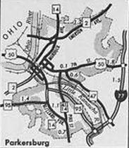
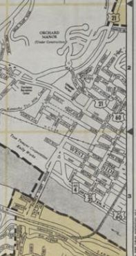
US 21 ALT #3: Appeared around 1950 or so as a renumbering of US 21E, running on Pike St from Blizzard/Broadway in southern Parkersburg to East St, then followed US 50 (now WV 618) into downtown Parkersburg to meet with US 21. In 1966, US 21 ALT became WV 14 ALT. Given that WV 14 ALT is unposted one might wonder if US 21 ALT was posted. It definitely was. See the 2nd to last photo on this page. Also it was posted downtown.
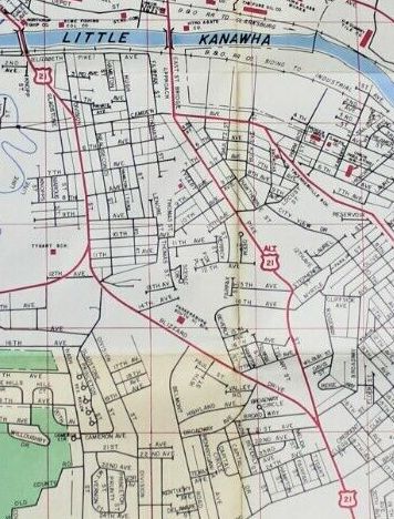
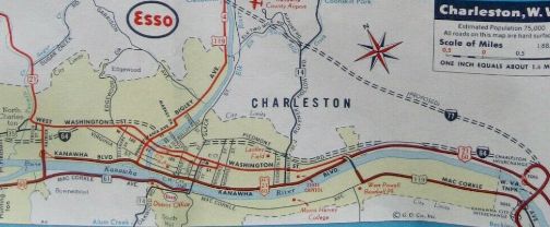
US 21 ALT #4: Appears to have existed at least from the early 1950s through the mid-to-late 1960s, running along Kanawha Blvd and Patrick St in Charleston. It is shown on more than one commercial map. When this was discontinued, Kanawha Blvd remained US 60 ALT (now also gone) and US 60 on Patrick St.
US 21 ALT #5: Appeared about 1956 as a new bypass of Mount Hope. As early as 1966, US 21 ALT was removed in favor of WV 16. Official maps are always too small to show the Mount Hope Bypass, but there is a 1957 Fayette County map that shows 21 ALT explicitly. Regrettably, the scan was blurry and close in illegible. | |||||||||||||
Previous: US 19 |
Next: US 22
Top | West Virginia Hwy Index
Home
Page last modified 22 July 2022