< US 48 | Home | US 50N >
US 50
| US 50 ALT obsoleted | ||||||
| US 50 ALT: 1973 Route Log OH STATE LINE: 0 - 0 WV 2 SB: 1 - 1 WV 2 NB: 1 - 2 US 50, WV 16 SB: 14 - 16 |
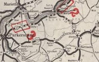
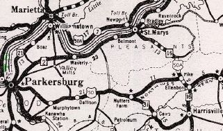
US 50 ALT #1: Appears in West Virginia annual reports as the Grafton Bypass. The 1935 report specifically shows both original US 50 and "alternate" 50 through and around Grafton respectively. I have yet to find any map that explicitly shows this. The 1938 Grafton inset I do have shows only US 50 on the bypass and US 250 or US 119 following US 50's former route through town. US 50 ALT #2: Appeared January 22, 1935 as a renumbering of US 50N from Pike to Ohio at St Marys. This was also a part of WV 16. There was some controversy, as Ohio wanted US 50N to become US 50 and US 50S to become US 50 ALT, but AASHO ruled the other way. Note that US 50N showed on county maps as late as 1949.
Between 1938-46, US 50 ALT was removed from CR 50/6 out of St. Marys
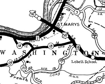
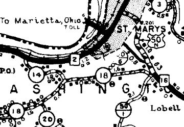
Between 1950-57, US 50 ALT was straightened out in Pleasants County leaving behind CR 16/8 and CR 16/9 loops below Maxwell; CR 16/5 and CR 16/7 loops above Maxwell; CR 16/4 and CR 16/6 at Cloverdale Church About 1971, per Wikipedia, US 50 was placed on its Appalachian Corridor D routing in Ritchie County. This means US 50 ALT was extended east over old US 50 Pike to new US 50 Ellensboro. In November 1973 (AASHO), US 50 ALT was dropped from the route, citing the new US 50 routing as part of the Appalachian Corridor making US 50 ALT unnecessary. The Ohio River bridge at St Marys was a twin bridge to the Silver Bridge used by US 35 at Point Pleasant. When the Silver Bridge collapsed in 1967, the St Marys bridge was closed for inspection and never reopened. A ferry was established which ended up being in place until 1977 when the current bridge downstream was opened. The original 1928 bridge was torn down in 1971 except the part over the back channel to Middle Island, which is still there. | |||||
Previous: US 48 |
Next: US 50N
Top | West Virginia Hwy Index
Home
Page last modified 30 April 2022