< WV 310 | Home | WV 331 >
|
|
|
|
| ROUTE LOG |
Virginia State Line: 0 - 0 WV 3: 3.1 - 3.1 Virginia State Line: 0.9 - 4.0 GAP IN ROUTE Virginia State Line: 0 - 4.0 I-64 (exit 183), US 60: 0.3 - 4.3
|
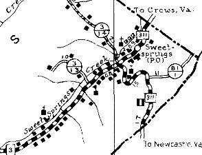
| Creation: WV 311 was designated in 1941 as a renumbering of WV 81, running from the Virginia line below Sweet Springs to the Virginia line just above Sweet Springs. This is the only WV 311.
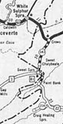
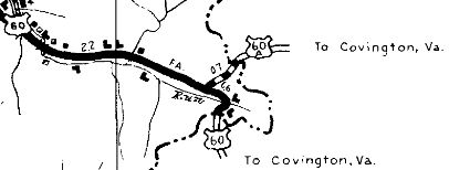
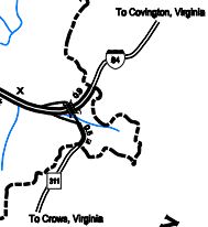
Adjustments: In 1947, a second piece of WV 311 appeared east of White Sulphur Springs replacing US 60 which used to head south to Crows VA before angling northeast to Covington.
Improvements: Upon designation, WV 311 was fully paved; no multilane segments. Comment: From the mid 1940s to the mid 1970s, this was the highest numbered state route in West Virginia. | |||||||
Previous: WV 307 | Next: WV 311 |
Top | West Virginia Hwy Index
Home
Page last modified 29 November 2017