< VA 3 | Home | VA 5 >
VA 4 ALT | VA 4-X
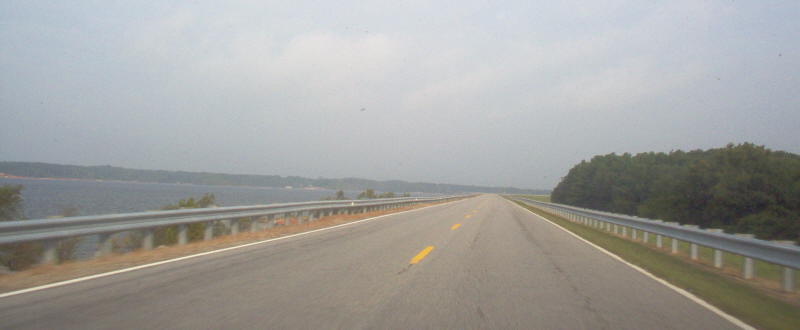
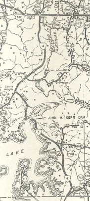
Photo: VA 4 on the earthen portion of Kerr Dam (photo by Mapmikey 9/23/06)
|
|
|
| ROUTE LOG |
US 58: 0 - 0 NC STATE LINE: 11.02 - 11.02
|
|
| Previous VA 4's:
1922 ROUTE LOG BEGIN VA 4: 0 - 0 MD STATE LINE: 64 - 64 1937 ROUTE LOG WV STATE LINE: 0 - 0 Harrisonburg-Rockingham Line: 21.62 - 21.62 VA 42: 1 - 22.62 US 11: 0.25 - 22.84 Rockingham-Harrisonburg Line: 0.75 - 23.59 VA 253: 1.25 - 24.84 VA 12 SB: 6.53 - 31.37 VA 12 NB: 8.36 - 39.73 Greene-Rockingham Line: 6.66 - 46.69 VA 230: 7 - 53.69 VA 243 WB: 3 - 56.69 VA 243 WB: 2 - 58.69 US 29: 5 - 63.69 Orange-Greene Line: 1 - 64.69 VA 20: 5 - 69.69 US 15 NB, VA 231: 6 - 75.69 Louisa-Orange Line: 1 - 76.69 US 15 SB, VA 22: 4.15 - 80.84 VA 16 NB: 10.59 - 91.43 VA 16 SB: 0.10 - 91.53 VA 49 NB: 5.46 - 96.99 VA 49 SB: 3.75 - 100.74 Hanover-Louisa Line: 11.89 - 112.63 VA 54: 6.20 - 118.83 Henrico-Hanover Line: 11.95 - 130.78 VA 4 ALT: 0.10 - 130.88 VA 4 ALT: 2.40 - 133.28 VA 161: 3.92 - 137.20 US 250 WB: 2.4 - 139.60 Richmond-Henrico Line: 0.5 - 140.10 VA 161: 1.32 - 141.42 US 1 NB: 0.97 - 142.39 US 1 SB: 0.61 - 143.00 US 60 WB, US 250 END: 0.49 - 143.49 US 360 WB: 0.56 - 144.05 US 360 EB: 0.70 - 144.75 US 60 EB: 0.25 - 145.00 Henrico-Richmond Line: 1.33 - 146.33 VA 156 NB: 6.52 - 152.85 US 60 WB: 0.95 - 153.80 VA 156 SB: 3.4 - 157.20 New Kent-Henrico Line: 2.30 - 159.50 US 60 EB: 0.35 - 159.85 VA 155 NB: 7.55 - 167.40 VA 155 SB: 3.90 - 171.30 VA 30 SB: 11.80 - 183.10 King William-New Kent Line: 1.20 - 184.30 VA 296: 0.14 - 184.44 VA 30 NB: 0.09 - 184.53 VA 298: 0.09 - 184.62 King and Queen-King William Line: 0.68 - 185.30 VA 14 NB: 3.45 - 188.75 VA 14 SB: 1.84 - 190.59 Gloucester-King and Queen Line: 2.93 - 193.52 US 17 SB: 3.15 - 196.67 Middlesex-Gloucester Line: 1.66 - 198.33 US 17 NB: 1.80 - 200.13 VA 227: 2.09 - 202.22 VA 225: 8.54 - 210.76 END VA 4: 8.50 - 219.26 1946 ROUTE LOG US 19: 0 - 0 VA 67 NB: 5 - 5 VA 67 SB: 3 - 8 VA 83 WB: 24 - 32 VA 83 EB: 4 - 36 KY STATE LINE: 13 - 49 |
VA 4 #1: Began in January 1918 as an original state route defined by the general assembly:
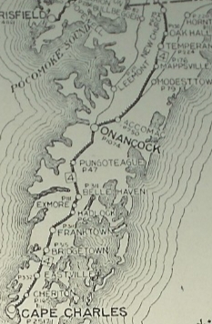
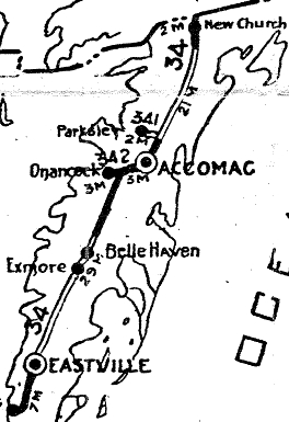
Route 4: Maryland Line, Accomac, Eastville, Cape Charles A 1924 Northampton Times article shows where VA 4 ran...Randolph/Pine to Mason, where the original ferry to Norfolk came in.
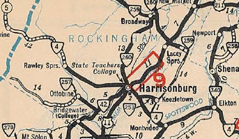
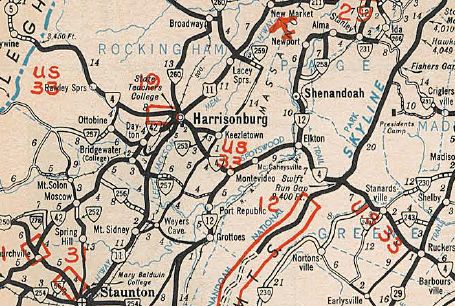
VA 4 #2: Appeared in July 1933 as a renumbering of: VA 814 from the West Virginia line near Rawley Springs to Harrisonburg
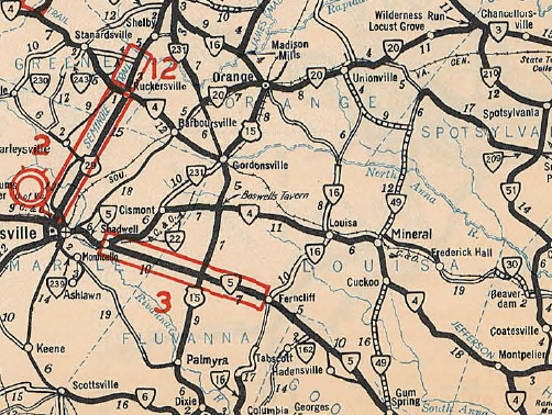
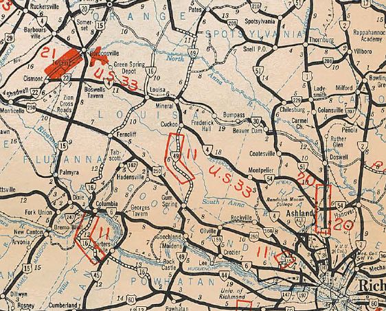
VA 4 followed US 33 then US 33 Business through Stanardsville (except SR 677 loop); US 33; US 33 to Gordonsville except SR 678 through Barboursville; US 15; VA 22 to Mineral; US 522 to Cuckoo; US 33 to Henrico County except SR 709 through Farrington.
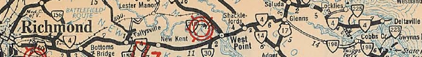
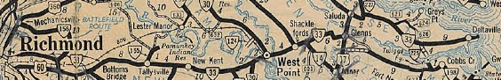
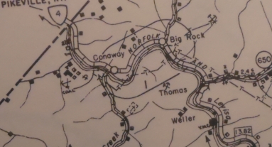
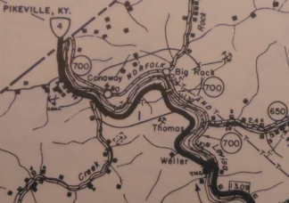
In Henrico County, VA 4 followed US 33 to Hunton Park Blvd, then used Old Mountain Rd which is cutoff by I-295. On the other side of I-295, VA 4 used Old Mountain Rd, Mountain Rd, Courtney Rd and Old Courtney Rd back to US 33. After a bit of 33, VA 4 followed Old Route 33 (no longer connects to), Hungary Rd, and Old Staples Mill Rd back to US 33. VA 4 followed US 33 to Broad St, then Broad St through Richmond to 25th St. VA 4 followed this to VA 33 Nine Mile Rd. VA 4 used VA 33 to Seven Pines, then US 60; Old Williamsburg Rd (cutoff by I-295); US 60 to the New Kent County Line. VA 4 then cut northeast (no road now with I-64 right there) and picked up SR 674 Clint Ln; VA 249 east to VA 33 east to West Point except the Pamunkey River Bridge was slightly north of today's new bridge. VA 4 followed VA 33 from West Point to Deltaville except SR 678 Shacklefords; SR 601 loop: SR 679 loop; SR 647 Batt; SR 629/641 Stormont; SR 707 loop
VA 4 from Richmond to Deltaville 1933 Official In Oct 1935 (CTB), VA 4 was removed from Mountain Rd/Courtney Rds and placed on modern US 33. The old route became VA 4 ALT (today this is Old Coutney Rd, Courtney Rd, Mountain Rd and the discontinuous segments of Old Mountain Rd (cutoff by I-295).
East of Richmond, VA 4 became VA 33.
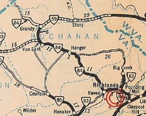
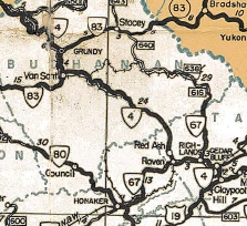
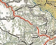
VA 33 replaces VA 4 east of Richmond 1938-39 Official VA 4 #3: Appeared in Oct 1940 (CTB) as a renumbering of VA 84, running from US 19 Claypool Hill west to the Kentucky State Line via Cedar Bluff, Richlands, and Grundy.
On 1/1/1947 (per Virginia Hwy Bulletin), VA 4 was renumbered as part of US 460. Today it is US 460 and US 460 Bus through Cedar Bluff and Richlands; VA 67/SR 751/SR 806 through Raven; SRs 804/805 Red Ash; SR 727 Grimleysville; SR 721 in Keen Mountain/Marvin; SRs 759 and 1013 in Janney; SR 725 in Tookland. There are innumerable abandoned alignments of US 460 on the big curves following various mountain streams.
|
||||||||||||||||||||||
Previous: VA 3 |
Next: VA 5
Top | Virginia Hwy Index
Home
Page last modified 7 February 2015