< VA 303 | Home | VA 304-Y | VA 305 >
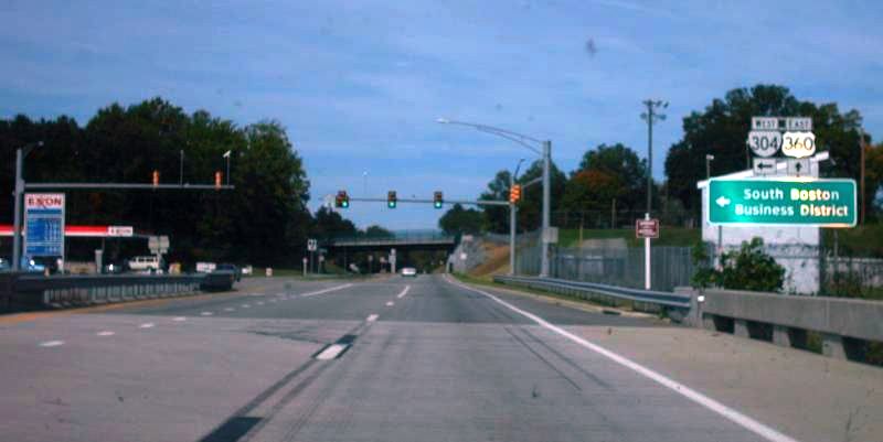
Photo: VA 304 from US 360 eastbound... (photo by Mapmikey 2011)
| ||||||||
| ROUTE LOG US 501: 0 - 0 US 360: 0.72 - 0.72 |
Creation: Appeared in 1984 as a renumbering of VA 304Y. Ran as it does today. This is the 3rd VA 304.
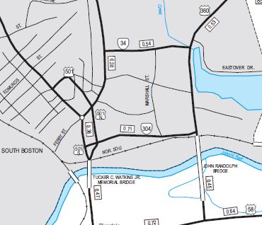
Adjustments: None Improvements: Paved upon inception; no multilane segments Posting: Fully posted at US 360, only posted US 501 SB. There are no 304 postings on VA 304 itself anywhere anymore. Multiplexes: NONE Legislative names: NONE Other names: Seymour Dr. Scenic Byway: No segments Comment: In-town connector between US 360 and US 501.
|
|||||||
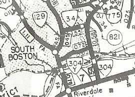
| Previous VA 304's: 1931 ROUTE LOG US 15, VA 32: 0 - 0 VA 20 WB: 12.2 - 12.2 VA 20 EB: 0.3 - 12.5 Appomattox-Charlotte Line: 12.77 - 25.27 US 60: 1.1 - 26.37 1983 ROUTE LOG US 58: 0 - 0 VA 304Y: 0.54 - 0.54 VA 34: 0.58 - 1.12 US 360, VA 344: 7.20 - 8.32 |
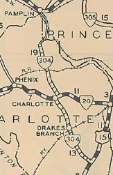
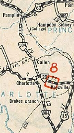
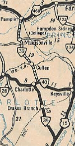
VA 304 #1: Appeared in August 1928. Ran from US 15/VA 32
(curr SR 713 near US 15-360, VA 47 jct) through Charlotte CH, ending at the
Charlotte-Prince Edward County line. Charlotte CH to Drakes Branch was
a renumbering of VA 202, while the rest was new routing.
In December 1930 (CTB Minutes), VA 304 was extended north 3.6 miles to US 60 (curr US 460 Bus) Pamplin. VA 304 was renumbered as VA 39 in July 1933. Today it is part of VA 47 except it used SR 697 through Cullen, SR 662/691 above Madisonville, and used SR 1103 to tie into then-US 60 in Pamplin City.
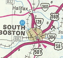
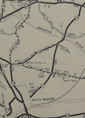
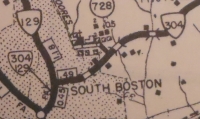
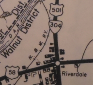
VA 304 #2: First appeared on the 1936 Halifax County map. The 1935 Halifax County map showed this as SR 690, SR 729 and SR 728. The March 1937 CTB was the first explicit mention of this route. Originally ran from US 360 (curr US 360-VA 344-VA 360 jct) southwest to South Boston's CL. In May 1948 (CTB), VA 304 was extended southwest into South Boston to VA 129, then south with VA 129 to US 501, then south with US 501 to end at US 58. Note this was already shown on County maps by 1945. In 1952, a new bridge over the Dan River (curr US 360) was constructed, previously assigned as VA 34. VA 304 was shifted over this to end at US 58 east of South Boston. The previous route into Downtown South Boston became VA 34, VA 129 and US 501. In 1984, VA 304 became US 360.
|
|||||||
Previous: VA 303 |
Next: VA 304-Y | VA 305
Top | Virginia Hwy Index
Home
Page last modified 24 January 2020