VA 201 to 220
< VA 181 to 200 | Home | VA 221 to 240 >
VA 217 view
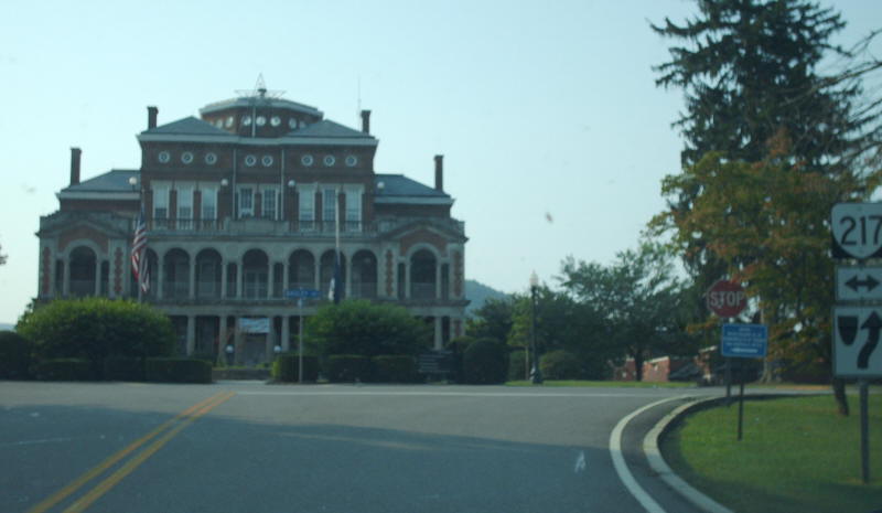
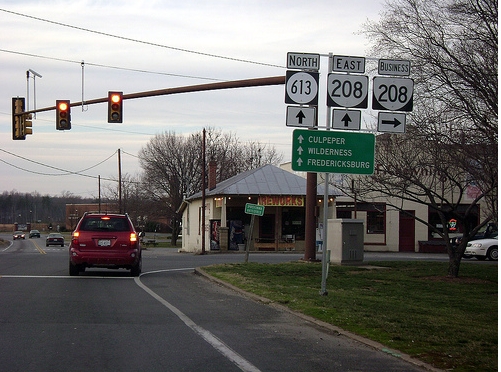
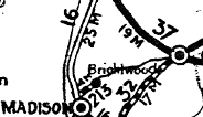
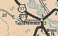
Photo: VA 217 and the facility it serves (photo by Mapmikey 8/18/07)
From: Mollusk (Lancaster County)
To: Heathsville (NOrthumberland County)
Total Length: 16.17 miles  
ROUTE LOG
VA 354: 0 - 0
VA 3: 3.22 - 3.22
VA 201Y: 2.74 - 5.96
Northumberland-Lancaster Line: 3.29 - 9.25
US 360: 6.92 - 16.17
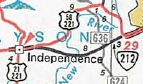
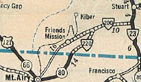
Creation: Appeared in July 1933 as a renumbering of VA 606 and VA 628. Ran essentially as it does today. This is the 3rd VA 201.
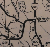
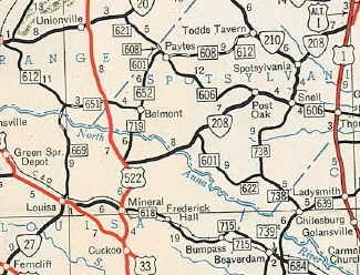
Adjustments: In Aug 1933 (CTB), VA 201 was extended west towards Monaskon.
In Sept 1937 (CTB), VA 201 was extended to Monaskon.
In May 1943 (CTB), VA 201 was truncated back to its current end, leaving behind SR 681 and a small bit of VA 354.
Sometime after 1961, VA 201 was given its current routing through McNeal's Corner. Before, VA 201 used today's VA 201Y and SR 600 to inexplicably use two legs of the triangle. The SW leg of the triangle is now VA 201Y and the SE leg is SR 600.
VA 201 (1935 Lancaster County)
VA 201 Original south end
1935 Lancaster County
VA 201 (1943 Lancaster County)
VA 201 extended to Monaskon
1943 Lancaster County
VA 201 (1940 Official)
VA 201 truncated to VA 354
Notice the erroneous VA 3 duplex
1940 Official

Improvements:  Paved upon inception from Lively to the Northumberland Line
In 1934 VA 201 was paved west of Lively.
The rest of VA 201 was paved in 1938.
no multilane segments
Posted:  Fully posted
Multiplexes:  NONE
Legislative names:  NONE
Other names:  White Chapel Rd (VA 354 to VA 201Y); Courthouse Rd (VA 201Y to US 360).
Scenic Byway:  NONE
Comment: VA 201 is extremely quiet. VA 201 used to have a duplex with VA 3 between Lively and VA 201Y.
The 1939 VDOT report on primary system development had recommended that VA 201 be decommissioned in its entirety.
Previous VA 201's:

1928 ROUTE LOG
US 15, VA 32: 0 - 0
VA 12 EB: 11 - 11
VA 12 WB: 11 - 22
VA 323 WB: 17 - 39
VA 323 EB: 3 - 42
US 60, VA 10, VA 20: 15 - 57


1932 ROUTE LOG
US 311, VA 33: 0 - 0
NC STATE LINE: 5.50 - 5.50
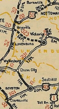
VA 201 #1: Appeared in April 1926 as a renumbering of VA 324 from VA 32 (now US 15) Clarksville to VA 12 (now US 58 Bus/VA 92) Boydton; duplex with VA 12 (now VA 92) to Chase City; replace VA 124 from Chase City to VA 323 (now VA 40) Lunenburg; duplex with VA 323 to Victoria, then north as new routing 3 miles.
In March 1927, VA 201 was extended north to US 60, VA 10-20 Burkeville.
In August 1928, VA 201 was renumbered: VA 44 from Clarksville to Boydton (now US 58 Bus and US 58); VA 12 Boydton to Chase City (now VA 92); VA 49 Chase City to Burkeville (now VA 49 and SR 723).
Today it is US 58 Business and US 58 east of Clarksville; SR 783 through Finchley; SR 756 into Boydton; one block of SR 707; VA 92 to Chase City; VA 49 to Victoria except SR 677 in Rehobeth area and SR 674/675 near Lunenburg; VA 49 then SR 723 to Burkeville.
VA 201 #2: Appeared in August 1928 as a renumbering of the original VA 337 running from US 311/VA 33 (now US 220 Bus) Ridgeway to the NC line towards Eden, where the route continued as NC 54.
In July 1933, VA 201 was renumbered as VA 106. Today it tiny part of VA 87 which has been rebuilt. VA 201 followed today's SRs 750 and 835.
VA 201 (1926 Official)
Original VA 201
1926 Official
VA 201 (1928 Official)
VA 201 #2
1928 Official
From:
To:
Total Length: 0.11 miles  
ROUTE LOG
VA 201: 0 - 0
SR 600: 0.11 - 0.11
Creation: It is uncertain when VA 201Y was born but it was after 1961 as a renumbering of VA 201. Ran as it does today between VA 201 and SR 600 at McNeals Corner in Lancaster County. This is the 2nd VA 201Y.
Adjustments: None
Improvements:  Paved upon inception; no multilane segments
Posted:  not posted
Multiplexes:  None
Legislative names:  None
Other names:  Courthouse Rd
Scenic Byway:  None
Comment: VA 201Y at this location hasn't made sense ever since VA 3 was removed from SR 600.
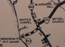
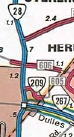
VA 201Y (1975 Lancaster County)
Current VA 201Y
1975 Lancaster County
Previous VA 201Y's:

1961 ROUTE LOG
VA 201: 0 - 0
VA 201: 0.12 - 0.12
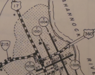
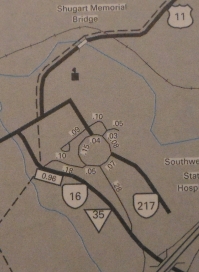
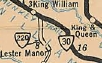
VA 201Y #1: Appears explicitly in the 1943 VDOT County Atlas but given how it was configured may go back to July 1933 as a renumbering of VA 628Y. It ran from then-VA 3/201 east to VA 201 at McNeals Corner. VA 3 was removed in the 1940's but maps show VA 201 using two corners of the triangle through at least 1961. Sometime after that it was renumbered as part of VA 201. VA 201Y (1961 Lancaster County)
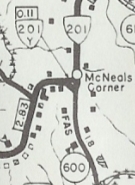
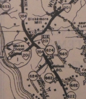
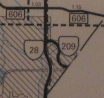
VA 201Y shown on the "wrong" leg
1961 Lancaster County
From: Templemans Corner (Westmoreland County)
To: Callao (Northumberland County)
Total Length: 17.91 miles  
ROUTE LOG
VA 3: 0 - 0
VA 203 SB: 12.58 - 12.58
VA 203 NB: 0.60 - 13.18
Northumberland-Westmoreland Line: 1.21 - 14.39
US 360: 3.52 - 17.91
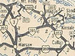
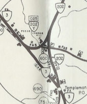
Creation: Appeared in July 1933 as a renumbering of VA 607 and VA 37-W. Ran as it does today, plus looped west and south back around to VA 3 Warsaw. This is the 3rd VA 202.
Adjustments: In May 1945 (CTB), VA 202 from Warsaw to Templemans was downgraded to SR 690.
In 1999, VA 202 at Templeman was reconfigued to its current VA 3 approach (new construction), leaving behind SR 766.
Improvements:  Paved upon inception; no multilane segments
Posted:  Fully posted; the last known cutout, in Callao, was removed around 1997.
Multiplexes:  VA 203 (0.60 mi)
Legislative names:  NONE
Other names:  Cople Hwy (Westmoreland Co); Hampton Hall Rd (Northumberland Co)
Scenic Byway:  None
Comment: VA 202 provides direct access from VA 3 Montross area to US 360 in Northumberland County.
VA 202 (1940 Official)
1940 Official
Previous VA 202's:

1928 ROUTE LOG
VA 20: 0 - 0
END VA 202: 4.00 - 4.00


1932 ROUTE LOG
VA 20: 0 - 0
END VA 202: 4.00 - 4.00
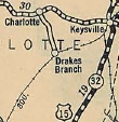
VA 202 #1: Appeared in March 1927 (CTB) as new primary routing, running from VA 20 (now VA 40) Charlotte CH south 4 miles towards Drakes Branch.
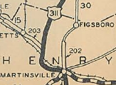
CTB minutes in 1928 suggest that VA 202 was renumbered as an extension of original VA 104 before the great renumbering in Aug 1928. Today it is part of VA 47. VA 202 was shown but not labeled on official maps.
VA 202 #2: Appeared in August 1928 as new primary routing, running from VA 12 (Broad and Church) Martinsville north 6.58 miles via duplex with US 311/VA 33 on Church St to Walnut St to Franklin St towards Figgsboro. See scan under VA 203 #1 entry.
In June 1930 (CTB), VA 202 was extended 2.5 miles to the Franklin County line.
In Dec 1930 (CTB), VA 202 was extended north 2 miles.
In July 1932 (CTB), VA 202 was extended north to VA 20 (now VA 40) Penhook.
In July 1933, VA 202 was renumbered as VA 108. Today it is VA 174, SR 714, all of current VA 108 and SR 890.
VA 202Y: Connected VA 3 and VA 202 in the Templeman area. Implied on Officials back to the mid 1930s and was shown in the 1943 VDOT County atlas. The 1932 Westmoreland County map implies a triangle setup so this may actually be a renumbering of VA 607.
In 1999, VA 202Y was renumbered as SR 767 when VA 202 was rebuilt to "split" the triangle.
Ever since the western piece of VA 202 was removed, VA 202Y looked like it was on the wrong leg of the triangle.
VA 202 #1 (1927 Official County)
VA 202 shown but not labeled
1927 Official

VA 202Y (1961 Westmoreland County)
VA 202Y on the "wrong" leg
1961 Westmoreland County

From:  Lyells (Richmond County)
To:  Kinsale (Westmoreland County)
Total Length:  9.36 miles  
ROUTE LOG
VA 3: 0 - 0
Westmoreland-Richmond Line: 0.40 - 0.40
VA 202 WB: 7.03 - 7.03
VA 202 EB: 0.60 - 7.63
SR 608-1007: 1.73 - 9.36
Creation: Appeared in July 1933 as a renumbering of VA 608. This is the 2nd VA 203. Ran essentially as it does today. See scan in VA 202 entry.
Adjustments: In Apr 1939 (CTB), VA 203 bypassed Griffiths Corner leaving behind a little SR 604 plus SR 670.
Improvements:  Paved at time of inception on VA 202 duplex and east to Kinsale.
VA 203 from VA 3 to VA 202 was paved in 1934.
No multilane segments.
Posted:  Fully posted
Multiplexes:  VA 202 (0.60 mi)
Legislative names:  None
Other names:  Oldhams Rd (VA 3 to VA 202); Cople Hwy (VA 202 duplex); Kinsale Rd (east of VA 202)
Scenic Byway:  No segments
Comment: The north end of VA 203 (why isn't this posted E-W?) is not intuitive in the field - as of April 2009 northbound the zig-zag is well posted but at SR 1007 where the road bends left there is a shield that 203 continues left - in error; westbound there is a 203 South shield at SR 1007.
The 1939 VDOT report on primary system development had recommended that VA 203 be decommissioned east of VA 202.
Previous VA 203's:

1932 ROUTE LOG
US 311, VA 33: 0 - 0
Patrick-Henry Line: 11.6 - 11.6
VA 203 #1: Appeared in August 1928 (CTB) as new primary routing, running from US 311/VA 33 (now US 220) Bassett Forks west 10 miles via Bassett.
In June 1930 (CTB), VA 203 was extended west 1.6 miles to the Patrick County line (at current SR 912 crossing).
In July 1933, VA 203 was renumbered as part of VA 57. VA 203 used VA 57 to Bassett (used SR 755, SR 715-716, SR 756 loops). VA 203 followed SR 682, then used SR 666 across Smith River then west back around to current VA 57 at West Bassett. VA 203 also used the SR 653 loop and the SR 687/912 at the Patrick County line.
VA 203 (1928 Official)
1928 Official
From:  Westmoreland County
To:  George Washington Birthplace Monument (Westmoreland County)
Total Length:  1.73 miles  
ROUTE LOG
VA 3: 0 - 0
END VA 204: 1.73 - 1.73
Creation:  Appeared in July 1933 as a 2-piece route:
1. VA 3 east to the George Washington Birthplace Monument (renumbering of VA 610).
2. US 360 west of Warsaw north to the Oak Row area (renumbering of VA 609. This is the 2nd VA 204.
Adjustments:  In Aug 1933 (CTB), Piece 2 was extended north 0.70 miles.
In May 1938 (CTB), piece 2 was extended 2.84 miles to just inside Westmoreland County Line.
In April 1949 (CTB), Piece 2 was decommissioned to SR 624.
Improvements:  Piece 1 was paved upon inception
About the lower half of piece 2 was paved in 1935 or 1936.
Piece 2 was paved to Foneswood about 1938.
The rest of piece 2 was paved in 1939.
No multilane segments.
Posting:  Fully posted; no reassurance shields eastbound at last report.
Multiplexes:  NONE
Legislative names:  Popes Creek Rd (since 7-16-87)
Other names:  None
Scenic Byway:  Entire route (since 8-15-02)
Comment:  VDOT has always valued George Washington, and has given this road 4 numbers over the years.
VA 204 (1940 Official)
1940 Official
Previous VA 204's:

1932 ROUTE LOG
VA 20: 0 - 0
Bedford-Franklin Line: 18.53 - 18.53
Bedford City-Bedford Line: 18.28 - 36.81
VA 10 WB: 0.51 - 37.32
VA 215 SB: 0.19 - 37.51
VA 215 NB: 0.27 - 37.78
Bedford-Bedford City Line: 0.83 - 38.61
VA 10 EB: 0.30 - 38.91
US 60, VA 14: 19.35 - 58.26
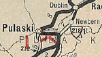
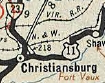
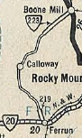
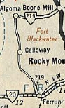
VA 204 #1: Appeared in August 1928. Ran from VA 20 (current VA 40) Rocky Mount northeast through Bedford (renumbering of VA 335) to end at US 60/VA 14 (now US 501) Big Island (new primary routing).
In July 1933, VA 204 was renumbered as VA 122. VA 122 has been rebuilt in many places, so VA 204 used these SR loops: SR 859 at Rocky Mount; SR 901-903 in Moneta; Nolans Dr; SR 860 at Bunker Hill; VA 122 Bus through Bedford
1933 Conoco
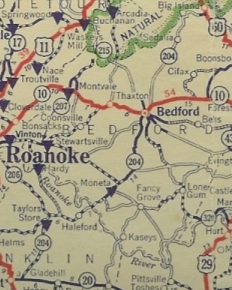
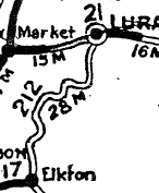
VA 204 #1
1933 Conoco
From:  Purkins Corner(King George County)
To:  Oak Grove (Westmoreland County)
Total Length:  18.39 miles  
ROUTE LOG
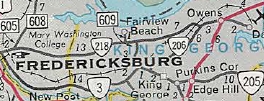
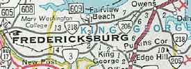
VA 3: 0 - 0
US 301: 1.26 - 1.26
VA 218: 6.12 - 7.38
Westmoreland-King George Line: 0.05 - 7.43
VA 205Y: 5.27 - 12.70
VA 3: 5.69 - 18.39
Creation:  Appeared in July 1933 as a renumbering of VA 611, running essentially as it does now. This is the 2nd VA 205.
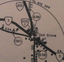
Adjustments:  In Oct 1959 (CTB), VA 205 was removed from today's SR 705 near Purkins Corner.
In Nov 1973 (CTB), VA 205 was removed from today's SR 706 east of Edgehill.
Improvements:  Fully paved upon inception; no multilane segments
Posted:  Fully posted; no known cutouts
Multiplexes:  None
Legislative names:  None
Other names:  Ridge Rd. (King George County); James Monroe Hwy (Westmoreland County)
Scenic Byway:  None
Comment:  VA 205 provides access to the Colonial Beach area.
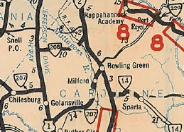
VA 205 (1940 Official)
1940 Official
Previous VA 205's:

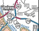
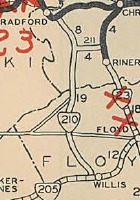
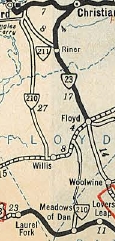
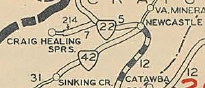
1932 ROUTE LOG
US 58, VA 12: 0 - 0
VA 213: 1.60 - 1.60
Floyd-Carroll Line: 10.20 - 11.80
VA 210 NB: 5.00 - 16.80
VA 210 SB: 0.80 - 17.60
VA 23: 11.20 - 28.80
VA 222: 2.25 - 31.05
Roanoke-Floyd Line: 19.14 - 50.19
VA 22 SB: 12.30 - 62.49
VA 22 NB: 1.35 - 63.84
Roanoke City-Roanoke Line: 1.80 - 65.64
Roanoke-Roanoke City Line: 0.45 - 66.09
Roanoke City-Roanoke Line: 1.10 - 67.19
END US 221, US 311, VA 33, VA 206: 2.00 - 69.19
VA 205 #1: Appeared August 1928 as new routing from VA 12 (now US 58) Hillsville northeast to the Floyd County Line, then as a renumbering of VA 232 through Floyd and ending at US 311/VA 33 (now US 220/VA 419 jct).
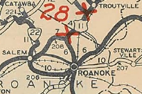
In Dec 1930 (CTB), VA 205 was rerouted to head directly northeast into downtown Roanoke to end at US 311/VA 33-206 (Jefferson at Elm). This was partially new primary routing and a renumbering of VA 206 #1. The old route to US 311 became part of VA 22 (now SR 897, SR 904 and VA 419).
In 1930, US 221 was assigned to the entirety of VA 205.
In July 1933, VA 205 was dropped from US 221, which it remains today except north of Bent Mtn VA 205 used SR 711.
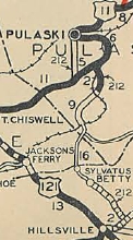
VA 205 (1929 Official)
1929 Official
From:  Colonial Beach (Westmoreland County)
To:  Colonial Beach (Westmoreland County)
Total Length:  0.71 miles  
ROUTE LOG
VA 205: 0 - 0
END VA 205Y: 0.70 - 0.70
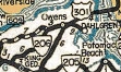
Creation:  Appeared in August 1933 (CTB) as a new primary route, running along Colonial Ave to its absolute dead end at the Potomac River. This is the first of 3 VA 205Y routes.
Adjustments:  In Feb 2015 (CTB), VA 205Y east was truncated 0.01 miles from its true dead end to the last driveway to a business.
Improvements:  Fully paved upon inception; no multilane segments
Posted:  Fully posted at VA 205 only back to at least 1995
Multiplexes:  NONE
Legislative names:  NONE
Other names:  Colonial Ave
Scenic Byway:  NONE
Comment:  VA 205Y begins showing up explicitly on VDOT Officials in 1944.
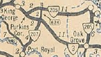
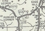
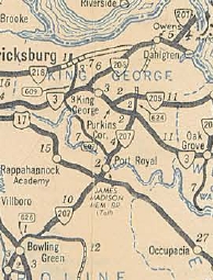
VA 205Y (1944 Official)
1944 Official
Previous VA 205Y's: 
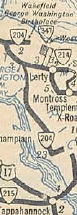
VA 205Y #2: Explicitly shown on the 1943 VDOT County Atlas as a triangle setup with VA 3 at Oak Grove. I am unsure of its start and end dates but it is NOT in the 1958 county atlas.
VA 205Y #3: Shown on the 1958 King George County map as a 0.04 mile connector between VA 3 and VA 205 at Purkins Corner. It is unclear when this began or ended but it is physically not present today and may have been destroyed by the VA 3 widening in the 1980s.
VA 205Y (1946 King George County)
VA 205Y #2
1946 King George County
VA 205Y (1958 King George County)
VA 205Y #3
1958 King George County
From:  King George (King George County)
To:  Dahlgren Naval Facility (King George County)
Total Length:  11.04 miles  
ROUTE LOG
VA 3: 0 - 0
VA 218 WB: 6.44 - 6.44
VA 218 EB: 2.19 - 8.63
US 301: 0.62 - 9.25
END VA 206: 1.79 - 11.04
Creation:  VA 206 was created July 1933 as a renumbering of VA 612, running the way it does now plus to the Potomac River. This is the 3rd VA 206.
Adjustments:  Between 1933-36, VA 206 was removed from SR 632 in the Hapstead area.
Sometime after 1936, VA 206 was truncated from the river to the Dahlgren Gate. I presume this was around 1941 during the War.
Improvements:  Paved upon inception; no multilane segments
Posted:  Fully posted
Multiplexes:  VA 218 (2.19 mi)
Legislative names:  NONE
Other names:  Dahlgren Rd (entire route)
Scenic Byway:  No segments
Comment:  VA 206 provides access to Dahlgren.
55 mph speed limits were removed from VA 206 in the mid-2000s.
VA 206 (1944 Official)
Current VA 206
1944 Official
Previous VA 206's:

1929 ROUTE LOG
US 11, VA 10: 0 - 0
VA 205: 4.8 - 4.8


1932 ROUTE LOG
VA 22: 0 - 0
VA 208: 3.42 - 3.42
Roanoke City-Roanoke line: 2.48 - 5.90
VA 207 WB: 0.45 - 6.35
US 11 NB, VA 10 EB, VA 33 NB: 2.53 - 8.88
US 11 SB, BEGIN US 311, VA 10 WB: 0.39 - 9.27
US 221, VA 205, VA 207 EB: 0.05 - 9.32
US 311 SB, VA 33 SB: 0.55 - 9.87
Roanoke-Roanoke City Line: 0.40 - 10.27
Franklin-Ronaoke Line: 5.10 - 15.37
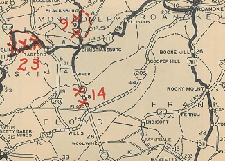
VA 206 #1: Appeared August 1928 as new primary routing. It began at US 11/VA 10 Roanoke in the Raleigh Court neighborhood at the junction of Brandon and Grandin, headed southwest over Grandin, the SE on Guillford, SW on Livingston, then south on Spring Rd to US 221 south to end at VA 205 (now US 221-SR 897 jct south of Cave Springs).
In Dec 1930 (CTB), VA 206 was renumbered as VA 205 and a small bit became a Roanoke City street (see this topo map which shows a main road doing this along with current US 221. Today it is still mostly US 221.
VA 206 #2: Created Dec 1930 (CTB) as new primary routing. Ran from US 311/VA 33 (now US 220 Bus/US 221 jct) Roanoke southeast to the Franklin County Line.
In Oct 1932 (CTB), VA 206 was extended with US 311 to VA 207, then west on VA 207 to western Roanoke, then northwest as new routing to Roanoke County line, then replaced VA 225 out to VA 22 (now SR 863) Hanging Rock.
In July 1933, VA 206 was renumbered as VA 116. Today it is still VA 116 in Roanoke except it used 11th St and Gilmer Ave instead of Melrose all the way. VA 206 used today's Cove Rd and VA 419 north of there.
VA 206 (1928 Official)
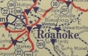
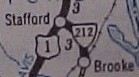
VA 206 shown but not really correctly
1928 Official

VA 206 (1933 Conoco)
VA 206 #2 shown in last routing
1933 Conoco

From:  Carmel Church (Caroline County)
To:  Bowling Green (Caroline County)
Total Length:  11.93 miles  
ROUTE LOG
US 1: 0 - 0
I-95 (exit 104): 0.46 - 0.46
VA 207 Bus: 10.02 - 10.48
US 301, US 301 Bus, VA 2, VA 207 Bus: 1.45 - 11.93
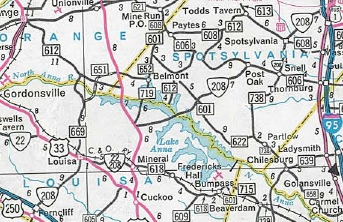
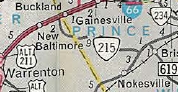
Creation:  VA 207 was created in July 1933. Ran from VA 51 (now SR 738) Chilesburg to US 1 Ladysmith (renumbering of VA 614, duplexed with US 1 south to Carmel Churc, then replaced VA 613 to end at VA 2 Bowling Green. This is the 2nd VA 207.
Adjustments:  In 1935 or 1936, VA 207 from Chilesburg to Ladysmith was renumbered as VA 229 (now SR 639).
Also in 1935 or 1936, VA 207 was given a second piece from Port Royal southwest 8.34 miles towards Bowling Green, which replaced VA 229 #2.
In Aug 1936 (CTB), piece 2 was extended from Port Royal to VA 3 which may have been partially an upgrade to SR 624 (see VA 205 scan).
In late 1939, a third piece of VA 207 was opened as new construction from VA 206 near Dahlgren to the new Potomac River Bridge location
VA 207 (1933)
VA 207 Chilesburg to Bowling Green
1933 Official
VA 207 (1936)
VA 207 Carmel Church to Port Royal
1936 Official
VA 207 (1940)
VA 207 extended to Maryland
1940 Official

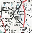
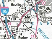
In Oct 1940 (CTB), pieces 2 and 3 were renumbered as VA 301 (now US 301).
In May 1952 (CTB), VA 207 was rebuilt in the Ruther Glen area to the modern alignment, leaving behind SR 716 (now SR 652 and 716) through Pattersons Corner, Moncure Corner and McDuff (some of this is destroyed by I-95). Also, SR loops 639/713, SR 714 and SR 601/715 at Athens were created by modern 207 construction.
In March 1954 (CTB), VA 207 was rebuilt to bypass Milford and central Bowling Green, moving the VA 207 endpoint to the current US 301 Bus/VA 2/VA 207 Bus jct. This left behind SR 722 through Milford and SR 614 into central Bowling Green.
In 1994, VA 207 was given its southern freeway bypass of Bowling Green, leaving behind VA 207 Bus.
VA 207 (1950 Official)
VA 207 zig-zags
1950 Official
VA 207 (1956 Official)
VA 207 straightened out
1956 Official
VA 207 (1996 Official)
VA 207 bypasses B. Green
1996 Official

Improvements:  All parts of VA 207 were paved upon inception.
The southernmost 2 miles were 4-laned in 1964.
VA 207 was 4-laned to SR 639 in 1972.
VA 207 was 4-laned to what is now the south end of VA 207 Bus in 1973.
VA 207's solo portion of the Bowling Green Bypass was 4-laned in 2001 or 2002 (the 1994 official erroneous shows 4-laning).
Posted:  Fully posted;
Multiplexes:  None
Legislative names:  NONE
Other names:  Rodgers Clark Blvd (all except Bowling Green Bypass)
Scenic Byway:  No segments
Comment:  VA 207 is one of a few primary non-interstates to have mile markers, which it does for its entire route.
Official Maps 1970-72 erroneously show the VA 207 portion of the Bowling Green bypass as existing.
From I-95, VA 207 is prominently advertised as the last exit to reach US 301 and the Potomac River Bridge. Even US 1 has TO US 301 shields in both directions.
Previous VA 207's:

1932 ROUTE LOG
VA 208: 0 - 0
Roanoke City-Roanoke line: 1.45 - 1.45
VA 206 NB: 0.38 - 1.83
US 11 NB, VA 10 EB, VA 33 NB: 2.53 - 4.36
US 11 SB, BEGIN US 311, VA 10 WB: 0.39 - 4.75
US 221, US 311 SB, VA 33 SB, VA 205, VA 206 SB: 0.05 - 4.80
Roanoke-Roanoke City Line: 1.95 - 6.75
Bedford-Roanoke Line: 3.70 - 10.45
CR 60-100: 16.8 - 27.25
VA 207 #1: Appeared in August 1928 as new primary routing, running from US 311/VA 33) now US 220 Bus Roanoke east 1.82 miles through Vinton. A second piece was born running from the Bedford/Roanoke line east 4.31 miles.
In Aug 1929 (CTB), VA 207 piece 2 was extended east 2.53 miles.
In June 1930 (CTB), VA 207 piece 2 was extended east 1.90 miles.
In Dec 1930 (CTB), VA 207 piece 2 was extended east 0.73 miles.
In June 1931 (CTB), VA 207 piece 2 was extended east 3.77 miles, and piece 1 was connected to piece 2.
In July 1932 (CTB), a new VA 207 piece was born, from VA 208 (current US 11A-460/VA 117 jct) east to the Roanoke City Limit. Also, the original part of VA 207 was extended east 4.27 more miles.
In Oct 1932 (CTB), VA 207's two pieces were connected through the City of Roanoke.
See scans under VA 206 entry.
In July 1933, VA 207 was renumbered as part of VA 24. Today it is US 11A-460 on Melrose, 11th St, Gilmer Ave; US 11 to downtown Roanoke; east on Tazewell, south on 13th, east on Dale Ave to Vinton; Sycamore St, 1st St, then Washington St through Vinton; VA 24; SR 886 Drewery's Hill Rd then Oddfellows Rd and Wildcat Rd through Stewartsville; VA 24; Ross Rd; VA 24; Masons Rd through Chamblissburg; VA 24; SR 747 to SR 801, ending at the SR 801-806 jct.

From:  near Milford (Caroline County)
To:  Bowling Green (Caroline County)
Total Length:  2.23 miles  
ROUTE LOG
VA 207: 0 - 0
US 301 Bus NB, VA 2 NB: 1.27 - 1.27
US 301, END US 301 Bus, VA 2 SB: 0.96 - 2.23
Creation: Created in 1994 when the VA 207 bypass south of Bowling Green was opened.
Adjustments: None
Improvements:  Paved upon inception; no multilane segments
Posted:  Fully posted on its solo portion only. No 207 Business postings on Main St. Note that the 2003 Route Log clearly indicates 207 Business follows Main St back out to the bypass.
Multiplexes:  US 301 Bus, VA 2 (0.96 mi)
Legislative names:  None
Other names:  Rodgers Clark Blvd (outside Bowling Green); W. Broaddus Ave (solo portion inside Bowling Green); Main St (US 301 Bus/VA 2 duplex)
Scenic Byway:  no segments
Comment: It would make much more sense to have 207 Bus follow 301 Business north to US 301 than what is does on paper officially now.
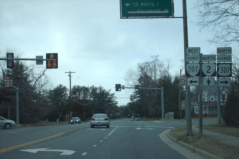
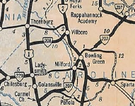
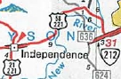
VA 207 Business
photo by Mapmikey
From:  Ferncliff (Louisa County)
To:  Four Mile Fork (Spotsylvania County)
Total Length:  47.35 miles  
ROUTE LOG
US 250: 0 - 0
I-64 (exit 143): 0.38 - 0.38
US 33 WB, VA 22 WB: 8.95 - 9.33
US 33 EB: 0.40 - 9.73
US 522 SB, END VA 22: 5.21 - 14.94
US 522 NB: 5.43 - 20.37
Spotsylvania-Louisa Line: 3.62 - 23.99
VA 208 Bus: 12.49 - 36.48
VA 208 Bus: 4.88 - 41.36
US 1, US 1 Bus: 5.99 - 47.35
Creation:  Appeared May 1950 (CTB) running from US 522 Wares Crossroads east to Snell (upgrade to SRs 613 and 606), then replacing VA 51 through Spotsylvania CH to end at US 1/US 1 ALT Four Mile Fork. This is the 3rd VA 208.
Adjustments:  In May 1972 (CTB), VA 208 was extended along US 522 to Mineral, then along VA 22 to Louisa, then south as an upgrade to SR 659 to end at US 250 Ferncliff. The Ferncliff-Louisa segment had previously been a state highway before, the last being VA 27.
In Jan 2005 (Scott Kozel post to mtr), VA 208 was placed on a new bypass to the east of central Louisa, leaving behind SR 630.
In Jan 2008 (Larry Gross post to mtr), VA 208 was placed on a newly constructed road that will eventually fully bypass Spotsylvania CH, Snell and Post Oak. VA 208 continues on Brock Rd (SR 613) west to the new road (just west of SR 608). The old route became VA 208 Business.
The new bypass (Phase 1) actually continues southwest of SR 613/VA 208 over to SR 648 and at the transition between these two roads there is a BEGIN VA 208 shield since at least Nov 2008.
In Dec 2011, VA 208 was placed on a newly constructed bypass of Post Oak, leaving behind SR 606 and SR 793.
In late 2012, VA 208 was (sorta) signed on the rebuilt portion of SR 648 from the "END" of VA 208 south to the original VA 208, although the END/BEGIN shields from 2008 were still up in April 2013, as were all postings on the original 208 via Snell to Spotsylvania CH.
In mid-to-late 2013, VA 208 was fully moved onto the Lake Anna Pkwy over SR 648 back to the original VA 208 routing. The old VA 208 routing via Snell became an extended VA 208 Business.
VA 208 (1952)
VA 208 from US 522 to US 1
1952 Official
VA 208 (1974)
VA 208 extended to Ferncliff
1974 Official
VA 208 (2012)
VA 208 bypasses Spotsy CH and Snell
2012 Official

Improvements:  Paved upon inception;
VA 208 was multilaned from US 1 to just north of current VA 208 Business in two segments: the north half in 1984 and the south half in 1991.
The Spotsylvania Bypass is multilane.
Posted:  Fully posted; cutout still present on SR 613 EB approaching what is now VA 208 Business west end; A cutout on 208 west approaching US 522 was replaced fall 2007.
Multiplexes:  US 33, VA 22 (0.40 mi)
VA 22 (5.21 mi)
US 522 (5.43 mi)
Legislative names:  New Bridge (over Lake Anna) since 4/17/03; Zachary Taylor Hwy (US 522 duplex)
Other names:  Courthouse Rd (US 250 to SR 630); Main St, Louisa Rd (Town of Louisa); Davis Hwy (VA 22 duplex); Louisa Hwy (Mineral); New Bridge Rd (US 522 to Lake anna); Courthouse Rd (Spotsylvania Co)
Scenic Byway:  No segments
Comment:  VA 208 serves the Lake Anna area from Fredericksburg.
SR 623 provides a good bypass of Mineral for VA 208 through-traffic.
Previous VA 208's:

1932 ROUTE LOG
US 11, VA 10, VA 22 SB: 0 - 0
VA 22 NB: 0.15 - 0.15
Roanoke-Salem Line: 0.30 - 0.45
VA 207: 2.15 - 2.70
VA 206: 1.30 - 4.00
VA 221: 2.20 - 6.20
US 11, VA 33: 1.45 - 7.65


1944 ROUTE LOG
US 1: 0 - 0
VA 2: 10.00 - 10.00
VA 208 #1: Appeared in August 1928 as new primary routing, running from US 11, VA 10-22 Salem northeast to US 11, VA 33 near Hollins. See the scan in the VA 206 entry.
In July 1933, VA 208 was renumbered as VA 117. Today it is US 11A-460 east of Salem and VA 117 northeast to US 11.
VA 208 #2: Appeared in July 1933 as a renumbering of VA 615. Ran from US 1 south of Thornburg east to VA 2 Villboro.
In May 1945 (CTB), VA 208 was downgraded to SRs 606 and 625.
VA 208Y: Appears explicitly in the 1940 VDOT County Atlas, but not on the 1936 Caroline County map. Formed a triangle at the east end of VA 208 with VA 2. The May 1946 CTB minutes specifically mention this 0.10 mile road because they forgot to decomission it when they axed VA 208 in May 1945. This makes 208Y the only Y route not to have touched its parent. Today it is part of SR 607.
VA 208Y was also shown on the 1942 Topo map of the area.
VA 208 (1933)
VA 208 #2
1933 Official
1940 Caroline County
VA 208Y in Villboro
1940 Caroline County

From:  Spotsylvania CH (Spotsylvania County)
To:  Spotsylvania CH (Spotsylvania County)
Total Length:  7.09 miles  
ROUTE LOG
VA 208: 0 - 0
VA 208: 7.09 - 7.09
Creation: Created in January 2008 when the first part of VA 208 bypass was opened.
Adjustments: In mid-to-late 2013, VA 208 Business was extended over VA 208 west through Snell back over to the new VA 208 alignment on the Lake Anna Parkway.
Improvements:  Paved upon inception; no multilane segments
Posted:  Fully posted
Multiplexes:  None
Legislative names:  None
Other names:  Courthouse Rd
Scenic Byway:  no segments
Comment: VA 208 Business looks to be in line for a big expansion when the second phase of the VA 208 bypass is built in the future.
VA 208 Business
photo courtesy Will Weaver
From:  near Dulles Airport (Loudon County)
To:  Herndon (Fairfax County)
Total Length:  0.80 miles  
ROUTE LOG
VA 28: 0 - 0
Fairfax-Loudon Line: 0.61 - 0.61
SR 605: 0.19 - 0.80
Creation:  Appeared Dec 1990 (CTB) as new routing. Ran from its current western terminus at VA 28, parallel to the exit ramp from VA 267 west to VA 28 north, then parallel with VA 267 to the original Rock Hill Rd/Innovation intersection at the southeast corner of the Virginia Center for Innovative Technology (CIT). This is the 4th VA 209.
Adjustments:  Closed in January 2016 for reconstruction on new alignment north of the CIT, with a new eastern terminus at SR 847 which is 0.10 miles past Rock Hill Road (SR 605). The realigned highway was opened in early 2017. Most of the original VA 209 alignment was physically removed.
Improvements:  Paved and multilaned upon inception;
The intersection was turned into a right-in/right-out interchange in 2008. This was turned into a full trumpet interchange that opened in 2017.
Posted:  Was posted in white rectangles only at VA 28 until the VA 28 partial interchange was built in 2008. Was not posted at all from 2008-2017. Now posted only in white rectangles at SR 605.
Multiplexes:  None
Legislative names:  None
Other names:  Innovation Ave
Scenic Byway:  No segments
Comment:  The 2016-17 realignment was necessary to make way for the Innovation Center station on Metrorail's Silver Line. VA 209 was not accessible from VA 28 SB from 2008 to 2017.
The Center for Innovative Technology is an odd shaped building that is visible for miles.
Thanks to Dave Montouri and also VDOT District Engineers for updated information on VA 209.

VA 209 (1992-93 Official)
1992-93 Official
VA 208 (1995 Loudoun County)
VA
1995 Loudoun County

Previous VA 209's:

1932 ROUTE LOG
CR 8: 0 - 0
VA 23 NB: 3.51 - 3.51
VA 23 NB: 0.45 - 3.96
Roanoke-Montgomery Line: 11.85 - 15.81
VA 22 NB: 9.70 - 25.51
VA 22 SB: 0.85 - 26.36
VA 217: 0.35 - 26.71
Botetourt-Roanoke Line: 2.80 - 29.51
US 11, VA 33: 15.22 - 44.73
GAP IN ROUTE
Roanoke-Botetourt Line: 0 - 44.73
VA 10: 0.70 - 45.43


1947 ROUTE LOG
SR 609: 0 - 0
VA 51: 16.40 - 16.40


1970 ROUTE LOG
VA 205: 0 - 0
END VA 209: 1.38 - 1.38
VA 209 #1: Appeared in August 1928 as new primary routing. It began at US 11-VA 33 Cloverdale and ran to Daleville then northwest around through Catawba to the Montgomery County line heading towards Blacksburg. Part of VA 209 replaced 0.35 miles of VA 221 and a duplex with VA 22 (now VA 311).
In June 1930 (CTB) a second piece of VA 209 was born running from VA 23 (now US 460 Bus) Blacksburg east 2.4 miles.
In Dec 1930 (CTB), piece 1 extended west 4.8 miles towards Blacksburg. Piece 2 was extended west along Turner St then Prices Fork Rd 1.46 miles.
In July 1932 (CTB), pieces 1 and 2 were connected, plus extended west to Linkous Store.
Also in July 1932, a new piece was created replacing CR 113 running north from VA 10 (now SR 7xx Bonsack Rd) to the Botetourt County Line
In July 1933, all parts of VA 209 were renumbered as VA 114. Today this is SR 685, VA 412, US 460 Bus, Roanoke St/SR 785, VA 311, SR 779 (except northwest of Tinker Mtn VA 209 went through what is now a large quarry) and US 220. The Bonsack piece is SR 604.
VA 209 (1929 Official)
VA 209 #1 initial routing with erroneous VA 221 designation
1929 Official
VA 209 (1932 Montgomery County)
VA 209 expands into Montgomery County
1932 Montgomery County

VA 209 #2: Appeared in July 1933 as a renumbering of VA 616. Ran from VA 51 (now VA 208-SR 738 jct) Snell west through Post Oak and Paytes, then curling southwest to end 0.3 miles short of the SR 601/652 junction in Granite Springs.
In April 1944 (CTB), VA 209 west was truncated to SR 609 Paytes leaving behind SR 601.
In May 1948 (CTB), the rest of VA 209 was downgraded to a bit of SR 608 and a long segment of SR 606 (today Post Oak to Snell is part of VA 208).
VA 209 #3: Appeared Nov 1957 (CTB) as a new designation running from VA 205 to the James Monroe Memorial, south of Colonial Beach.
The April 1986 CTB Minutes indicated that VA 209 was barricaded in 1971 by Westmoreland County and VDOT removed the route from maps. This is because the defunct Monroe Birthplace Monument Association, chartered with acquiring and preserving the site, never developed the surrounding land nor erected any type of memorial depicting the historical site which was to have been served by the road. So in 1986, VA 209 was officially decommissioned.
For a number of years, VA 209 was not a road at all. There are historic markers along VA 205 at its location near SR 625. From Google Earth you could still make out VA 209's run to the parking area for the never-built monument. However, about 2009, the road was put back into service as the Monroe Birthplace now has something to visit.
VA 209 (1933 Official)
VA 209 #2 at fullest reach
1933 Official
VA 209 (1961 Westmoreland County)
VA 209 into the Monroe Birthplace
1961 Westmoreland County
From: Madison Heights (Amherst County)
To: Madison Heights (Amherst County)
Total Length: 3.32 miles  
ROUTE LOG
VA 163: 0 - 0
US 29 Bus: 0.54 - 0.54
VA 334: 0.58 - 1.12
US 29: 2.2 - 3.32
Creation:  Appeared in Sept 1961 (CTB) as a renumbering of part of VA 130. It initially ran from US 29 ALT (now VA 163) to VA 334 at the Central Virginia Training Center. This is the 3rd VA 210.
Adjustments:  In early 2005, VA 210 was extended east out to the new US 29 Madison Heights Bypass as new construction. The remaining stub down to VA 334 was briefly posted as VA 210 still after the extension but is now posted as part of VA 334.
VA 210 (1965 Official)
VA 210 original routing.
1965 Official
VA 210 (2006-08 Official)
VA 210 rerouted out to new US 29.
2006 Official

Improvements:  VA 210 was paved upon inception.
VA 210 was multilaned east of US 29 Bus about 2005.
Posted:  Fully posted;
Multiplexes:  none
Legislative names:  None
Other names:  Colony Rd
Scenic Byway:  No segments
Comment:  VA 210 as extended now allows easy access from US 460 westbound traffic (via US 29 north) into Madison Heights.
Previous VA 210's:

1932 ROUTE LOG
US 58, VA 12: 0 - 0
CR 10: 2.00 - 2.00
GAP IN ROUTE
CR 2: 0 - 2.00
US 221 NB, VA 205 NB: 5.00 - 7.00
US 221 SB, VA 205 SB: 0.80 - 7.80
Montgomery-Floyd Line: 15.25 - 23.05
VA 211: 12.20 - 35.25
US 11, VA 10: 0.45 - 35.70


1951 ROUTE LOG
VA 3: 0 - 0
VA 51: 11.99 - 11.99
VA 210 #1: Appeared August 1928 as new primary routing, running from VA 205 (now US 221) Willis north to US 11/VA 10 (now Rock Rd at Auburn Rd) Radford.
In Dec 1930 (CTB), VA 210 was extended briefly over VA 205, then south as new routing 5 miles over CR 2. Additionally, a second piece was created running from VA 12 (now US 58) Meadows of Dan north 2 miles over CR 10.
In July 1932 (CTB), VA 210 piece 1 was extended south 3.45 more miles.
In July 1933, both pieces became VA 102. Today it is SRs 758, a small bit of the Blue Ridge Pkwy, SR 799, a little US 221, SR 787, Rock Rd.
VA 210 (1929 Official)
VA 210 original routing.
1929 Official
VA 210 (1932 Official)
VA 210 expanded south to Meadows of Dan
1932 Official

VA 210 #2: Created in July 1933 as a renumbering of VA 617, running from VA 3 near Wilderness to VA 51 (now VA 208) Spotsylvania CH.
In May 1952, VA 210 was downgraded to SR 613.
VA 210 TEMP: Assigned in Aug 1931 (CTB) to run from US 221/VA 205 at Shelors Mill (several miles northeast of Willis) southwest to the Edwards Store (about 5 miles from US 221 along today's SR 726) "that this be marked as a temporary route and that no decision shall be made on the final location of this until surveys have been made of both this route and the Willis Route, previous to construction"
In July 1932, the CTB voted to select the Willis route.
VA 210 TEMP is shown as THE VA 210 on the 1932 Floyd County map and the '32 Official.
VA 210 (1933 Official)
VA 210 #2
1933 Official

US 211
From: Timberville (Rockingham County)
To: New Market (Shenandoah County)
Total Length: 49.82 miles  
ROUTE LOG
VA 42: 0 - 0
Shenandoah-Rockingham Line: 4.27 - 4.27
VA 305: 1.31 - 5.58
I-81 (exit 264), US 211: 0.05 - 5.63
Creation:  Appeared in March 1977 (CTB) as a renumbering of VA 260, running the way it does now. This is the 3rd VA 211.
Adjustments:  None
Improvements:  paved upon desgination; no multilane segments
Posted:  Fully posted; cutouts at VA 42 removed in early 2000s
US 211 error shields exist at VA 42 (also US 211 error cutouts used to be there), at the bottom of I-81 ramp, leaving New Market and at least one SR jct.
Multiplexes:  none Legislative names:  None
Other names:  New Market Rd (Rockingham Co); W. Old Cross Rd (Shenandoah Co)
Scenic Byway:  No segments
Comment:  VA 211 combined with VA 42 make a back door route to Harrisonburg from I-81.
VA 211 (2006 Official)
2006 Official
Previous VA 211's:

1926 ROUTE LOG
VA 21: 0 - 0
VA 21: 0 - 0


1932 ROUTE LOG
VA 23: 0 - 0
VA 210: 6.20 - 6.20
VA 211 #1: Appeared July 1924 (CTB) as a renumbering of VA 21, running from VA 21 (now US 15-29) Buckland through Manassas to end at VA 21 (now US 29) Centerville. However, it is explicitly shown on the 1923 Official map.
In October 1926, VA 211 was renumbered as VA 28. Today it is VA 215, SR 779, VA 28 to Manassas Park, SR 616 and SR 657.
VA 211 #2: Appeared in August 1928 as new primary routing. Ran from VA 23 (now VA 8) Riner northwest 4.43 miles.
In Aug 1929 (CTB), VA 211 was extended west 1 mile.
In June 1931 (CTB), VA 211 was extended to VA 210 (now Rock Rd) Radford.
In July 1933, VA 211 became VA 110. Today it is SR 658, cutoff by I-81, a little SR 600, VA 177 and abandoned roadway near Rock Rd.
The 1928-29 Official maps show VA 211 connecting to VA 210 well south of Radford but I believe this is in error (see scan in VA 210 entry).
VA 211 (1924 Official)
1924 Official
From: White Oak (Stafford County)
To: White Oak (Stafford County)
Total Length: 0.87 miles  
ROUTE LOG
VA 3 Bus: 0 - 0
VA 218: 0.87 - 0.87
Creation:  Appeared in June 2004 (CTB) as a renumbering of VA 218, running as it does now. This is the 6th (!) VA 212.
Adjustments:  None
Improvements:  Paved and multilaned since inception;
Posted:  The VA 212-218 swap was fully posted beginning Sept 22, 2004
Multiplexes:  None
Legislative names:  None
Other names:  Chatham Heights Rd
Scenic Byway:  No segments
Comment:  About half of current VA 212 was part of VA 212 #5 at one point but the way the roads were reconfigured and renumbered, it became a rerouted VA 218 first, then a renumbering back to VA 212.
VA 212 (1988 Official)
VA 212 #5.
1988 Official
VA 212 (2006 Official)
Current VA 212.
2006 Official
Previous VA 212's:

1926 ROUTE LOG
VA 17: 0 - 0
VA 21: 17.3 - 17.3


1932 ROUTE LOG
VA 205: 0 - 0
Pulaski-Carroll Line: 11.60 - 11.60
VA 10 EB: 12.60 - 24.20
US 11 SB, VA 10 WB: 4.33 - 28.53
US 11 NB, VA 10: 4.45 - 32.98


1947 ROUTE LOG
US 1: 0 - 0
SR 608: 3.50 - 3.50


1978 ROUTE LOG
US 58, US 221: 0 - 0
US 58, US 221: 8.68 - 8.68


2003 ROUTE LOG
US 1, US 17 Bus: 0 - 0
VA 218: 1.3 - 1.3
VA 212 #1: Designated by the CTB in Dec 1923, running from VA 17 (now SR 759) Elkton north via Shenandoah and Stanley to end at VA 21 (now US 211 Bus) Luray.
In Oct 1926, VA 212 was renumbered as VA 251. Today it is part of US 340; SR 683 through Shenandoah; SR 650 around to Alma; SR 638 over to Stanley; US 340 Business.
VA 212 #2: Appeared August 1928 as new primary routing in two pieces: VA 205 (now US 221) Hillsville north 5.46 miles and US 11/VA 10 (now Dora Hwy) Pulaski south to US 11/VA 10 (now F-047), east with US 11/VA 10 to Draper, then south as new routing 8.40 miles (including a ferry over the New River).
In Aug 1929 (CTB), piece 1 was extended north 3 more miles.
In Dec 1930 (CTB), piece 2 was extended south 2.9 miles to Carroll County
In June 1931 (CTB), piece 1 was extended north to meet piece 2.
In 1931, US 11 was assigned to VA 212 over Draper Mtn.
In July 1933, VA 212 was renumbered as part of VA 100 from Hillsville to Draper; VA 101 from Draper west to US 11 and US 11 north to Pulaski.
Today it is VA 100 to Sylvatus (except SR 783 loop); SR 693 to Hiawassee, SR 777 along the south edge of the New River; SR 658 north of the river to Draper; F-047 west past VA 100; F-044 north to US 11 to Pulaski.
VA 212 #3: Created in July 1933 as a renumbering of VA 618, running from US 1 Stafford CH east to Brooke Station.
VA 212 was downgraded to SR 687 in May 1948 (CTB). Today it is parts of SR 630 and SR 629.
VA 212 (1924 Official)
VA 212 #1.
1924 Official
VA 212 (1929 Official)
VA 212 #2.
1929 Official
VA 212 (1941-42 Official)
VA 212 #3.
1941-42 Official

VA 212 #4: Created Oct 1975 (CTB) as new construction of current US 58-221 west of VA 94 to SR 638.
About 1978, VA 212 was extended west back to US 58-221 (now VA 274).
In Nov 1979 (CTB), VA 212 was renumbered as part of US 58 and US 221.
VA 212 (1977 Official)
VA 212 #4.
1977 Official
VA 212 (1978 Official)
VA 212 #4 extended.
1978 Official
VA 212 (1980 Official)
VA 212 replaced by US 58-221.
1980 Official
VA 212 #5: Appeared Oct 1985 (CTB) as an upgrade to SR 664, running from US 1-17 Bus Falmouth east to VA 218 White Oak. See scan above.
VA 212 was truncated to the current VA 212-218 intersection around 2003.
In June 2004 (CTB), VA 212 was renumbered as part of VA 218.
From:  City of Manassas Park
To:  Manassas City Line
Total Length: 1.89 miles  
ROUTE LOG
VA 28: 0 - 0
Manassas-Manassas Park Line: 1.89 - 1.89
Creation:  Created Aug 1964 (CTB Minutes) as an upgrade to SR 1501. Runs as it does now. This is the 4th VA 213.
Adjustments:  In June 1971 the CTB rejected a proposal by the Prince William Board of Supervisors to extend VA 213 through the Westgate community (presumably connecting to today's VA 234 Business someplace).
Improvements:  Paved upon inception; no multilane segments
Posting:  No longer posted. There was one VA 213 shield on VA 28 SB that was removed around 2001 when the VA 28-213 intersection was rebuilt and no signs were placed at the end of the project.
Multiplexes:  None
Legislative names:  None
Other names:  Manassas Dr
Scenic Byway:  No segments
Comments:  VA 213 is totally residential and its necessity as a primary route when it doesn't connect to anyplace else is questionable.
VA 213 did not appear on VDOT Official Maps until 1975.
VA 213 (1977 Official)
Current VA 213.
VA 213 (1975 Prince William County)
Current VA 213
1975 Prince William County
Previous VA 213's:

1925 ROUTE LOG
VA 16: 0 - 0
END VA 213: 9 - 9
GAP IN ROUTE
VA 37: 0 - 9
END VA 213: 10.5 - 19.5


1932 ROUTE LOG
VA 10: 0 - 0
US 11 NB, VA 10 EB: 6.74 - 6.74
US 11 SB, VA 10 WB: 0.05 - 6.79
Giles-Pulaski Line: 9.00 - 15.79
VA 42 WB: 1.50 - 17.29
VA 42 EB: 3.30 - 20.59
VA 23: 7.30 - 27.89


1942 ROUTE LOG
US 1: 0 - 0
Fauquier-Stafford Line: 11.25 - 11.25
VA 213 #1: Appeared March 1924 (CTB) in 2 pieces:
1. VA 16 (now VA 231) Madison 5 miles towards Culpeper as an upgrade to CR 6.
2. An upgrade to CR 3, running from VA 37 (now US 15 bus-29 bus-522 split) Culpeper north 8 miles. VA 213 used Main St to Williams St to West St north out of town.
In May 1926 (CTB), VA 213 piece 1 was extended north 4 miles and piece 2 was extended north 2.5 miles to Rixeyville
In Oct 1926 both pieces of VA 213 were renumbered as part of VA 28. Today it is US 29 Bus and US 29 and part of VA 229.
VA 213 is erroneously shown on the Culpeper inset of the 1927 Official map; conversely, little of VA 213 is shown on the 1924 and 1925 Official maps.
VA 213 (1924 Official)
VA 213 #1
1924 Official

VA 213 #2: Appeared in Aug 1928 as a renumbering of VA 109. It ran from US 11/VA 10 Dublin north to VA 23 (now US 460 Bus) Pearisburg.
In Dec 1931 (CTB), VA 213 was extended south to VA 10 (now SR 672) near McAdam, replacing VA 218 #1.
In July 1933, VA 213 was renumbered as VA 100. Today it is F047, SR 611 through Newbern; SR 682 toward Pulaski; a bit of VA 100; SR 746 through Pulaski; VA 100 to Giles County, except the mountain climb north of Pulaski has been rebuilt with only bits of the original route accessible. On the Giles County side, VA 213 used part of SR 660; closed bridge; SR 730; VA 100 into Pearisburg.
VA 213 (1929 Official)
VA 213 #2 initial route
1929 Official
VA 213 (1932 Official)
VA 213 extended over VA 218
1932 Official
VA 213 #3: Appeared in July 1933 as a renumbering of VA 619, running from Aquia Church east of US 1 Aquia west to near the Fauquier-Stafford Line.
In Aug 1933 (CTB), VA 213 was extended west 0.25 mile to the Fauquier County line.
In May 1943 (CTB), VA 213 was downgraded to SR 610.
VA 213 (1933 Official)
VA 213 #3
1933 Official
From:  Lerty (Westmoreland County)
To:  Stratford Hall (Westmoreland County)
Total Length:  2.48 miles  
ROUTE LOG
VA 3: 0 - 0
SR 609: 2.48 - 2.48
Creation:  Appeared in July 1933 as a renumbering of VA 620 running as it does now.
This is the 2nd VA 214.
Adjustments:  None
Improvements:  Paved upon inception; no multilane segments
Posting:  Fully posted; the eastern end is clearly marked
Multiplexes:  None
Legislative names:  None
Other names:  Stratford Hall Rd
Scenic Byway:  Entire route (since 8-15-02)
Comment:  VA 214 serves Stratford Hall, birthplace of Robert E. Lee.
VA 214 (1977 Official)
1977 Official
Previous VA 214's:

1932 ROUTE LOG
VA 22: 0 - 0
END VA 214: 6.90 - 6.90
VA 214 #1: Appeared in August 1928 as new routing, running 6 miles west from VA 22 (now VA 311) in Craig County..
In June 1930 (CTB), VA 214 was extended to Craig Healing Springs.
In July 1933, VA 214 was renumbered as VA 113. Today it is SR 658.
VA 214 (1929 Official)
1929 Official
From:  Buckland (Faquier County)
To:  near Bristow (Prince William County)
Total Length:  10.81 miles  
ROUTE LOG
US 15, US 29: 0 - 0
Prince William-Fauquier Line: 3.68 - 3.68
VA 28: 7.13 - 10.81
Creation:  Appeared in Nov 1961 (CTB) as a renumbering of VA 295. Ran just as it does today. This is the 3rd VA 215.
Adjustments:  None
Improvements:  Paved upon inception; no multilane segments
Posting:  Fully posted;
Multiplexes:  None
Legislative names:  None
Other names:  Vint Hill Rd (entire route)
Scenic Byway:  None
Comment:  VA 215 was once the original route of VA 21 in the early 1920s.
VA 215 is erroneously shown as VA 11 on the 1962 Official.
The 1939 VDOT report on primary system development had recommended that VA 215 (then VA 28) be decommissioned in its entirety.
VA 215 (1963 Official)
Current VA 215.
1963 Official
Previous VA 215's:

1932 ROUTE LOG
VA 22: 0 - 0
Botetourt-Craig Line: 8.76 - 8.76
VA 17 NB: 17.42 - 26.18
VA 17 SB: 0.28 - 26.46
US 11 NB, VA 33 NB: 15.49 - 41.95
US 11 SB, VA 33 SB: 0.15 - 42.10
Bedford-Botetourt Line: 4.41 - 46.51
Botetourt-Bedford Line: 2.55 - 49.06
Bedford-Botetourt Line: 2.10 - 51.16
City of Bedford-Bedford Line: 12.70 - 63.86
VA 10 EB, VA 204 NB: 0.84 - 64.70
VA 10 WB, VA 204 SB: 0.27 - 64.97
Bedford-City of Bedford Line: 1.15 - 66.12
CR 2: 10.22 - 76.34


1943 ROUTE LOG
US 17: 0 - 0
END VA 215: 7.56 - 7.56
VA 215 #1: Appeared in August 1928 as new routing, running 4.41 miles west from VA 17 (now US 220) Eagle Rock toward Strom.
In Dec 1930 (CTB), VA 215 was extended east 10.2 miles towards Buchanan. Also, a second piece was created running from VA 10 (now US 221 Bus-VA 122 Bus) Bedford northwest to the Botetourt line.
In July 1932, the two pieces were connected and extended 10.21 miles to Gillespie. Also, the 1932 Craig and Botetort County maps show VA 215 in place from VA 22 (now VA 311) New Castle northeast to Strom connecting to VA 215's original route.
In July 1933, VA 215 was renumbered as VA 42 from New Castle to Strom and VA 43 from Strom to southeastern Bedford County. Today it is SR 615 from Craig Springs to Eagle Rock and VA 43 elsewhere.
VA 215 (1929 Official)
VA 215 initial route
1929 Official
VA 215 (1932 Official)
VA 215 extended to Bedford
1932 Official

VA 215 #2: Appeared July 1933 as a renumbering of VA 621 running from US 17 Tappahannock west to the Rexburg area.
In May 1943 (CTB), VA 215 was rebuilt leaving behind SR 669.
In April 1944 (CTB), VA 215 was downgraded to SR 627.
Today it is mostly SR 627 but the airfield at Tappahannock blocks the original path of VA 215, which ended at the US 17-SR 657 jct, 1 block north of US 360.
The eastern half of VA 215 had been the original route of US 17.
VA 215 (1933 Official)
VA 215 #2
1933 Official
VA 215 (1940 Essex County)
VA 215 ending in central Tappahannock
1940 Essex County
From:  Hayes (Gloucester County)
To:  Achilles (Gloucester County)
Total Length:  3.61 miles  
ROUTE LOG
US 17: 0 - 0
SR 649-653: 3.61 - 3.61
Creation:  Appeared in July 1933 as a renumbering of VA 622. Originally ran from today's SR 1216 east to SR 649-653. This is the 2nd VA 216.
Adjustments:  In Feb 1964 (CTB), VA 216 was truncated to its current location when US 17 was rebuilt through the area. This left behind SR 1219.
Improvements:  Paved upon designation; no multilane segments
Posting:  Fully posted
Multiplexes:  NONE
Legislative names:  NONE
Other names:  Guinea Rd
Scenic Byway:  No segments
Comment:  VA 216 is rapidly becoming a commuter route as southern Gloucester County develops.
VA 216 (2006 Official)
2006 Official
Previous VA 216's:

1932 ROUTE LOG
VA 23: 0 - 0
WV STATE LINE: 1.86 - 1.86
VA 216 #1: Appeared in August 1928 as a renumbering of VA 231. Ran from VA 23 (now SR T1001) Rich Creek north 1.8 miles to the West Virginia line. There is a small possibility this started out using SR 726 originally, but it definitely used today's US 219 routing out of Rich Creek by 1930 (bridge date).
In July 1933, VA 216 was renumbered as VA 124.
VA 216 (1929 Official)
1929 Official
From:  City of Marion
To:  Southwestern State Hospital
Total Length:  2.2 miles  
ROUTE LOG
VA 16: 0 - 0
END VA 217: 2.2 - 2.2
Creation:  Appeared by 1949 (VDOT Route Log) as a new designation for roads within the Southwestern State Hospital, which is much older than this. Mileage was available in 1932 but nobody came from the Hospital to claim it. Sometime after Sept 1942 the number 217 was assigned to this facility. This is the 3rd VA 217.
Adjustments:  In May 1954 (CTB), 1.35 miles of roads were added to VA 217.
Improvements:  Paved upon designation; no multilane segments
Posting:  Posted at the southern VA 16 access and also in 3 places internally on the circle road, which does not match the county map as to what is VA 217. A cutout was at VA 16 up to the mid 1990s.
Multiplexes:  None
Legislative names:  NONE
Other names:  Too Numerous to list
Scenic Byway:  No segments
Comment:  VA 217 has 3 access points to the facility: VA 16 right at I-81; VA 16 about 1/2 mile north of that; Main St (a couple blocks north of US 11/VA 16 veering away.
VA 217 consists of a circle road with several spokes, not all of which exit the facility.
VA 217 is not shown on the 1958 Smyth County map. It is odd to have assigned 217 to this when numerous 3xx numbers were available.
VA 217 (1995 Smyth County)
1995 Smyth County
Previous VA 217's:

1932 ROUTE LOG
VA 209: 0 - 0
END VA 217: 0.70 - 0.70


1941 ROUTE LOG
US 17, VA 14: 0 - 0
SR 606: 3.95 - 3.95
VA 217 #1: Appeared in August 1928 as a renumbering of VA 221. Ran from VA 209 (now SR 779) to the Catawba Hospital.
In July 1933, VA 217 was renumbered as VA 123. Today it is part of VA 320.
VA 217 is erroneously shown as VA 117 on the Aug 1928 Official and VA 221 on the 1929 Official.
VA 217 #2: Appeared in July 1933 as a renumbering of VA 623, running from US 17/VA 14 Ark southwest towards Allmonds Wharf.
In Sept 1942 (CTB), VA 217 was downgraded to SR 606.
VA 217 (1932 Official)
VA 217 #1
1932 Official

VA 217 (1940 Gloucester County)
VA 217 #2.
1940 Gloucester County
From:  Falmouth (Stafford County)
To:  near Ninde (King George County)
Total Length:  30.00 miles  
ROUTE LOG
US 1, US 17 Bus: 0 - 0
VA 212: 1.13 - 1.13
King George-Stafford Line: 6.59 - 7.72
VA 206 WB: 13.79 - 21.51
VA 206 EB: 2.19 - 23.70
US 301: 0.28 - 23.98
VA 205: 6.02 - 30.00
Creation:  Appeared in July 1933 as a renumbering of VA 624. Initially ran from VA 3 White Oak to VA 206 Berthaville with a 3 mile gap in western King George County. This is the 3rd VA 218.
Adjustments:  The gap was closed in VA 218 in Aug 1933 (CTB).
It appears VA 218 was removed from Stafford SR 674 in Jan 1943 (CTB).
It appears VA 218 was removed from SR 1107 in the White Oak area east of SR 607 in Oct 1950 (CTB).
It appears VA 218 was removed from King George SR 651 in March 1953 (CTB).
In May 1967 (CTB), VA 218 was extended along VA 206 to Owens, then replaced SR 624 and SR 618 southeast (with new construction over Machodoc Creek) to end at VA 205.
VA 218 (1963)
VA 218 ending at VA 206
1963 Official

VA 218 (1970)
VA 218 extended to VA 205
1970 Official

Around 2003, VA 218 was rerouted over part of VA 212 to avoid a rairoad underpass, then put on a new bridge over the railroad to meet back up with traditional VA 218 east of SR 607. This left behind OSR 218 (not a driveable road).
In June 2004 (CTB), VA 218 was sent to Falmouth, replacing VA 212. The previous road over to VA 3 Business became the current VA 212. Posting of these changes did not occur until Sept. 22, 2004. See scans in VA 212 entry.
Improvements:  VA 238 was fully paved upon designation; no multilane segments
Posting:  Fully posted;
Multiplexes:  VA 206 (2.19 mi)
Legislative names:  None
Other names:  Butler Rd (Falmouth to VA 212); White Oak Rd (VA 212 to King George Line); Caledon Rd (King George west of VA 206); Dahlgren Rd (VA 206 duplex); Windsor Dr (Owens to VA 205).
Scenic Byway:  King George County except west of SR 605; VA 206 duplex; Owens to US 301 (since 3/20/97)
Comment:  VA 218 in King George County west of VA 206 is an old-school road...little in the way of improvement in sight lines and curves, especially in the Fairview Beach area.
VA 218 runs through one of the last remaining old-growth forests in the eastern United States, which is accessible at Caledon Natural Area.
Previous VA 218's:

1930 ROUTE LOG
US 11, VA 10: 0 - 0
END VA 218: 4 - 4


1932 ROUTE LOG
VA 23: 0 - 0
US 11, VA 10: 1.20 - 1.20
VA 218 #1: Appeared in August 1929 (CTB) as new routing. Ran from US 11/VA 10 (now SR 674) McAdam northeast 4 miles to Newbern.
In Dec 1930 (CTB), VA 218 was renumbered as part of VA 213. Today it is F-047 and SR 611.
VA 218 #2: Appeared in Dec 1930 (CTB) as new primary routing connecting VA 23 (now just Depot St) Cambria to US 11/VA 10 in the Christiansburg area.
In July 1933, VA 218 was renumbered as VA 111, which it remains today.
VA 218 (1930)
VA 218 #1
1930 Official

VA 218 (1932)
VA 218 #2
1932 Official
US 219
VA 219  not currently assigned
Previous VA 219's:

1932 ROUTE LOG
VA 20: 0 - 0
CR 23-130: 4.54 - 4.54
GAP IN ROUTE
CR 6: 0 - 4.54
US 311, VA 33: 5.00 - 9.54


1937 ROUTE LOG
VA 30: 0 - 0
END VA 219: 1.20 - 1.20
VA 219 #1: Appeared in March 1930 from leftover Franklin County mileage (CTB), running from VA 20 (now VA 40) Ferrum College north 1.46 miles.
In March 1931 (CTB), excess mileage from VA 222 was given to extend VA 219 north towards Calloway, ending at the current SR 602-640 jct.
In 1932, VA 219 was assigned to replace VA 223 from US 311/VA 33 (now US 220) Boones Mill west 5 miles.
In July 1933, both pieces of VA 219 were renumbered as VA 123. Today it is parts of SR 602 and SR 739.
VA 219 #2: Appeared July 1933 as a renumbering of VA 625 running from VA 30 to the Port Richmond airport near West Point.
ABout 1938, VA 219 was renumbered as VA 124. Today it is SR 701.
1931 Official
VA 219 #1 and VA 223
1931 Official
1932 Official
VA 219 replaces VA 223
1932 Official
1933 Official
VA 219 #2
1933 Official
US 220
VA 220  not currently assigned
Previous VA 220's:

1932 ROUTE LOG
VA 200: 0 - 0
NC STATE LINE: 5.00 - 5.00


1937 ROUTE LOG
VA 30: 0 - 0
SR 632-634: 5.70 - 5.70
VA 220 #1: Appeared in June 1930 as new primary routing, running from VA 200 (current VA 103-SR 738) east of Claudeville to the NC State Line connecting to then-NC 80.
In July 1933, VA 220 was renumbered as part of VA 103.
VA 220 #2: Appeared July 1933 as a renumbering of VA 626 running from VA 30 Whites Shop south to SR 632 Lanesville.
About 1935, VA 220 was renumbered as VA 293. Today it is SR 632.
1931 Official
VA 220 #1.
1931 Official
1933 Official
VA 220 #2.
1931 Official


From:  City of Roanoke
To:  near Hollins (Botetourt County)
Total Length:  10.16 miles  


ROUTE LOG
I-581 (exit 4), US 11 ALT SB, US 220, US 460 WB, VA 116 NB: 0 - 0
US 11, US 11 ALT END, US 221 SB, VA 116 SB: 0.24 - 0.24
VA 115: 0.49 - 0.73
Roanoke-Roanoke City Line: 2.69 - 3.42
US 221 NB, US 460 EB: 1.63 - 5.05
Botetourt-Roanoke Line: 0.50 - 5.55
US 11: 4.54 - 10.09
I-81 (exit 150), US 220: 0.07 - 10.16

Creation:  Appeared in July 1978 (CTB) as an addition to US 460 from I-581 out to Bonsack, then north replacing SR 604 to US 11, then a brief duplex with US 11, then replacing F-049 (had been US 220) the short distance from US 11 to I-81.
Adjustments:  About 1990, VA 220 ALT was rerouted near its north end to meet directly with the US 11/VA 220 ALT split at I-81. This left behind a little US 11 plus SR 811 (US 220 used to meet US 11 at SR 811 but the interchange with I-81 moved US 220 northward.
Improvements:  Fully paved upon designation
Upon inception, VA 220 ALT was multilaned on its US 460 overlay.
In 1990, about the northern half of the independent segment was multilaned.
In 1993 or 1994, VA 220 ALT's multilaning was extended south about half the remaining distance to US 221-460.
In 1995 or 1996, the rest of VA 220 ALT was multilaned.
Posting:  Fully posted; Back to the early 90s, posted only in erroneous US 220 ALT shields. Up until about 2010 there was only one posting within the City of Roanoke (EB Orange Ave at Williamson). There are now US 220 ALT postings at each direction on I-581 approaching the interchange.
Multiplexes:  US 11 ALT, US 460, VA 116 (0.24 mi)
US 221, US 460 (4.81 mi)
Legislative names:  NONE
Other names:  Orange Ave (City of Roanoke); Challenger Ave (US 221-460 duplex in Roanoke Co); Cloverdale Rd (Roanoke/Botetourt co)
Scenic Byway:  No segments
Comment:  Not sure why this isn't part of US 460, really. From I-81 NB this is signed prominently as the way to get to US 460 and Lynchburg.
A very short segment near the US 221-460 split was once part of today's VA 114.
VA 220-A (1979)
1979 Official

Previous: VA 181 - 200  |  Next: VA 221 - 240
Top  |  Virginia Hwy Index Home

Page last modified 11 February 2018