< VA 405 | Home | VA 407 >
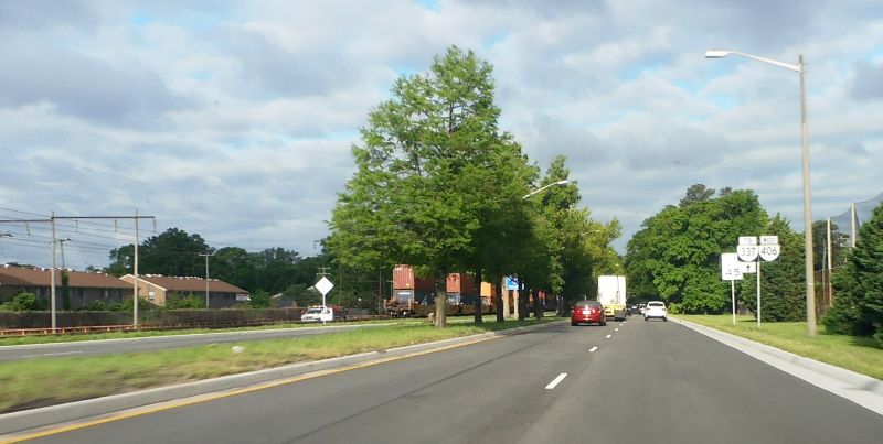
Photo: VA 406 leaving I-564 (photo by Mapmikey 5/6/17)
| ||||||
| ROUTE LOG VA 337: 0 - 0 I-564: 1.61 - 1.61 |
Creation: VA 406 was created in Dec 1980 (CTB) as new
routing, running the way it does now. The road itself dates to the
early 70s. This is the 3rd VA 406.
Adjustments: None Improvements: Paved and multilaned upon inception Posted: For a number of years, VA 406 was only fully posted from I-564 and mentioned on nearby I-64. The only other posting for VA 406 was a set of trailblazers coming out from the Joint Forces Staff College area on Meredith St. D'Sean Lee reported that in late 2016, after the original concrete was paved with asphalt, correct VA 406 markers were placed at VA 337 and at other locations along Terminal Blvd. Multiplexes: None Legislative names: None Other names: International Terminal Blvd Scenic Byway: No segments Comment: VA 406 provided access to the Norfolk International Terminal before the Imtermodal Connector was built, alleviating the need for trucks to use VA 165 Little Creek Rd which has truck restrictions. It's also an alternative route for some Navy Base traffic to get to/from I-64. Two different times (1974, 1993), Mapmikey has lived within 5 blocks of Terminal Blvd. |

1986 Official |
||||
| Previous VA 406's:
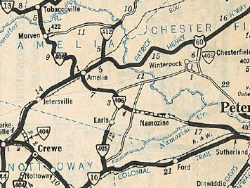
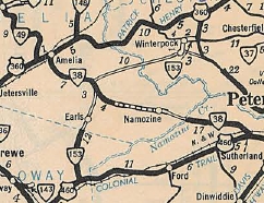
1932 ROUTE LOG VA 13: 0 - 0 Amelia-Powhatan Line: 2.82 - 2.82 VA 422: 2.15 - 4.97 VA 20 WB: 8.16 - 13.13 VA 20 EB: 1.00 - 14.13 Dinwiddie-Amelia line: 24.96 - 39.09 VA 10: 7.10 - 46.19 |
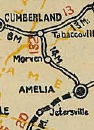
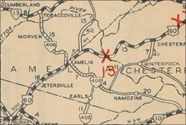
VA 406 #1: Appeared August 1928 as a renumbering of VA 132
from VA 13 Tobaccoville to VA 20 (now SR 656) near Amelia, then after
duplexing with VA 20 into Amelia, replaced CR 1 east 10.82 miles to
just past Wilsons Corner. A second piece was created as an upgrade to
CR 2 running 7 miles west from VA 10 (now US 460) Sutherland to the
Amelia County Line.
In Aug 1929 (CTB), the Amelia piece was extended east 2 miles. In Dec 1930 (CTB), the Amelia piece was extended east 5.91 miles through Mannboro. In June 1931 (CTB), the Amelia piece was extended east 0.84 miles. In July 1932 (CTB), the Amelia piece was extended east 4.39 miles to connect to the other piece.
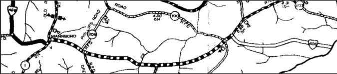 VA 406 extended to Dinwiddie County to connect the two pieces 1932 Amelia County In July 1933, VA 406 was renumbered as VA 49 north of Amelia CH and VA 38 east of Amelia CH. Today the route is SR 681 from Tobaccoville to near Amelia; SR 656/1009 into Amelia; VA 38 to Scotts Fork; VA 153 and SR 708 east to Sutherland.
VA 406 #2: Likely assigned as the state route designation for I-85 in the pre-construction days of Virginia interstate. It is not explicitly mentioned in the CTB Minutes but based on the 4xx routes that were mentioned, 406 fits the pattern established in association with the list of interstate corridors in Oct 1957. |
|||||
Previous: VA 405 |
Next: VA 407
Top | Virginia Hwy Index
Home
Page last modified 12 February 2025