< US 176 | Home | US 178 ALT | US 178 Bus | US 217 >
|
|
|
| ROUTE LOG |
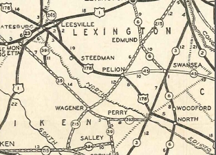
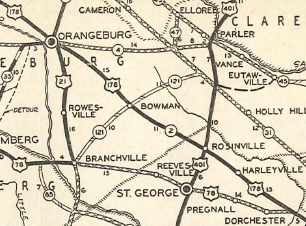
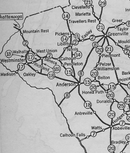
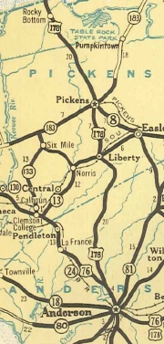
US 78: 0 - 0 SC 453: 8.1 - 8.1 US 15: 4.9 - 13.0 I-95 (exit 82): 2.5 - 15.5 Orangeburg-Dorchester Line: 2.1 - 17.6 SC 210 EB: 6.3 - 23.9 SC 210 WB: 0.1 - 24.0 US 21 SB, US 21 BUS, US 178 BUS: 12.8 - 36.8 US 301: 1.4 - 38.2 SC 33: 1.1 - 39.3 US 21 BUS, US 601: 0.8 - 40.1 US 21 NB: 1.0 - 41.1 US 178 BUS: 1.1 - 42.2 SC 172: 12.3 - 54.5 US 321: 3.4 - 57.9 SC 394: 0.8 - 58.7 Lexington-Orangeburg Line: 4.7 - 63.4 SC 3: 0.4 - 63.8 SC 302: 8.5 - 72.3 SC 113: 7.6 - 79.9 I-20 (exit 39): 6.8 - 86.7 SC 245: 5.4 - 92.1 SC 391 SB: 2.6 - 94.7 US 1: 0.4 - 95.1 SC 23 EB, SC 391 NB: 0.2 - 95.3 SC 23 WB: 0.1 - 95.4 Saluda-Lexington Line: 0.5 - 95.9 SC 39 SB: 13.1 - 109.0 SC 121 SB: 1.3 - 110.3 US 378: 0.2 - 110.5 SC 121 NB: 0.2 - 110.7 SC 39 NB: 0.1 - 110.8 Greenwood-Saluda Line: 10.5 - 121.3 SC 246: 0.8 - 122.1 SC 248: 6.3 - 128.4 US 25 SB: 4.4 - 132.8 SC 67: 1.3 - 134.1 SC 225: 0.5 - 135.6 US 25 BUS, US 178 BUS, US 221 SB: 1.2 - 136.8 SC 34: 1.3 - 138.1 US 221 NB, SC 72 EB, SC 72 BUS: 3.5 - 141.6 SC 254: 1.6 - 143.2 US 25 BUS, US 178 BUS, SC 72 WB: 0.6 - 143.8 US 25 NB, SC 185: 5.9 - 149.7 SC 246: 0.7 - 150.4 SC 420: 6.0 - 156.4 Abbeville-Greenwood Line: 0.6 - 157 SC 184: 2.4 - 159.4 Anderson-Abbeville Line: 4.9 - 164.3 US 76 EB, SC 252 EB: 0.7 - 165 SC 252 WB: 0.1 - 165.1 SC 20 NB: 7.1 - 172.2 SC 20 SB: 0.1 - 172.3 SC 413: 2.3 - 174.6 SC 252: 3.9 - 178.5 US 29 NB: 3.6 - 182.1 US 29 SB: 0.6 - 182.7 SC 28 BUS SB: 1.2 - 183.9 US 29 BUS SB, SC 81 SB: 0.1 - 184.0 SC 24: 0.2 - 184.2 US 29 BUS NB, SC 81 NB, SC 28 Bus NB: 0.4 - 182.6 SC 28 BUS SB: 2.4 - 185.0 US 76 WB, SC 28 NB, END SC 28 BUS: 1.2 - 186.2 I-85 (exit 21): 2.1 - 188.3 SC 88: 10.5 - 198.8 Pickens-Anderson Line: 1.6 - 200.4 SC 135: 1.4 - 201.8 US 123: 2.6 - 204.4 SC 93: 1.6 - 206.0 SC 183: 7.2 - 213.8 SC 288: 8.5 - 222.3 SC 11: 0.2 - 222.5 NC STATE LINE: 10.2 - 232.7
|
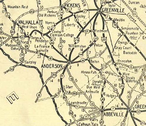
Creation: Appeared in 1933, replacing SC 24 from US 78 to US 29 Anderson. SC 2 was attached to US 178 from US 78 to Orangeburg.
|
Adjustments: In 1937, US 178 was extended through Anderson with US 76, then replaced SC 14 through Liberty and Pickens before heading into North Carolina.
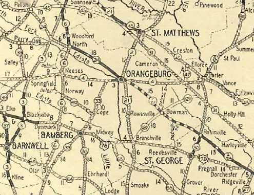
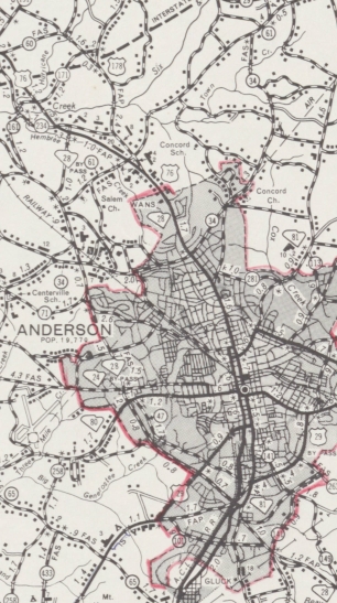
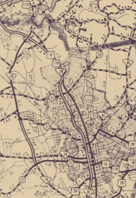
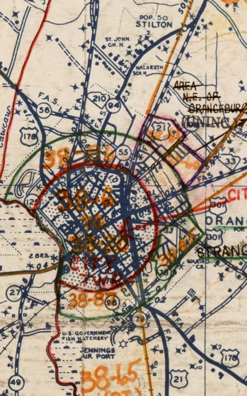
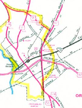
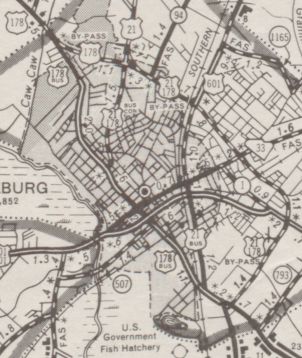
Between 1946-50, US 178 was removed from Kirksey Dr in South Greenwood, leaving behind S-24-40. About 1949, US 178 was placed on its original Orangeburg Bypass by replacing S-38-56 and S-38-55, then followed US 21 south on Magnolia through eastern Orangeburg back to US 178. The old route through town became US 178 Business. In 1964, US 178 was rerouted in Anderson to use Murray Ave instead of Main St. Main St. remained part of SC 28 (now SC 28 Bus except in downtown which is no longer state maintained).
About 1967, US 178 was removed from Magnolia Ave in Orangeburg and sent further around the east and south of Orangeburg. Magnolia Ave became US 21 Bus and Broughton Ave became an extended US 178 Bus.
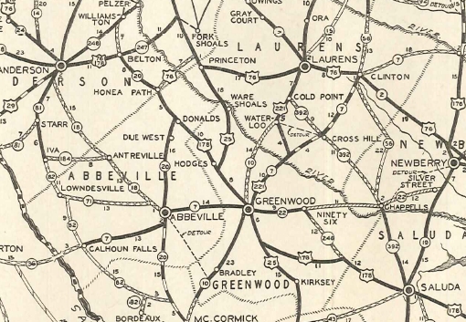
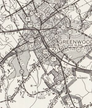
In 1968, US 178 was placed on its bypass of Greenwood, leaving behind US 178 Business.
Improvements: Fully paved upon designation The first multilane section of US 178 was in 1963: about 3 miles worth in Greenwood In 1964, US 178 was multilaned on Murray Ave in Anderson; US 29 Byp multiplex; The next section to be upgraded was an extended Greenwood section, south to the US 25 SB split; also, Murray Ave north to the US 76 WB split north of Anderson, both between 1965-67. In 1968 or 1969, US 178 was 4-lane from Greenwood to Hodges; also US 178 was 4-laned from US 29 east to SC 252. In 1974, US 178 was four laned from SC 252 to Belton. Between 1983-85, the northern half of the US 178 Greenwood Bypass was 4-laned. Official Maps show the Orangeburg bypass 4-laned west of US 301 between 1993-97, but I know it was 4-laned by 1987. By 2008, US 178 was multilaned a bit north out of Pickens. By 2013, US 178 was multilaned 2 miles north off the Orangeburg Bypass Comment: US 178 serves several main towns areas - Orangeburg, Saluda, Greenwood, Belton, Anderson, Pickens - but is not a primary route to get anywhere. Of course, I used US 178 all the time running back and forth from Goose Creek to Clemson. US 178 is the closest primary route to South Carolina's highest point - Mt. Sassafras - which is easily reached by car via S-39-199. US 178 north of SC 11 is an actual mountain road - quite twisty - a rarity in South Carolina. | |||||||||||||||||||
Previous: US 176 |
Next: US 178 ALT | US 178 Bus | US 217
Top | South Carolina Hwy Index
Home
Page last modified 16 August 2017