< SC 1 | Home | SC 2 ALT | SC 3 >
|
|
|
| ROUTE LOG |
US 21, US 176, US 321: 0 - 0 SC 35: 1.3 - 1.3 US 21, US 176, US 321: 2 - 3.3 US 1: 0.7 - 4.0 US 378: 0.1 - 4.1
|
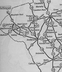
Creation: An original state highway that began at SC 6 (now S-10-3) Charleston and headed northwest throguh Summerville, Orangeburg, Columbia, Newberry, Laurens to Greenville, then west through Easley, Clemson, Seneca, and Walhalla before exiting into Georgia at Mountain Rest. This is the only SC 2.
|
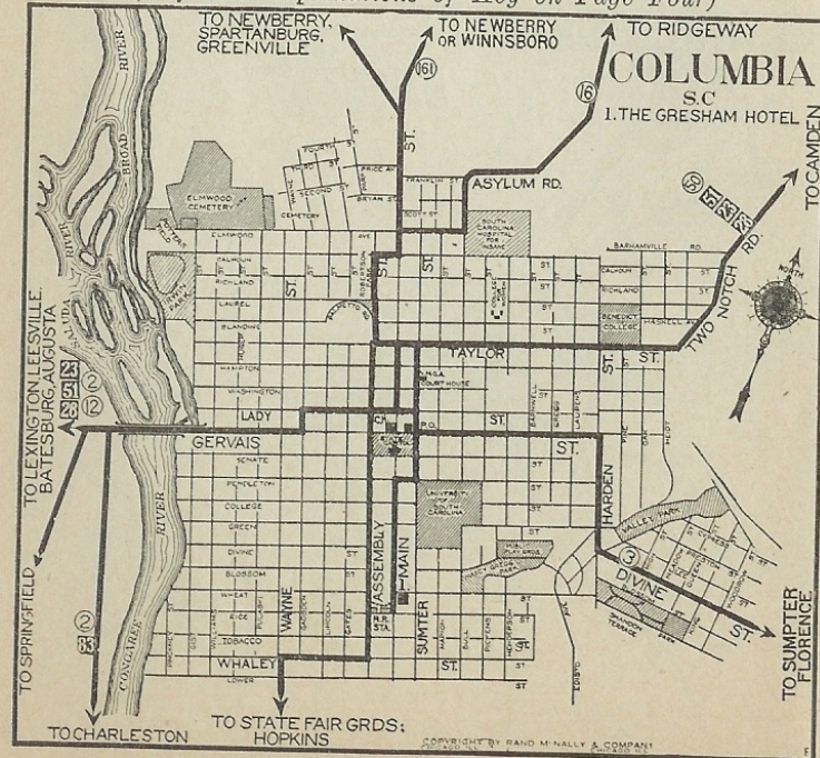
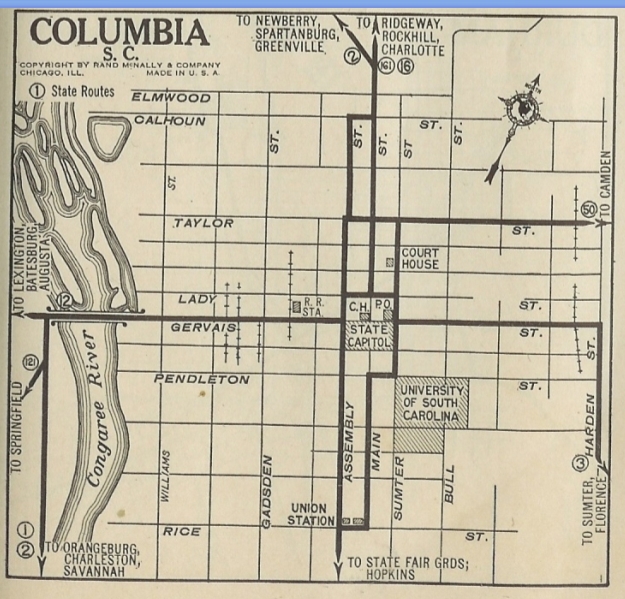
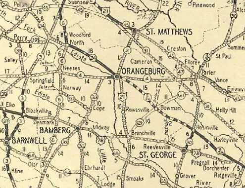
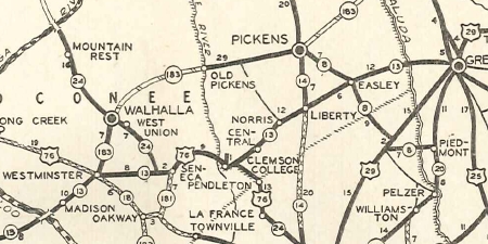
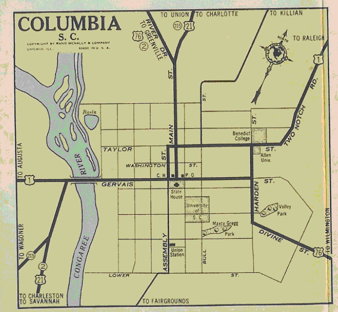
C. Mark Sublette provides a summary of the history of SC 2 from Walhalla to Greenville: Virtually the entire highway route between Toccoa, Georgia, and Greenville, South Carolina, was constructed using the original 1872-73 railroad alignment of the Richmond and Danville Railroad, including the three-span thru-truss bridge over the Tugalo River at the state line. This was abandoned during the Southern Railway’s major rebuilding project of 1916-1918, which company had absorbed the R&D in the great 1894 reorganization by J. P. Morgan and associates. The now-excess right of way was then adapted for vehicle use. Many of the original cuts still exist between Toccoa and Westminster, S.C., but road-widening between Westminster and Seneca, and between Clemson and Central have obliterated the railroad-era cuts. Between Central, Liberty, and Easley the profile of the former rail alignment can still be discerned as long portions remain a two-lane road. Adjustments: It is unclear if SC 2 went through St Matthews originally and if so, in 1923, SC 2 was routed around St. Matthews, leaving behind an extended SC 31 (now SC 6 and US 601). If SC 2 ever used S-32-66 Old State Rd from Cayce due south through the old Eastman complex into Calhoun County I believe it stopped doing so by 1925. Between 1923-25, SC 2 was rerouted in Columbia from Gervais-Gadsden-Lady-Assembly-Calhoun-Main to use Gervais-Assembly-Calhoun-Main.
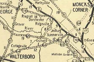
If SC 2 ever used S-36-368 and S-38-56 Bush River rd from Gary to Newberry via Helena it stopped doing so by 1926. Also by 1926, SC 2 was removed from S-10-881 Lincolnville Rd and S-10-76 from Summerville to Ladson and placed on newly constructed US 78 and what appears to be today's S-10-63 Owens Dr. In 1927, US 76 was added to SC 2 from Greenville to Columbia, US 21 was added from Columbia to Orangeburg, and US 78 was added from Dorchester to Charleston, yet for some reason SC 2 was not removed from these segments in 1928 like every other state route was.
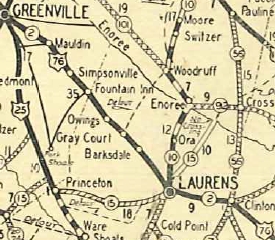
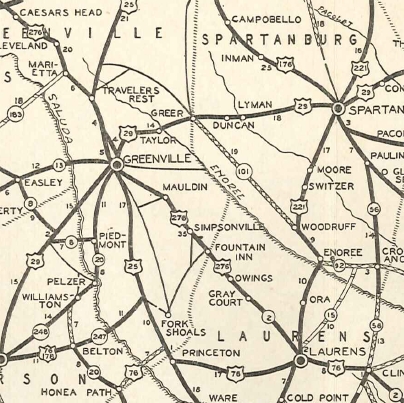
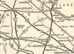
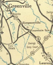
Also in 1927, SC 2 was removed from S-23-144 Old Stage Rd and S-23-566 Old Laurens Rd between Mauldin and Simpsonville; S-23-55 S Main St in Simpsonville; S-30-183 Spring St in Laurens; White House Pond Rd east of Rosinville; S-18-92 Pat St in Harleyville; Water Wheel Rd east of Ridgeville; S-18-22 Orangeburg Rd and S-18-478 Brewer Rd in Jedburg In 1928, SC 2 was removed from today's S-37-60 and SC 188 between West Union and Seneca and placed on newly constructed alignment (current SC 28). If SC 2 ever used Sumney St northeast of Clemson; S-39-212 Mauldin Rd and S-39-15 Gaines St into Central it stopped doing so in 1928. In 1929, SC 2 was removed from Tate Rd in Norris; S-39-171 Old Norris Rd west out of Liberty; S-39-61 Beverly to Easley; Woodyard Rd in Kinards In 1931, SC 2 was removed from the Mt Moriah Rd loop east of Sandy Run. Between 1926-32, SC 2 was rerouted in Columbia from Gervais-Assembly-Calhoun-Main to instead use Gervais-Assembly-Taylor-Main In 1933, US 76 was redesignated as US 276 from Greenville to Laurens, and US 178 was added to SC 2 from Orangeburg to Dorchester. Yet SC 2 still remained on all the US routings.
In 1933, SC 2 west was truncated to Greenville. The route became SC 13 west to Seneca and SC 24 (which had been added as a long overlay in 1929) from Seneca to Georgia. Today this is SC 28 from Georgia to Clemson except: S-37-3 through West Union; SC 59/130 through Seneca; S-37-1 over to Newry area; abandoned routing under Lake Hartwell; S-39-4 through Clemson; SC 93 from Clemson to Easley; US 123 east of Easley; SC 124
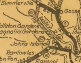
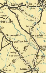
In 1934 or 1935, it appears US 78/SC 2 was removed from S-10-63 Owens Dr and Richardson Ave through Summerville and placed on more newly constructed US 78, Richardson Ave north of SC 64 (now US 17 ALT) became SC 61 (now S-18-65). It appears that in 1936 or 1937, US 76/SC 2 received a bypass of Prosperity. The old route became an extended SC 391 and another primary route (likely an ALT designation of US 76, SC 2, or SC 391) that is now S-36-11. In 1938, US 276/SC 2 was placed on newly constructed route on the east side of the railroad from Barksdale through Gray Court and Owings to Fountain Inn area. The old route became secondary except right in Gray Court was a primary route with unknown designation (probably an ALT route of SC 2 or SC 101) plus a little of SC 101 itself. Today the old route is the very lengthy Old Laurens Rd which is mostly not in the secondary system but is S-30-414 on the northernmost couple miles; SC 101 and S-30-13 Main St in Gray Court.
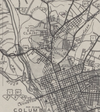
Also about 1938, SC 2 was removed from St. Matthews by instead replacing the last bit of SC 31, leaving behind SC 6 and SC 26 (now US 601). About 1939, US 52-78/SC 2 was placed on the newly constructed Rivers Ave between what is now Piggly Wiggly Ave and the King Street viaduct (not continuous today). The old route eventually became US 52 ALT but is today S-10-886 and S-10-39. In 1939 or 1940, US 76/SC 2 was put on new construction in the SC 60 area leaving behind an unknown primary designation (now abandoned routing) and a 0.2 mile extension of SC 60. About 1940, SC 2 was rerouted in Columbia to run from Gervais-Assembly-Taylor-Main to instead use Gervais-Main.
Between 1939-41, US 76/SC 2 was put on new routing west of Little Mountain, leaving behind SC 2 ALT (now S-36-24); also removed from S-36-575 east of Little Mountain. Between 1940-43, SC 2 was removed from St. Matthews, leaving behind About 1946, US 21/SC 2 was removed from today's S-38-25 Boundary St and S-38-94 St Matthews Rd between Orangeburg and Stilton and placed on what is now US 601. At that time, Boundary St below St Matthews Rd became SC 210. In 1947, SC 2 was reduced to its current routing. Today the removed portions are US 276 Greenville to Mauldin; SC 417; SC 14; US 76 Bus in Laurens; US 76 to Newberry except S-30-3 Main St in Clinton; S-36-642 College St, S-36-60 Main St, within Newberry; US 76; US 176; US 601; US 178 Business; US 178; US 78 to Charleston
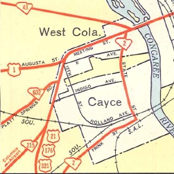
Improvements: SC 2 was paved from Columbia to White Rock and from Otranto to Charleston by 1923. By 1926, SC 2 was paved Charleston to Summerville; Dixiana to White Rock; Prosperity to Newberry; Clinton to Laurens; Mauldin to Greenville; Clemson to Seneca. In 1927, SC 2 was paved from Summerville to Rosinville In 1928, SC 2 was paved White Rock to Kinards; Laurens to Mauldin; Central to Clemson; Seneca to Walhalla. In 1929, SC 2 was paved around St. Matthews; Greenville to Liberty. In 1931, SC 2 was paved from Rosinville to Orangeburg except a section east of Bowman; St. Matthews to Dixiana; Kinards to Laurens; Liberty to Central; Walhalla to Mountain Rest The remaining segments of SC 2 (around Bowman; Orangeburg to St. Natthews; Mountain Rest to Georgia) were paved in 1932. SC 2 was multilaned on its US 52 overlay from Otranto to the King St Viaduct about 1939. By the mid-40s, SC 2 was multilaned on its US 1 overlay. Current SC 2 has no true multilane segments. Comment: SC 2 now serves just Cayce, and may be the most emasculated route in the history of routes, from 250+ miles down to just 4. | |||||||||||||||||||
Previous: SC 1 |
Next: SC 2 ALT | SC 3
Top | South Carolina Hwy Index
Home
Page last modified 16 April 2021