< US 17 | Home | US 21 | US 21 Bus | US 25 >
| US 21 ALT not currently assigned | ||||||||||||
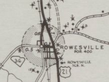
| Previous US 21 ALT's: 1947 ROUTE LOG US 21, SC 5 SB, SC 213: 0 - 0 SC 5 NB: 0.4 - 0.4 SC 34: 0.5 - 0.9 US 21: 0.9 - 1.8 1947 ROUTE LOG US 21: 0 - 0 SC 36 SB: 0.3 - 0.3 US 21: 0.6 - 0.9 1947 ROUTE LOG US 17, US 21: 0 - 0 SC 28 EB: 1.8 - 1.8 Hampton-Beaufort Line: 0.4 - 2.2 US 17-Y, SC 28 WB: 0.1 - 2.3 US 17, US 21: 0.1 - 2.4 1947 ROUTE LOG US 21, US 301: 0 - 0 US 21: 3.5 - 3.5 1952 ROUTE LOG US 21, SC 5: 0 - 0 SC 72 ALT: 0.6 - 0.6 US 21: 3.1 - 3.7 |
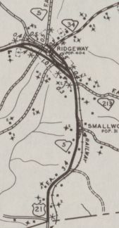
US 21 ALT #1: Appeared by 1938 as a renumbering of mainline US 21 along Dogwood Ave through Ridgeway.
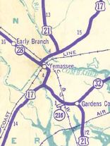
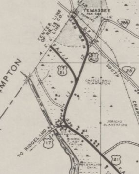
US 21 ALT #3: Appeared about 1939 as a renumbering of US 17-21 into Yemassee. In 1947, US 21 ALT was downgraded to S-7-3 and S-25-1.
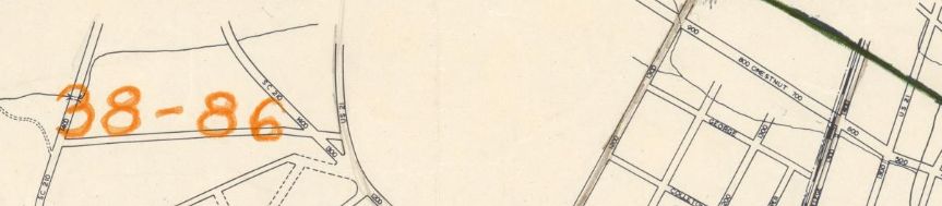
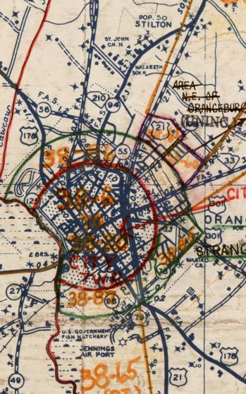
US 21 ALT #4: Appeared about 1942 as new primary routing, running from US 21-301 (now SC 33) Orangeburg up Magnolia Ave to end at US 21/SC 2 (now S-38-94) in Stilson. In 1948, US 21 ALT was renumbered as mainline US 21. Today this is now US 21 Business and US 601. This US 21 ALT is explicitly mentioned in SCDOT annual reports as well as shown on a 1947 Orangeburg City map (shows two different US 21 routes).
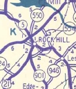
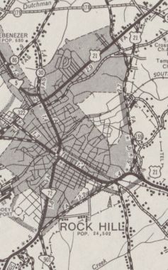
US 21 ALT #5: Appeared about 1948 as a renumbering of SC 554 around the east of Rock Hill. In 1950, US 21 ALT south was truncated to the relocated US 21, leaving behind SC 72 ALT. In 1953, US 21 ALT was renumbered as part of US 21. US 21 ALT was explicitly shown on a 1948 City of Rock Hill map.
| |||||||||||
Previous: US 17 |
Next: US 21 | US 21 Bus | US 25
Top | South Carolina Hwy Index
Home
Page last modified 4 August 2017