< TN 5 | Home | TN 6 CONN | TN 7 >
|
|
|
|
| ROUTE LOG |
AL STATE LINE: 0 - 0 TN 227 WB: 2.3 - 2.3 TN 227 EB: 4.6 - 6.9 TN 98: 7.9 - 14.8 US 64, TN 15: 3.2 - 18.0 TN 240: 16.1 - 34.1 Maury-Lawrence Line: 0.9 - 35.0 TN 20: 0.3 - 35.3 TN 243: 6.2 - 41.5 TN 166: 2.2 - 43.7 TN 6 CONN: 2.3 - 46.0 US 412 WB, US 412 Bus, TN 99: 5.8 - 51.8 TN 50: 1.3 - 51.3 TN 7 NB: 3.9 - 55.2 US 31 SB, US 43 END, US 412 EB, TN 7 SB, TN 99: 1.6 - 56.8 TN 246: 2.5 - 59.3 TN 396: 5.9 - 65.2 TN 247: 1.4 - 66.6 Williamson-Maury Line: 0.3 - 66.9 I-840 (exit 28): 5.1 - 72.0 TN 248: 0.9 - 72.9 US 31 NB, US 31 Bus Begin, TN 397: 4.2 - 77.1 TN 246: 2.0 - 79.1 US 431 Bus, TN 96 WB, TN 106: 0.1 - 79.2 TN 96 EB: 0.1 - 79.3 US 31 SB, US 31 Bus END, US 431, TN 397: 1.9 - 81.2 TN 441: 2.1 - 83.3 TN 253: 2.3 - 85.6 TN 252: 2.6 - 88.2 Davidson-Williamson Line: 0.2 - 88.4 TN 254: 0.1 - 88.5 TN 255: 3.7 - 92.2 TN 155: 1.6 - 93.8 US 31 ALT, US 41 SB, US 41 ALT SB, US 70S EB, TN 1 EB, TN 11 SB: 3.1 - 96.9 US 70, US 70S WB, US 431 SB, TN 1 WB, TN 24: 0.3 - 97.2 US 41 ALT NB, TN 12: 0.7 - 97.9 I-24 (exit 48): 1.2 - 99.1 US 31 END, US 31E Begin, US 31W, US 41 NB, US 431 NB, TN 11 NB: 0.1 - 99.2 US 31W, US 41, US 431, TN 11: 0.2 - 99.4 TN 155 WB: 4.8 - 104.2 TN 155 EB: 0.9 - 105.1 TN 45: 2.1 - 107.2 Sumner-Davison Line: 4.3 - 111.5 TN 6 CONN: 0.8 - 112.3 TN 258: 1.3 - 113.6 TN 385: 4.7 - 118.3 TN 109: 6.2 - 124.5 TN 25, TN 174 WB: 1.0 - 125.5 TN 174 EB: 1.5 - 127.0 US 231 SB, TN 376: 12.3 - 139.3 TN 52: 5.0 - 144.3 KY STATE LINE: 6.0 - 150.3
|
Creation: Appeared in 1923 as an original state highway, running generally as it does today.
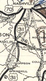
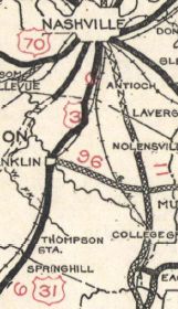
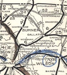
| Adjustments: About 1927, TN 6 was removed from Old Jackson Rd north of TN 20; Davis Cothran Rd; Williams Holler Rd; Old Hwy 43 in Sandy Hook In late 1926, US 31 was assigned to TN 6 from Columbia to Kentucky. By 1929, TN 6 was removed from TN 240/TN 20 through Summertown. The 1929 Official shows TN 6 using TN 247/US 431 to go from Spring Hill to Franklin and the 1930 issue shows TN 6 using current US 31. This may have been a temporary routing during construction, as the 1906 topo shows a road where US 31 runs now. In July 1929 (AASHO), US 31 north of Nashville became US 31E. In 1930, TN 6 was placed on current US 31 from Franklin to Nashville. The old route became TN 106.
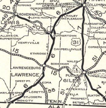
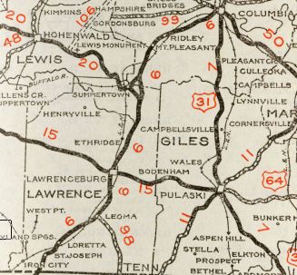
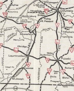
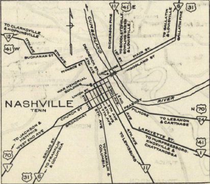
I am skeptical this was real, but in 1931 or 1932, TN 6 is shown on Tennessee State Officials as moving from Pruition Rd/TN 227 from the Alabama line at Iron City (this is clearly shown on the 1929 and 1930 Officials) to its current corridor due south of St Joseph. In 1935, TN 6 was removed from Main St through St Joseph; Old US 43 loop; 2nd/Broad/Main through Loretto; lengthy Old Andrew Jackson Hwy from Loretto to TN 98; White Rd to Dunn; Old Florence Rd (now spilt by US 64); Military Ave through Lawrenceville In 1937 or 1938, TN 6 was rerouted in Nashville to use Broadway to 1st to Deadrick In 1939 or so, US 43 was added to TN 6 from Columbia south to Alabama. AASHO first created this in 1934 but Tennessee did not appear to accept it for several years.
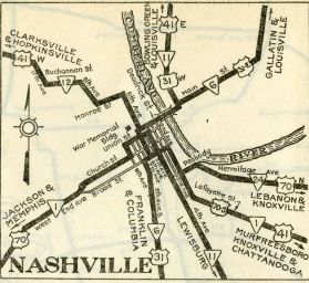
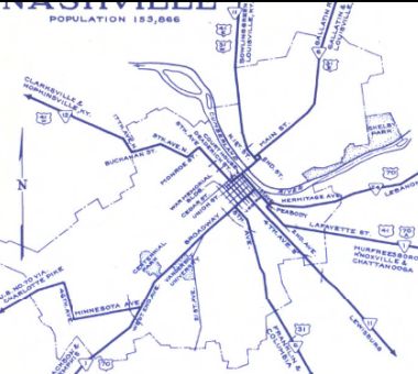
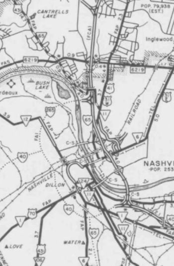
Around 1947, TN 6 was moved onto the new US 31 alignment in Columbia, leaving behind 7th St to the courthouse; Main St/E 5th/Riverside Dr north from there. About 1949, TN 6 was removed from Rockland Rd in Hendersonville About 1954, TN 6 was removed from Old Hwy 31 south of TN 396 Between 1952-56, TN 6 was rerouted in Nashville, to follow Deadrick to 8th then south to US 31-70 Broadway. About 1960, TN 6 was rerouted in Nashville to leave 8th, using the new James Robertson Pkwy. About 1962, TN 6 was removed from Alexander Springs Rd through Alexander Springs; Old Hwy 43 south of TN 240
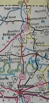
About 1964, TN 6 was removed from TN 25/E Main St in Gallatin About 1966, TN 6 was rebuilt from Gallatin to the Kentucky line. Surviving pieces: Sideview Rd in Shiloh; 3 short Old Hwy 31E loops up through Bethpage; the lengthy Old US Hwy 31E through Westmoreland and Sugar Grove. The northern bit of this is now part of TN 174.
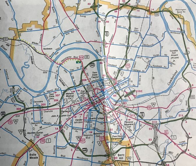
In the 1970s, TN 6 was removed from James Roy Rd and S Old Hwy 43 north of TN 20. About 1978, TN 6 was moved onto the Ellington Pkwy Freeway and TN 155, leaving behind Gallatin Pike through northeastern Nashville.
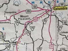
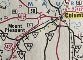
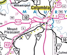
Also about 1978, TN 6 was put on its bypass of Mt Pleasant, tying back into the old road at the Maury County airport. It is unclear if the non-TN 166 part of the old route received a new state route designation but today it is part of TN 243. About 1989, TN 6 was placed on more new alignment from the Maury County airport to US 412 west of Columbia, then followed US 412 east into Columbia. The connector to TN 243 at the airport became TN 6 CONN and the route to Columbia via Trotwood avenue became more TN 243. In 1999, TN 6 was removed from Lawrenceville Hwy in the Sandy Hook area. In 2000, TN 6 was given its full bypass of Columbia, leaving behind US 412 Bus and US 31 within Columbia.
About 2007, TN 6 was removed from Shelton Dr in St Joseph Posting: TN 6 is fully unposted. TN 6 is mapped as secondary between TN 254 Brentwood and TN 155 in northern Nashville. TN 6 is considered primary everywhere else. Secret US Route Overlay: US 43 (56.8 mi) US 31 I (20.3 mi) US 31 Bus (4.1 mi) US 31 II (18.0 mi) US 31E (51.1 mi) Comment: TN 6 is a major corridor from Columbia southwest towards the Florence/Muscle Shoals AL area. TN 6 does still have independent utility north out of Nashville. | ||||||||||||||||||
Previous: TN 5 |
Next: TN 6 CONN | TN 7
Top | Tennessee Hwy Index
Home
Page last modified 24 July 2021
