< SC 48 | Home | SC 49 ALT | SC 50 >
|
|
|
|
| ROUTE LOG |
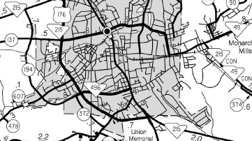
US 221: 0 - 0 I-385 (exit 5): 2.4 - 2.4 SC 308: 2.2 - 4.6 Spartanburg-Laurens Line: 3.7 - 8.3 I-26 (exit 44): 0.9 - 9.2 SC 92: 0.9 - 10.1 SC 56: 2.3 - 12.4 Union-Spartanburg Line: 1.2 - 13.6 US 176, SC 215: 14.5 - 28.1 SC 18: 0.9 - 29.0 SC 105: 8.3 - 37.3 SC 9 WB: 2.5 - 39.8 Chester-Union Line: 0.3 - 40.1 SC 9 EB: 0.3 - 40.4 York-Chester Line: 3.0 - 43.4 SC 322: 2.2 - 45.6 SC 97: 3.1 - 48.7 SC 211: 5.3 - 54 US 321: 5.5 - 59.5 US 321 Bus SB: 0.4 - 59.9 SC 5 Bus, SC 161 Bus: 0.5 - 60.4 US 321 Bus NB: 0.4 - 60.8 SC 5, SC 161: 1.5 - 62.3 SC 55, SC 274 SB: 9.5 - 71.8 SC 274 NB, SC 557: 2.1 - 73.9 NC STATE LINE: 2.9 - 76.8
|
Creation: Appeared in 1938 as a renumbering of SC 163 from US 321 York northeast to North Carolina. This is the 2nd SC 49.
|
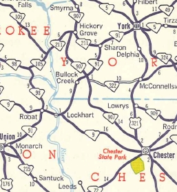
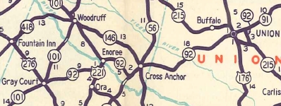
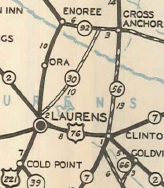
Adjustments: In 1956, SC 49 was extended southwest replacing SC 91 to Monarch, then replaced SC 92 to past Cross Anchor, then replaced SC 30 southwest to US 221.
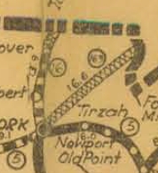
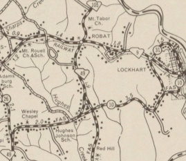
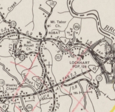
In late 1959, SC 49 was rerouted at Lockhart to use newly constructed roadway and a bit of S-44-10 to connect back up with SC 49. The old routing via Mt Tabor remained part of SC 9 and an extended SC 105. Also around this time, SC 49 was removed from Old Lower Lockhart Rd; Frank Hill Loop; S-44-415/26 Phillipi Church/Wesley Chapel Rd between Monarch and SC 105.
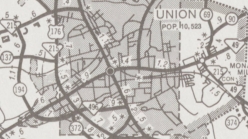
Between 1995-2005, SC 49 was removed from Main St in central Union between US 176/SC 215 and Arthur Blvd (became S-44-6) and instead placed on Arthur Blvd and US 176/SC 215.
Improvements: Fully paved upon designation. SC 49 was 4-laned from SC 274-557 to NC between 1998-2000. SC 49 was multilaned when moved to Arthur Blvd and Us 176/SC 215 in Union between 1995-2005. SC 49 was 4-laned from SC 274-557 to SC 55-274 in 2005. Comment: There is a SC 49 TRUCK in Union that uses the unposted SC 496 and US 176/SC 215 south of SC 49. SC 49 provides a direct routing from York to Charlotte, NC. | Previous SC 49's:
1934 ROUTE LOG US 521, US 701: 0 - 0 Horry-Georgetown Line: 23.0 - 23.0 US 117: 11.9 - 34.9 |
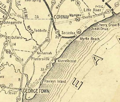
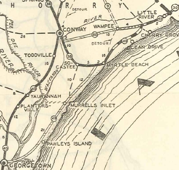
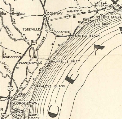
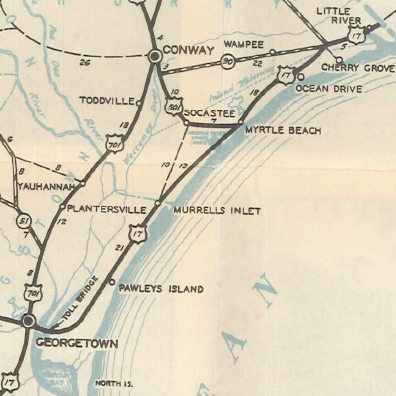
SC 49 #1: Appeared about 1929 as new primary routing, running from SC 26-40 (now US 17-521 jct) in Georgetown northeast to end at SC 9 (now S-26-20) Nixon's Crossroads.
In 1932, SC 49 was extended northeast to North Carolina, replacing part of SC 9.
In 1933, SC 49 north was truncated to today's S-26-15 in Myrtle Beach. Myrtle Beach to North Carolina became US 117. Today this is US 17 except it used S-26-20 and SC 90 in the Nixons Crossroads area. In 1935, the rest of SC 49 was renumbered as US 17. SC 49 used High St in Georgetown and a ferry across the Pee Dee, Black, and Waccamaw Rivers.
|
||||||||||||||||||||


Previous: SC 48 |
Next: SC 49 ALT | SC 50
Top | South Carolina Hwy Index
Home
Page last modified 18 January 2016