index
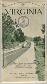
1944 Official Map
 
 
The Virginia Highways Project
originally created by Dave Strong
 
Welcome to the Virginia Highway Project!  This website is a joint venture between "Froggie" and "Mapmikey" and details the routes and highways of Virginia, and began as a combining of Mapmikey's Virginia Highway's site and Froggie's Virginia Highway Ends photo site.  Additional material related to Virginia will be offered as time allows.

Updates (1/6/24): New page for VA 460; updates to I-381, US 1, US 50, US 121, US 211, VA 6Y, VA 7; split the VA 6, VA 7 and VA 300 families, plus the VA 261-280 and VA 421-499 groups into separate pages with more mapscans;
Updates (1/19/23): VA 317 #1 and VA 372 have been decommissioned; a new VA 372 was put into the system
Updates (3/27/22): a huge update to the US routes in Virginia, with 27 new routes identified; also a draft version of the 1933 route list has been found, with 5 more routes found
Updates (6/10/18): added the West Virginia Hwy Annex Page
Updates (7/7/17): added a lot of information and images to the Waysides page
Updates (5/27/17): about 350 photos added to Virginia ENDS gallery
Updates (1/8/17): New routes documented for the first time: US 220 ALT #1 and VA 287 #1; New route log available (1951); VA 281-300 page broken into indivdual pages with more mapscans and info, especially routes 284-287; historic pics on VA 297 and 297 Bus pages; more info on the eastern end of US 60 and northern end of US 501; mapscan found for the Richmond VA 88; VA 164 was extended.
Updates (11/11/16): about 50 photos added to Error Signs of Virginia and 170 photos added to Old Signs of Virginia
Updates (2/13/16): New route documented for the first time: VA 265 #2
Updates (11/28/15): New route has been created, VA 8 Bus. Additional information added to VA 241 and VA 355 #1
Updates (3/17/15): Updates to the following entires: Numerous edits have been made (too many to summarize - go here to see the full list. New routes are documented for the first time: I-864, US 11Y #1, US 29 ALT #5, US 360 ALT #4, US 460 Bus (Grundy), VA 9Y, VA 10A, VA 13Y #1, VA 23 TEMP, VA 25Y, VA 27 ALT, VA 31Y, VA 33Y #1, VA 42Y, VA 109Y, VA 254 ALT, VA 284 #1, VA 323 TEMP, VA 336 #3, VA 337 ALT #2, VA 406 #2, VA 408 #2, VA 410 #2, VA 411 #2, VA 412 #2, and VA 464 These entries were substantially updated: VA 143, VA 238, VA 307, VA 411, VA 441, VA 530/530Y. A new superpage has been created for route-log/VA 337. A new US 33-VA 33 transition gallery has been written.
Updates (1/10/15): Updates to the following entires: The I-64, I-66, I-73 , I-77, I-81, I-85 and I-95 pages have been revamped with a lot more detail and mapscans. All 3di routes were given their own pages and also updated. A new superpage has been created for Shirley Highway, VA 350. Route logs have been added for 1935, 1941, 1949, 1957, 1979, 1999, and 2001. A new photo gallery is available of 1960s scenes around the I-495 beltway.
Updates (11/27/14): Updates to the following entires: The US 25E , US 48, US 220 , US 240, and US 340 pages have been revamped with a lot more detail and mapscans. 1 new route is documented - VA 281. Additionally, VA 172 and VA 280 have been extended.
Updates (3/29/14): substantial update to Virginia Cutouts
Updates (1/27/14): Part 1 gallery update to Virginia Placenames (300 or so photos) | Sign Error Pics (46 photos) | Old Signs of Virginia (64 photos)

Questions, Comments, or Corrections? Contact us at the e-mail addresses at the bottom of this page.


What's Here:
 
Virginia Highways:
Route Lists/Histories (updates) | Virginia Highway Ends | Froggie's Virginia Photos | Virginia Multiplexes
  The neighbors:
NC Hwys Annex Page - Mapmikey/Adam Prince
         NC ENDS gallery
SC Hwys Annex Page - Mapmikey
Tennessee Annex - Froggie/Mapmikey
West Virginia Hwys Annex Page - Mapmikey

Washington DC Hwy Page - William Yurasko
Maryland Hwy Page - Mike Pruett
U.S. Highways Page - Robert Droz (covers all US Routes)
Interstate Highways Page - David Steinberg (covers all interstates)

Want something else road related?
AAroads kickoff page - Andy Field/Alex Nitzman (compilation of many road related sites)
Gribblenation - Material from much of the eastern U.S.
American Road Magazine - Celebrating the 2-lane highways of yesteryear

 
Other Virginia Stuff:
A History of Numbering | Sources | List of Counties | Virginia Waysides | State Line Crossings | Bridges of Virginia | Abandoned Bridges of Virginia | Hampton Roads Notes | Sign Error Pics | Old District 2 Unisigns | VA 91 Photo Journey | Cutout Gallery | Old Signs of Virginia | Virginia Placenames
 
Virginia related links:
VDOT (official VDOT site)
Old Dominion Roads - Adam Prince/Gribblenation (collection of photos and Virginia road related topics)
Roads to the Future - Scott Kozel (detailed info about road projects in the Mid-Atlantic region)
Virginia Arterials - Lou Corsaro/Eric Smith (detailed descriptions of arterials in Virginia)
 
The compilation of this material is original. Scanned maps are copyrighted by their publishers. This site uses small portions of these maps for research and educational purposes, which constitute fair uses. All other images (including photographs) were created by the authors unless otherwise specified. Do not present any of the information here on another Web site without first receiving permission from the author. 

Scanned portions of Official VDOT state and county maps appear with the consent of the Virginia Department of Transportation Office of Public Affairs Cartography Section subject to the following terms:
Restrictions on Use of Maps � VDOT�s Proprietary Rights
The maps constitute the property of the Department of Transportation and/or other agencies of the Commonwealth. They are proprietary and protected by copyright or other intellectual property laws. The Department expressly prohibits the copying of protected materials, other than for individual private use., without the Department�s prior written permission In no event shall the maps be sold or used for promotional, commercial or political purposes. Permission from the Department for any other use shall be granted or denied, in the Department�s sole discretion. The Department provides the maps as a public service for informational purposes. However, the Department makes no claims as to the accuracy, currency or completeness of the information provided. In no event shall the Department be liable for any errors or omissions with respect to such information. Users are solely responsible for compliance with the copyright and intellectual property laws with respect to use of any information gained from this site.
For more information about other sources, see the sources page.
 
Disclaimer:
These are personal web pages and are not connected to the Virginia Department of Transportation or the Commonwealth of Virginia in any way.
To get to the official VDOT web page, click here.

This is a hobby website. We try to be as accurate about any information within as possible, but we do not guarantee the accuracy for any purpose of anything presented at www.vahighways.com

Page last modified 6 January 2024

visitors have viewed this page since 25 September, 2005

(C) 2023-2005, Adam Froehlig and Mike Roberson